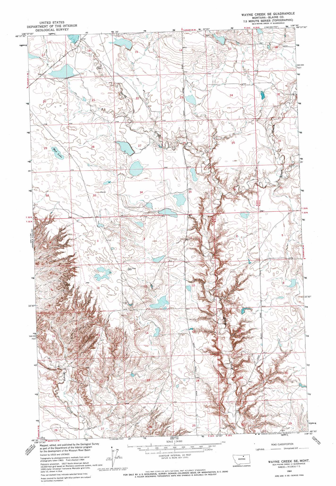
Wayne Creek Se Topo Map Montana
To zoom in, hover over the map of Wayne Creek Se
USGS Topo Quad 48108e5 - 1:24,000 scale
| Topo Map Name: | Wayne Creek Se |
| USGS Topo Quad ID: | 48108e5 |
| Print Size: | ca. 21 1/4" wide x 27" high |
| Southeast Coordinates: | 48.5° N latitude / 108.5° W longitude |
| Map Center Coordinates: | 48.5625° N latitude / 108.5625° W longitude |
| U.S. State: | MT |
| Filename: | o48108e5.jpg |
| Download Map JPG Image: | Wayne Creek Se topo map 1:24,000 scale |
| Map Type: | Topographic |
| Topo Series: | 7.5´ |
| Map Scale: | 1:24,000 |
| Source of Map Images: | United States Geological Survey (USGS) |
| Alternate Map Versions: |
Wayne Creek SE MT 1964, updated 1967 Download PDF Buy paper map Wayne Creek SE MT 2011 Download PDF Buy paper map Wayne Creek SE MT 2014 Download PDF Buy paper map |
1:24,000 Topo Quads surrounding Wayne Creek Se
Silver Bow Spring |
Hogeland |
Hogeland Se |
Turner |
Turner Se |
East Butte |
Wayne Creek Nw |
Hornbeck Lake |
Down Reservoir Nw |
Down Reservoir Ne |
Harlem |
Grable Coulee |
Wayne Creek Se |
Down Reservoir Sw |
Down Reservoir |
Fort Belknap Agency |
Threemile Reservoir |
Savoy |
Coburg |
Dodson Dam |
Fort Belknap Agency Se |
Wild Horse Butte |
Bigby Lake |
Weigand Reservoir |
Coburg Se |
> Back to 48108e1 at 1:100,000 scale
> Back to 48108a1 at 1:250,000 scale
> Back to U.S. Topo Maps home
Wayne Creek Se topo map: Gazetteer
Wayne Creek Se: Dams
Grabtak Number 2 Dam elevation 804m 2637′Hungover Dam elevation 824m 2703′
Mohair Number 1 Dam elevation 866m 2841′
Mohair Number 2 Dam elevation 862m 2828′
Sam Dam elevation 835m 2739′
Sunny Dam elevation 792m 2598′
Terry Dam elevation 839m 2752′
Thee End Dam elevation 831m 2726′
Transistor Number 1 Dam elevation 836m 2742′
Transistor Number 2 Dam elevation 839m 2752′
Wayne Creek Se: Lakes
Mud Lake elevation 834m 2736′Wayne Creek Se: Streams
Black Creek elevation 787m 2582′Wayne Creek Se: Valleys
Lone Tree Coulee elevation 802m 2631′Wayne Creek Se digital topo map on disk
Buy this Wayne Creek Se topo map showing relief, roads, GPS coordinates and other geographical features, as a high-resolution digital map file on DVD: