Turner Topo Map Montana
To zoom in, hover over the map of Turner
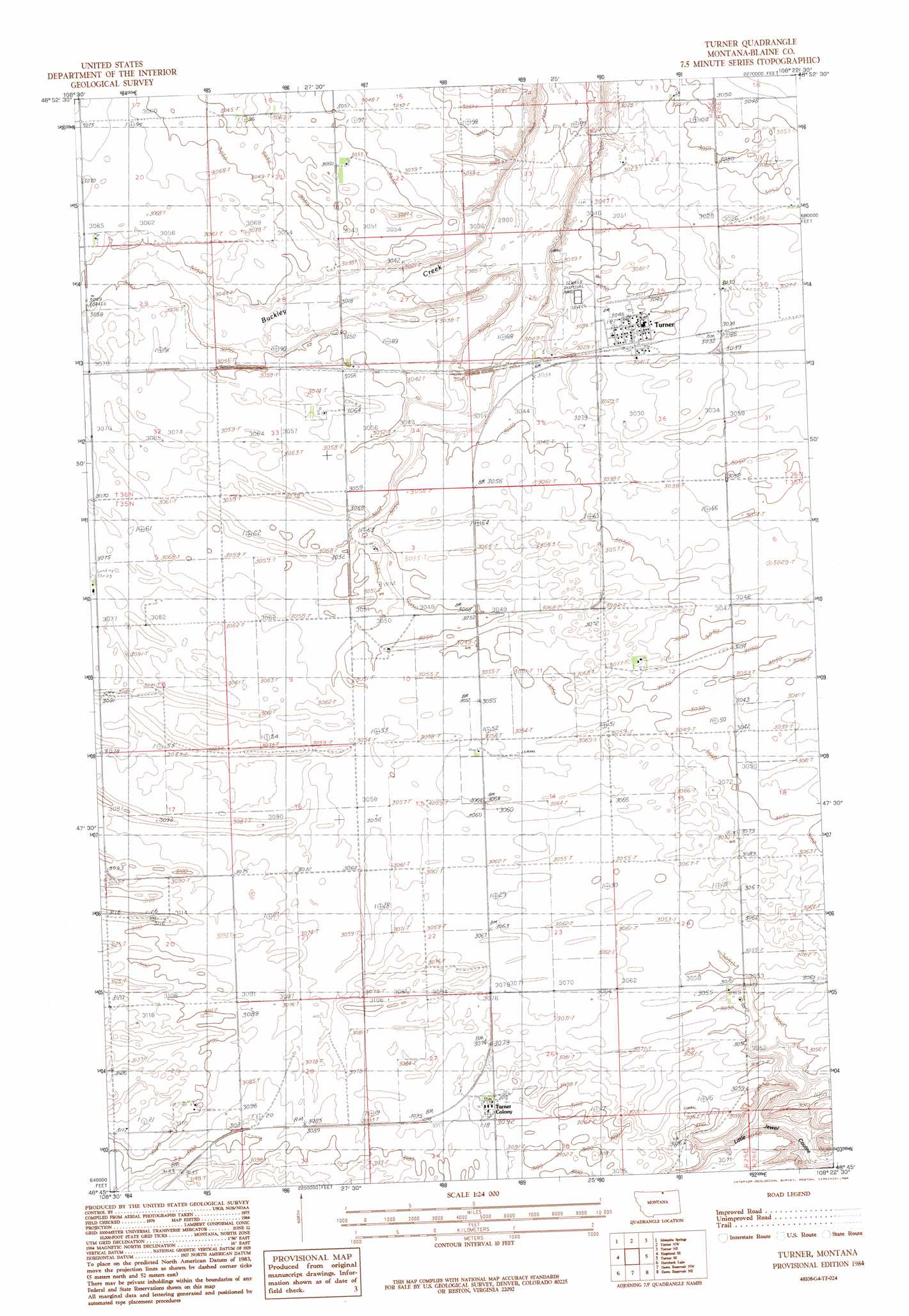
USGS Topo Quad 48108g4 - 1:24,000 scale
| Topo Map Name: | Turner |
| USGS Topo Quad ID: | 48108g4 |
| Print Size: | ca. 21 1/4" wide x 27" high |
| Southeast Coordinates: | 48.75° N latitude / 108.375° W longitude |
| Map Center Coordinates: | 48.8125° N latitude / 108.4375° W longitude |
| U.S. State: | MT |
| Filename: | o48108g4.jpg |
| Download Map JPG Image: | Turner topo map 1:24,000 scale |
| Map Type: | Topographic |
| Topo Series: | 7.5´ |
| Map Scale: | 1:24,000 |
| Source of Map Images: | United States Geological Survey (USGS) |
| Alternate Map Versions: |
Turner MT 1984, updated 1984 Download PDF Buy paper map Turner MT 2011 Download PDF Buy paper map Turner MT 2014 Download PDF Buy paper map |
1:24,000 Topo Quads surrounding Turner
Hogeland Nw |
Mosquito Springs |
Turner Nw |
Turner Ne |
Chapman Nw |
Hogeland |
Hogeland Se |
Turner |
Turner Se |
Chapman |
Wayne Creek Nw |
Hornbeck Lake |
Down Reservoir Nw |
Down Reservoir Ne |
Emerick Bench |
Grable Coulee |
Wayne Creek Se |
Down Reservoir Sw |
Down Reservoir |
Hubert Hill Sw |
> Back to 48108e1 at 1:100,000 scale
> Back to 48108a1 at 1:250,000 scale
> Back to U.S. Topo Maps home
Turner topo map: Gazetteer
Turner: Airports
Turner Airport elevation 930m 3051′Turner: Populated Places
Turner elevation 927m 3041′Turner Colony elevation 945m 3100′
Turner: Post Offices
Turner Post Office elevation 927m 3041′Turner: Wells
35N25E05BBCD01 Well elevation 936m 3070′36N25E29AC__01 Well elevation 931m 3054′
36N25E29ACBB01 Well elevation 931m 3054′
Turner digital topo map on disk
Buy this Turner topo map showing relief, roads, GPS coordinates and other geographical features, as a high-resolution digital map file on DVD: