Hogeland Topo Map Montana
To zoom in, hover over the map of Hogeland
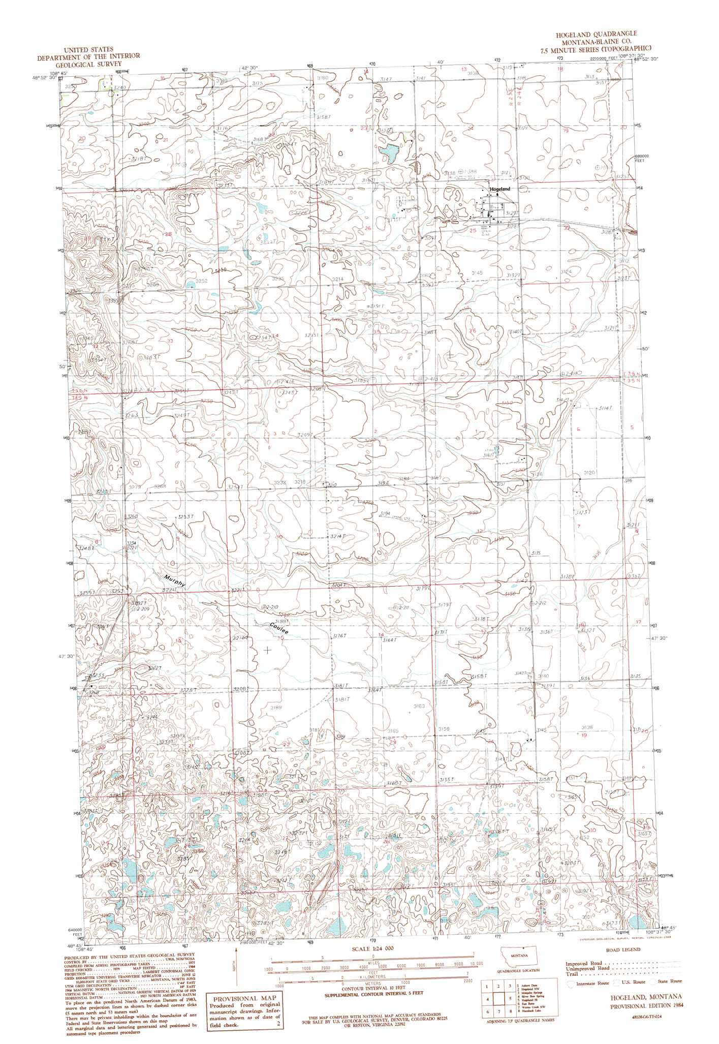
USGS Topo Quad 48108g6 - 1:24,000 scale
| Topo Map Name: | Hogeland |
| USGS Topo Quad ID: | 48108g6 |
| Print Size: | ca. 21 1/4" wide x 27" high |
| Southeast Coordinates: | 48.75° N latitude / 108.625° W longitude |
| Map Center Coordinates: | 48.8125° N latitude / 108.6875° W longitude |
| U.S. State: | MT |
| Filename: | o48108g6.jpg |
| Download Map JPG Image: | Hogeland topo map 1:24,000 scale |
| Map Type: | Topographic |
| Topo Series: | 7.5´ |
| Map Scale: | 1:24,000 |
| Source of Map Images: | United States Geological Survey (USGS) |
| Alternate Map Versions: |
Hogeland MT 1984, updated 1984 Download PDF Buy paper map Hogeland MT 2011 Download PDF Buy paper map Hogeland MT 2014 Download PDF Buy paper map |
1:24,000 Topo Quads surrounding Hogeland
Irvins Coulee |
Aubrey Dam |
Hogeland Nw |
Mosquito Springs |
Turner Nw |
Silver Bow Lake |
Silver Bow Spring |
Hogeland |
Hogeland Se |
Turner |
Harlem Nw |
East Butte |
Wayne Creek Nw |
Hornbeck Lake |
Down Reservoir Nw |
Fort Belknap Siding |
Harlem |
Grable Coulee |
Wayne Creek Se |
Down Reservoir Sw |
> Back to 48108e1 at 1:100,000 scale
> Back to 48108a1 at 1:250,000 scale
> Back to U.S. Topo Maps home
Hogeland topo map: Gazetteer
Hogeland: Airports
Hogeland Airport elevation 956m 3136′Hogeland: Populated Places
Hogeland elevation 957m 3139′Silver Bow (historical) elevation 976m 3202′
Hogeland: Post Offices
Hogeland Post Office elevation 957m 3139′Hogeland: Valleys
East Butte Coulee elevation 965m 3166′Murphy Coulee elevation 965m 3166′
Hogeland: Wells
35N23E01DBDD01 Well elevation 964m 3162′35N24E18BCDD01 Well elevation 957m 3139′
35N24E30AAAC01 Well elevation 961m 3152′
Hogeland digital topo map on disk
Buy this Hogeland topo map showing relief, roads, GPS coordinates and other geographical features, as a high-resolution digital map file on DVD: