Irvins Coulee Topo Map Montana
To zoom in, hover over the map of Irvins Coulee
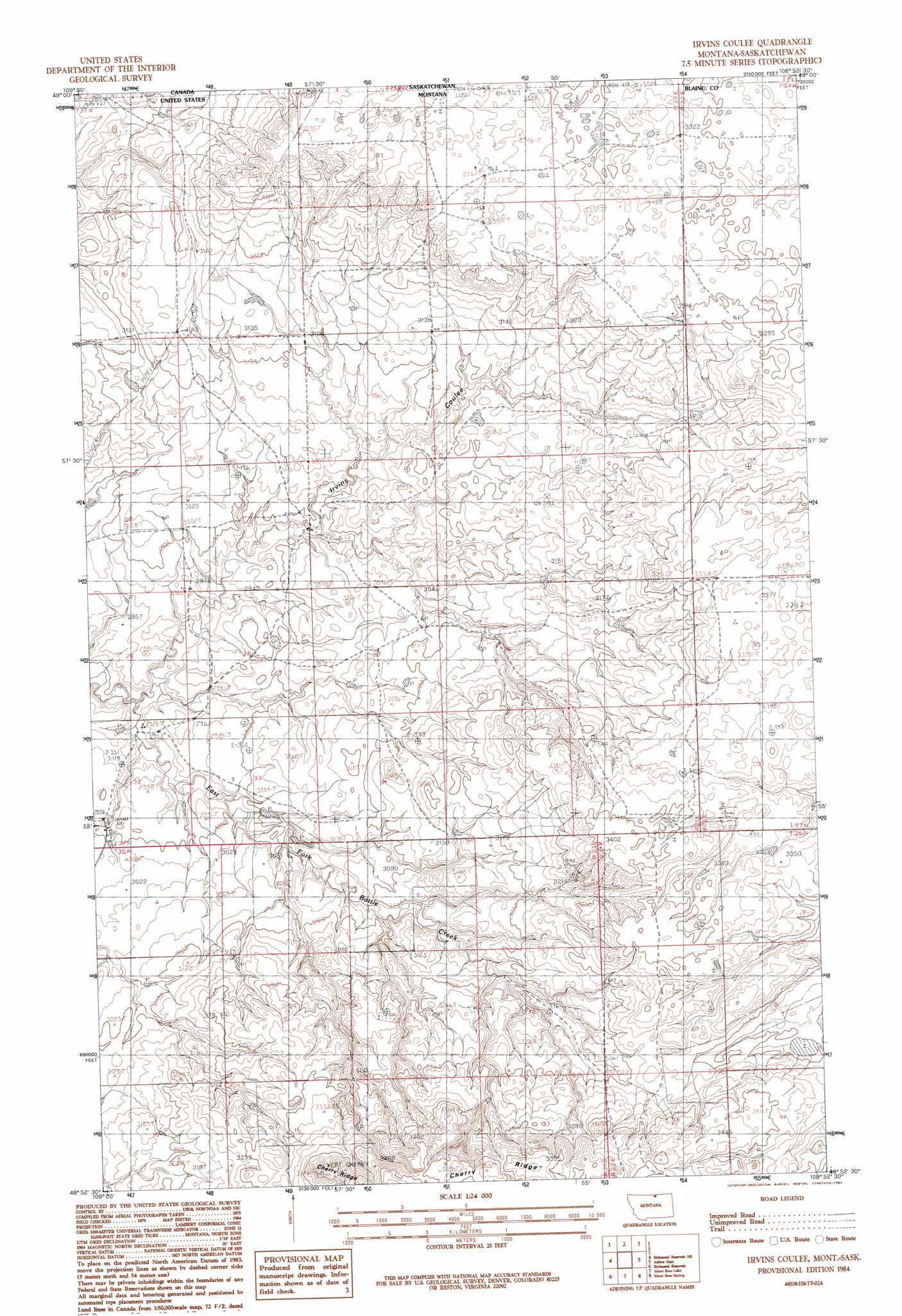
USGS Topo Quad 48108h8 - 1:24,000 scale
| Topo Map Name: | Irvins Coulee |
| USGS Topo Quad ID: | 48108h8 |
| Print Size: | ca. 21 1/4" wide x 27" high |
| Southeast Coordinates: | 48.875° N latitude / 108.875° W longitude |
| Map Center Coordinates: | 48.9375° N latitude / 108.9375° W longitude |
| U.S. State: | MT |
| Filename: | o48108h8.jpg |
| Download Map JPG Image: | Irvins Coulee topo map 1:24,000 scale |
| Map Type: | Topographic |
| Topo Series: | 7.5´ |
| Map Scale: | 1:24,000 |
| Source of Map Images: | United States Geological Survey (USGS) |
| Alternate Map Versions: |
Irvins Coulee MT 1984, updated 1984 Download PDF Buy paper map Irvins Coulee MT 2011 Download PDF Buy paper map Irvins Coulee MT 2014 Download PDF Buy paper map |
1:24,000 Topo Quads surrounding Irvins Coulee
Richmond Reservoir Nw |
Richmond Reservoir Ne |
Irvins Coulee |
Aubrey Dam |
Hogeland Nw |
Richmond Reservoir Sw |
Richmond Reservoir |
Silver Bow Lake |
Silver Bow Spring |
Hogeland |
Rabbit Hills |
Tule Lake |
Harlem Nw |
East Butte |
Wayne Creek Nw |
> Back to 48108e1 at 1:100,000 scale
> Back to 48108a1 at 1:250,000 scale
> Back to U.S. Topo Maps home
Irvins Coulee topo map: Gazetteer
Irvins Coulee: Dams
Gordon Cattle Company Number 3 Dam elevation 976m 3202′Irvins Coulee: Populated Places
Cherry Ridge Ranch elevation 917m 3008′Irvins Coulee: Valleys
Irvins Coulee elevation 889m 2916′Irvins Coulee: Wells
36N22E09BAC_01 Well elevation 964m 3162′37N21E02CAC_01 Well elevation 1025m 3362′
Irvins Coulee digital topo map on disk
Buy this Irvins Coulee topo map showing relief, roads, GPS coordinates and other geographical features, as a high-resolution digital map file on DVD: