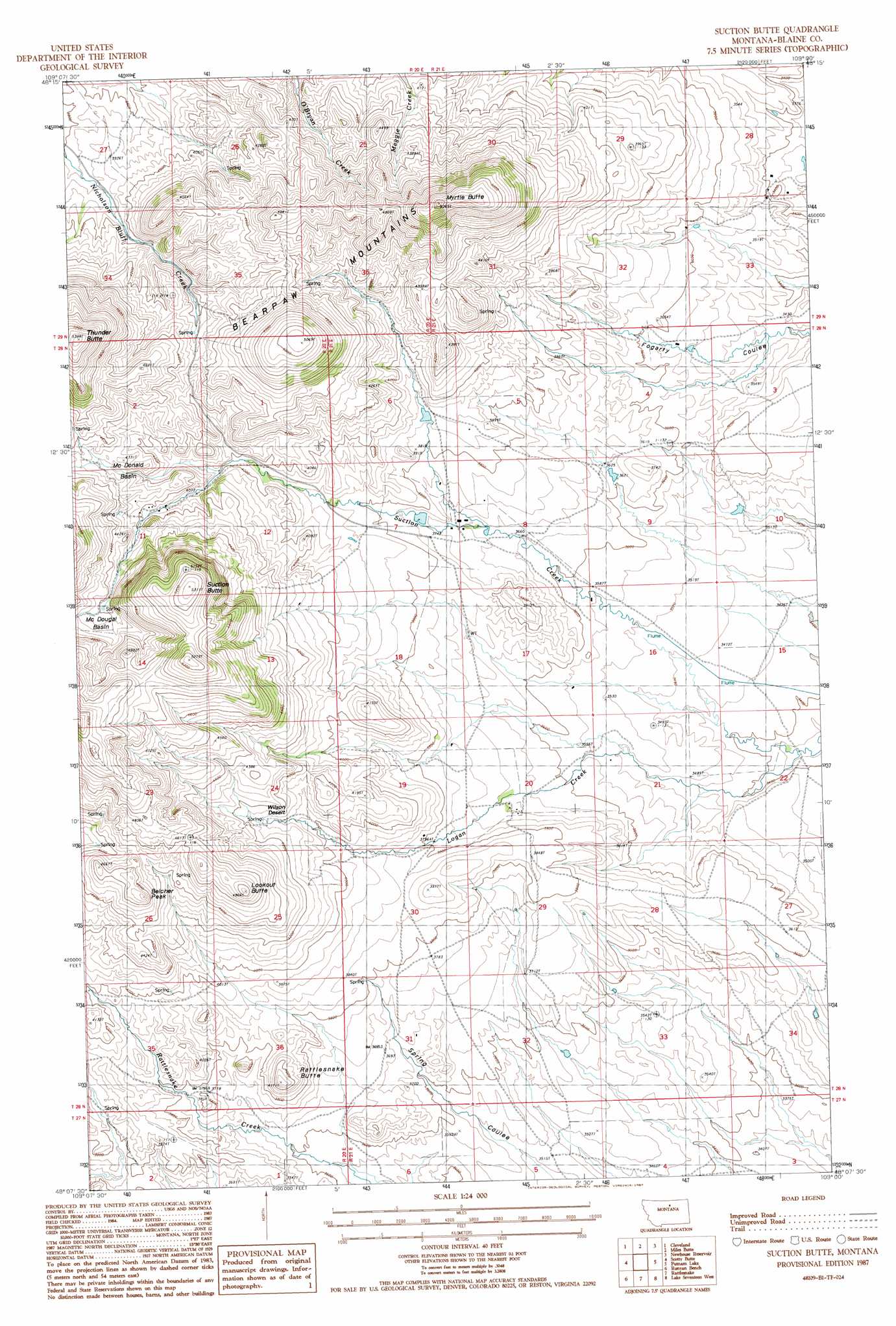
Suction Butte Topo Map Montana
To zoom in, hover over the map of Suction Butte
USGS Topo Quad 48109b1 - 1:24,000 scale
| Topo Map Name: | Suction Butte |
| USGS Topo Quad ID: | 48109b1 |
| Print Size: | ca. 21 1/4" wide x 27" high |
| Southeast Coordinates: | 48.125° N latitude / 109° W longitude |
| Map Center Coordinates: | 48.1875° N latitude / 109.0625° W longitude |
| U.S. State: | MT |
| Filename: | o48109b1.jpg |
| Download Map JPG Image: | Suction Butte topo map 1:24,000 scale |
| Map Type: | Topographic |
| Topo Series: | 7.5´ |
| Map Scale: | 1:24,000 |
| Source of Map Images: | United States Geological Survey (USGS) |
| Alternate Map Versions: |
Suction Butte MT 1987, updated 1987 Download PDF Buy paper map Suction Butte MT 2011 Download PDF Buy paper map Suction Butte MT 2014 Download PDF Buy paper map |
1:24,000 Topo Quads surrounding Suction Butte
Sayer Butte |
Cleveland Nw |
Cleveland Ne |
Big Coulee |
Fort Belknap Agency |
Lloyd |
Cleveland |
Miles Butte |
Newhouse Reservoir |
Fort Belknap Agency Se |
Corrigan Mountain |
Scotty Butte |
Suction Butte |
Putnam Lake |
Lake Seventeen Ne |
Williamson Butte |
Runyan Bench |
Rattlesnake |
Lake Seventeen West |
Lake Seventeen East |
Nolan Reservoir |
Sandpiper Reservoir |
Butch Reservoir |
John Coulee |
Crazyman Coulee |
> Back to 48109a1 at 1:100,000 scale
> Back to 48108a1 at 1:250,000 scale
> Back to U.S. Topo Maps home
Suction Butte topo map: Gazetteer
Suction Butte: Basins
McDonald Basin elevation 1302m 4271′McDougal Basin elevation 1352m 4435′
Suction Butte: Plains
Wilson Desert elevation 1260m 4133′Suction Butte: Streams
Logan Creek elevation 1023m 3356′Suction Butte: Summits
Belcher Peak elevation 1450m 4757′Lookout Butte elevation 1479m 4852′
Myrtle Butte elevation 1584m 5196′
Rattlesnake Butte elevation 1254m 4114′
Suction Butte elevation 1617m 5305′
Thunder Butte elevation 1641m 5383′
Suction Butte digital topo map on disk
Buy this Suction Butte topo map showing relief, roads, GPS coordinates and other geographical features, as a high-resolution digital map file on DVD: