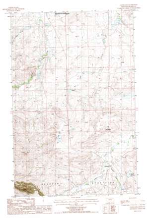
Cleveland Topo Map Montana
To zoom in, hover over the map of Cleveland
USGS Topo Quad 48109c2 - 1:24,000 scale
| Topo Map Name: | Cleveland |
| USGS Topo Quad ID: | 48109c2 |
| Print Size: | ca. 21 1/4" wide x 27" high |
| Southeast Coordinates: | 48.25° N latitude / 109.125° W longitude |
| Map Center Coordinates: | 48.3125° N latitude / 109.1875° W longitude |
| U.S. State: | MT |
| Filename: | o48109c2.jpg |
| Download Map JPG Image: | Cleveland topo map 1:24,000 scale |
| Map Type: | Topographic |
| Topo Series: | 7.5´ |
| Map Scale: | 1:24,000 |
| Source of Map Images: | United States Geological Survey (USGS) |
| Alternate Map Versions: |
Cleveland MT 1987, updated 1987 Download PDF Buy paper map Cleveland MT 2011 Download PDF Buy paper map Cleveland MT 2014 Download PDF Buy paper map |
1:24,000 Topo Quads surrounding Cleveland
> Back to 48109a1 at 1:100,000 scale
> Back to 48108a1 at 1:250,000 scale
> Back to U.S. Topo Maps home
Cleveland topo map: Gazetteer
Cleveland: Dams
Big Bear Dam elevation 1081m 3546′Faber Cattle Dam elevation 1104m 3622′
Gordon Cattle Company Number 1 Dam elevation 975m 3198′
Gordon Cattle Company Number 2 Dam elevation 1001m 3284′
Heaven Dam elevation 1127m 3697′
Number 6 Dam elevation 939m 3080′
Oak Dam elevation 1008m 3307′
Sugar Dam elevation 939m 3080′
Cleveland: Lakes
Ross Lake elevation 1087m 3566′Cleveland: Pillars
Sand Rocks elevation 1130m 3707′Cleveland: Populated Places
Cleveland elevation 1068m 3503′Cleveland: Post Offices
Cleveland Post Office (historical) elevation 1068m 3503′Nelson Post Office (historical) elevation 1230m 4035′
Cleveland: Reservoirs
Faber Reservoir elevation 1097m 3599′Cleveland: Streams
Cleveland Creek elevation 1049m 3441′Crown Butte Creek elevation 1075m 3526′
Granite Creek elevation 940m 3083′
Miles Creek elevation 934m 3064′
Nicholson Bluff Creek elevation 1062m 3484′
Schultz Creek elevation 1049m 3441′
Timber Creek elevation 1102m 3615′
Willow Creek elevation 1065m 3494′
Cleveland: Summits
Crown Butte elevation 1445m 4740′Timber Butte elevation 1629m 5344′
Cleveland digital topo map on disk
Buy this Cleveland topo map showing relief, roads, GPS coordinates and other geographical features, as a high-resolution digital map file on DVD:


