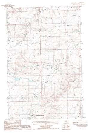
Cleveland Nw Topo Map Montana
To zoom in, hover over the map of Cleveland Nw
USGS Topo Quad 48109d2 - 1:24,000 scale
| Topo Map Name: | Cleveland Nw |
| USGS Topo Quad ID: | 48109d2 |
| Print Size: | ca. 21 1/4" wide x 27" high |
| Southeast Coordinates: | 48.375° N latitude / 109.125° W longitude |
| Map Center Coordinates: | 48.4375° N latitude / 109.1875° W longitude |
| U.S. State: | MT |
| Filename: | o48109d2.jpg |
| Download Map JPG Image: | Cleveland Nw topo map 1:24,000 scale |
| Map Type: | Topographic |
| Topo Series: | 7.5´ |
| Map Scale: | 1:24,000 |
| Source of Map Images: | United States Geological Survey (USGS) |
| Alternate Map Versions: |
Cleveland NW MT 1987, updated 1987 Download PDF Buy paper map Cleveland NW MT 2011 Download PDF Buy paper map Cleveland NW MT 2014 Download PDF Buy paper map |
1:24,000 Topo Quads surrounding Cleveland Nw
> Back to 48109a1 at 1:100,000 scale
> Back to 48108a1 at 1:250,000 scale
> Back to U.S. Topo Maps home
Cleveland Nw topo map: Gazetteer
Cleveland Nw: Dams
Garden Dam elevation 902m 2959′Snake Dam elevation 890m 2919′
Tiger Number 1 Dam elevation 883m 2896′
Cleveland Nw: Mines
Blackjack Mine elevation 879m 2883′Cleveland Nw: Oilfields
Bowes Oil Field elevation 919m 3015′Cleveland Nw: Parks
Bear Paw Battlefield - Nez Perce National Historical Park elevation 910m 2985′Cleveland Nw: Streams
Bean Creek elevation 854m 2801′Spring Creek elevation 920m 3018′
Cleveland Nw: Valleys
Olson Road Coulee elevation 836m 2742′Spring Coulee elevation 892m 2926′
Cleveland Nw: Wells
31N19E13ADBA01 Well elevation 898m 2946′31N19E13ADBA02 Well elevation 898m 2946′
31N20E28CDBD01 Well elevation 941m 3087′
32N19E36CDCA01 Well elevation 879m 2883′
32N19E36CDCB01 Well elevation 872m 2860′
32N20E32DDDC01 Well elevation 876m 2874′
32N20E33DDAD01 Well elevation 864m 2834′
32N20E34CCBB01 Well elevation 862m 2828′
Cleveland Nw digital topo map on disk
Buy this Cleveland Nw topo map showing relief, roads, GPS coordinates and other geographical features, as a high-resolution digital map file on DVD:


