Lloyd Nw Topo Map Montana
To zoom in, hover over the map of Lloyd Nw
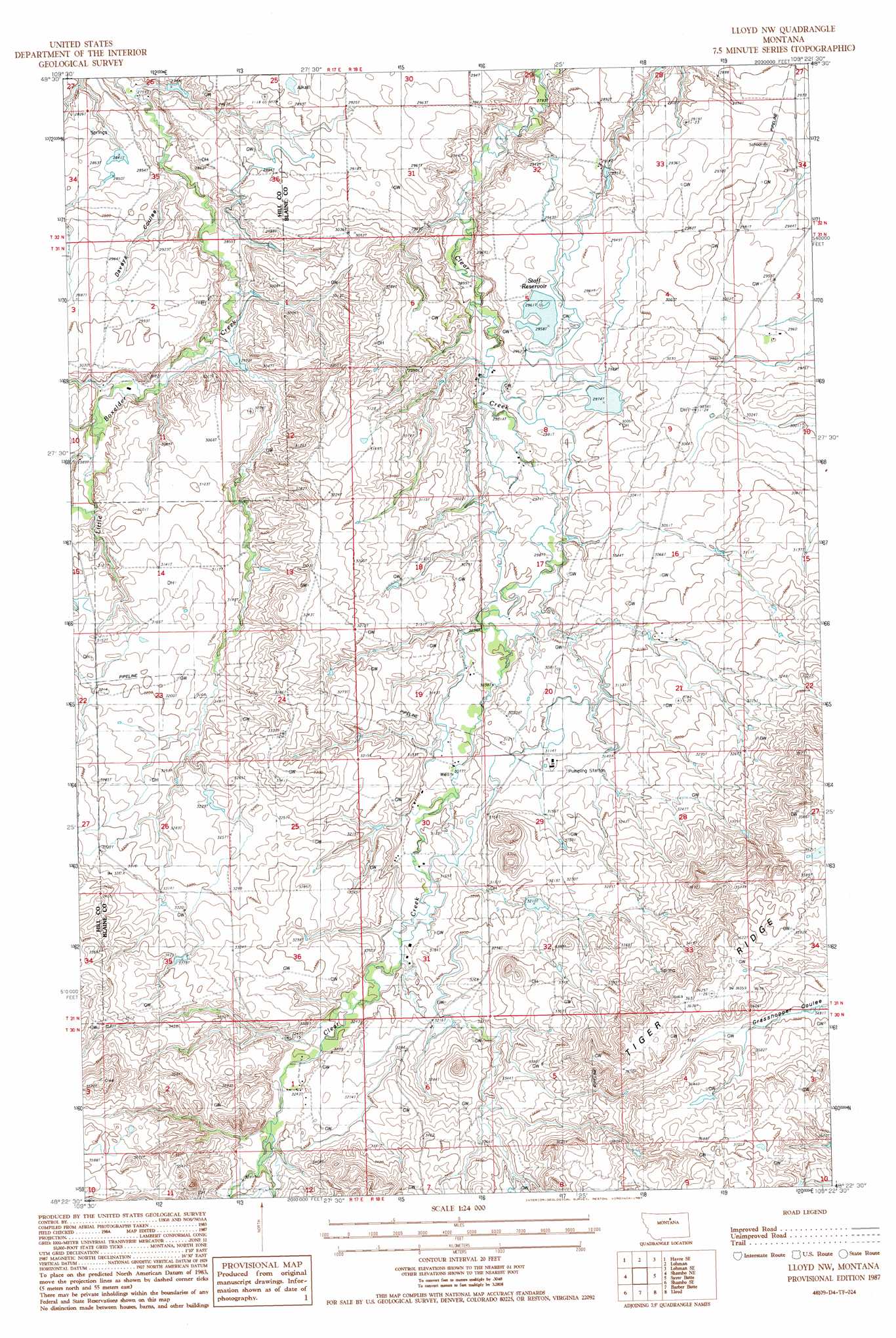
USGS Topo Quad 48109d4 - 1:24,000 scale
| Topo Map Name: | Lloyd Nw |
| USGS Topo Quad ID: | 48109d4 |
| Print Size: | ca. 21 1/4" wide x 27" high |
| Southeast Coordinates: | 48.375° N latitude / 109.375° W longitude |
| Map Center Coordinates: | 48.4375° N latitude / 109.4375° W longitude |
| U.S. State: | MT |
| Filename: | o48109d4.jpg |
| Download Map JPG Image: | Lloyd Nw topo map 1:24,000 scale |
| Map Type: | Topographic |
| Topo Series: | 7.5´ |
| Map Scale: | 1:24,000 |
| Source of Map Images: | United States Geological Survey (USGS) |
| Alternate Map Versions: |
Lloyd NW MT 1987, updated 1987 Download PDF Buy paper map Lloyd NW MT 2011 Download PDF Buy paper map Lloyd NW MT 2014 Download PDF Buy paper map |
1:24,000 Topo Quads surrounding Lloyd Nw
Havre Nw |
Havre Ne |
Reservoir Coulee |
Telescope Coulee |
Rabbit Hills |
Havre |
Havre Se |
Lohman |
Lohman Se |
Chinook |
Cement Hill |
Shambo Ne |
Lloyd Nw |
Sayer Butte |
Cleveland Nw |
Bearpaw Lake |
Shambo Se |
Barber Butte |
Lloyd |
Cleveland |
Bowery Peak |
Big John Butte |
Maddux |
Corrigan Mountain |
Scotty Butte |
> Back to 48109a1 at 1:100,000 scale
> Back to 48108a1 at 1:250,000 scale
> Back to U.S. Topo Maps home
Lloyd Nw topo map: Gazetteer
Lloyd Nw: Dams
Box Office Dam elevation 880m 2887′Staff Number 1 Dam elevation 900m 2952′
Staff Number 2 Dam elevation 906m 2972′
Lloyd Nw: Post Offices
Ada Post Office (historical) elevation 987m 3238′Lloyd Nw: Reservoirs
Staff Reservoir elevation 900m 2952′Lloyd Nw: Ridges
Tiger Ridge elevation 1105m 3625′Lloyd Nw: Valleys
Daveys Coulee elevation 859m 2818′Lloyd Nw: Wells
31N18E21BABB01 Well elevation 943m 3093′31N18E21BACA01 Well elevation 945m 3100′
Lloyd Nw digital topo map on disk
Buy this Lloyd Nw topo map showing relief, roads, GPS coordinates and other geographical features, as a high-resolution digital map file on DVD: