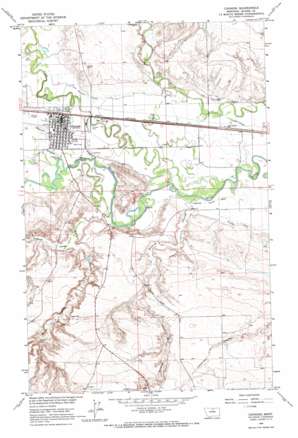
Chinook Topo Map Montana
To zoom in, hover over the map of Chinook
USGS Topo Quad 48109e2 - 1:24,000 scale
| Topo Map Name: | Chinook |
| USGS Topo Quad ID: | 48109e2 |
| Print Size: | ca. 21 1/4" wide x 27" high |
| Southeast Coordinates: | 48.5° N latitude / 109.125° W longitude |
| Map Center Coordinates: | 48.5625° N latitude / 109.1875° W longitude |
| U.S. State: | MT |
| Filename: | o48109e2.jpg |
| Download Map JPG Image: | Chinook topo map 1:24,000 scale |
| Map Type: | Topographic |
| Topo Series: | 7.5´ |
| Map Scale: | 1:24,000 |
| Source of Map Images: | United States Geological Survey (USGS) |
| Alternate Map Versions: |
Chinnok MT 1964, updated 1967 Download PDF Buy paper map Chinook MT 2011 Download PDF Buy paper map Chinook MT 2014 Download PDF Buy paper map |
1:24,000 Topo Quads surrounding Chinook
> Back to 48109e1 at 1:100,000 scale
> Back to 48108a1 at 1:250,000 scale
> Back to U.S. Topo Maps home
Chinook topo map: Gazetteer
Chinook: Airports
Edgar G Obie Airport elevation 734m 2408′Chinook: Canals
Matheson Ditch elevation 729m 2391′Chinook: Dams
Paradise Diversion Dam elevation 735m 2411′Chinook: Parks
Battle of Bears Paw Historical Marker elevation 735m 2411′Centennial Park elevation 740m 2427′
Hoon Field elevation 734m 2408′
North Side Park elevation 735m 2411′
Sweet Memorial Park elevation 735m 2411′
Chinook: Populated Places
Burns Trailer Court elevation 740m 2427′Chinook elevation 740m 2427′
Sprinkle Trailer Court elevation 740m 2427′
Chinook: Post Offices
Chinook Post Office elevation 740m 2427′Chinook: Streams
Lodge Creek elevation 727m 2385′Three Mile Creek elevation 731m 2398′
Chinook: Valleys
Black Coulee elevation 732m 2401′Redrock Coulee elevation 734m 2408′
Sharnikon Gulch elevation 730m 2395′
Sixmile Coulee elevation 730m 2395′
Threemile Coulee elevation 737m 2417′
Chinook: Wells
32N19E02ADA_01 Well elevation 747m 2450′32N19E26AABA01 Well elevation 853m 2798′
32N20E03BCDC01 Well elevation 728m 2388′
33N19E02ABAD01 Well elevation 758m 2486′
Chinook digital topo map on disk
Buy this Chinook topo map showing relief, roads, GPS coordinates and other geographical features, as a high-resolution digital map file on DVD:


