Kiehns Coulee Topo Map Montana
To zoom in, hover over the map of Kiehns Coulee
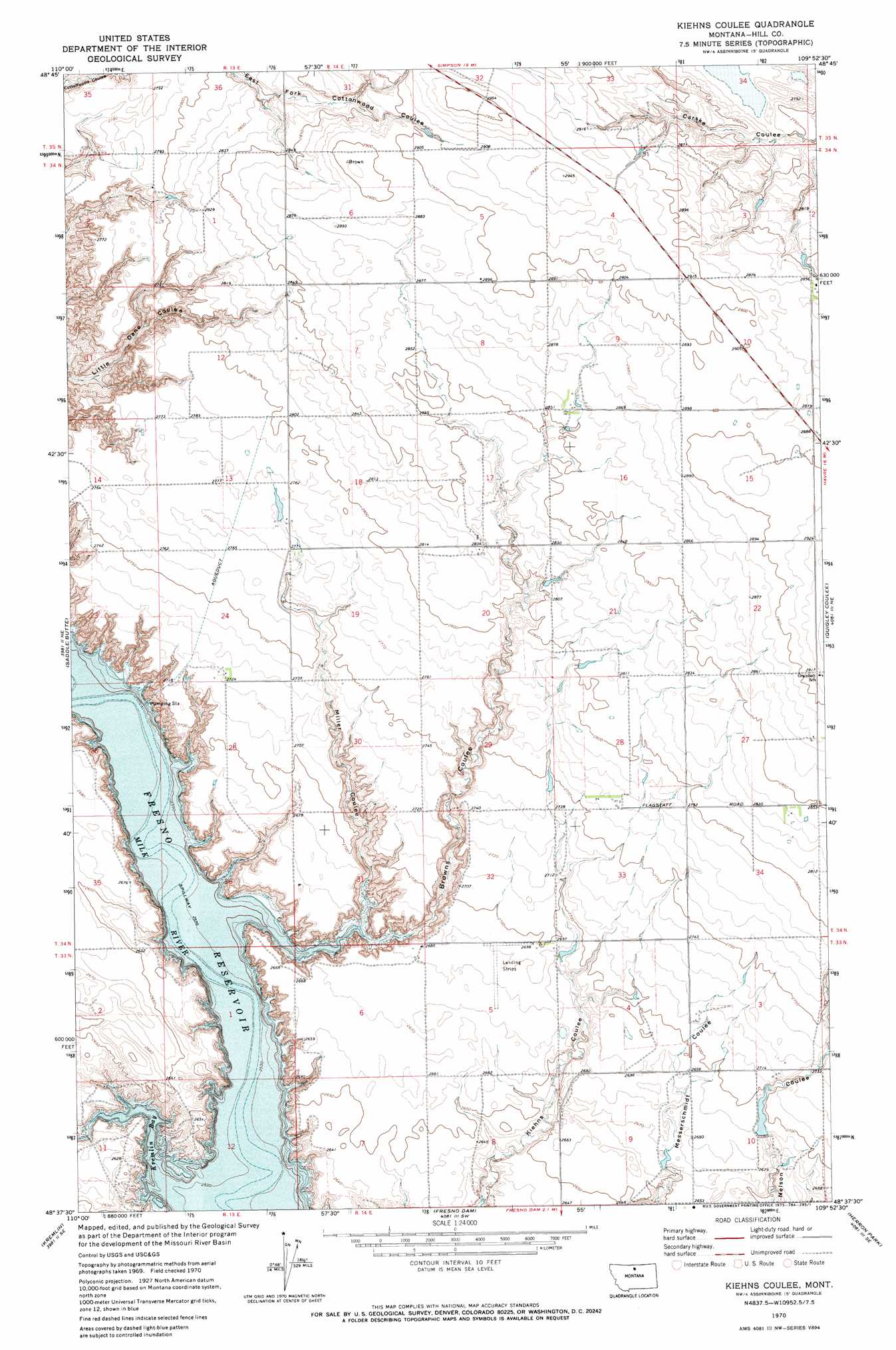
USGS Topo Quad 48109f8 - 1:24,000 scale
| Topo Map Name: | Kiehns Coulee |
| USGS Topo Quad ID: | 48109f8 |
| Print Size: | ca. 21 1/4" wide x 27" high |
| Southeast Coordinates: | 48.625° N latitude / 109.875° W longitude |
| Map Center Coordinates: | 48.6875° N latitude / 109.9375° W longitude |
| U.S. State: | MT |
| Filename: | o48109f8.jpg |
| Download Map JPG Image: | Kiehns Coulee topo map 1:24,000 scale |
| Map Type: | Topographic |
| Topo Series: | 7.5´ |
| Map Scale: | 1:24,000 |
| Source of Map Images: | United States Geological Survey (USGS) |
| Alternate Map Versions: |
Kiehns Coulee MT 1970, updated 1973 Download PDF Buy paper map Kiehns Coulee MT 2011 Download PDF Buy paper map Kiehns Coulee MT 2014 Download PDF Buy paper map |
1:24,000 Topo Quads surrounding Kiehns Coulee
Simpson |
Wild Horse Lake West |
Wild Horse Lake East |
Creedman Coulee West |
Creedman Coulee East |
Ninemile Coulee East |
Saint Johns |
Cottonwood |
Hilldale Colony |
Lake Thibadeau Sw |
Dry Lake |
Saddle Butte |
Kiehns Coulee |
Quigley Coulee |
Havre Nw |
Sage Lake |
Kremlin |
Fresno Dam |
Herron Park |
Havre |
Box Elder Nw |
Bailey Reservoir |
Laredo |
Laredo Ne |
Cement Hill |
> Back to 48109e1 at 1:100,000 scale
> Back to 48108a1 at 1:250,000 scale
> Back to U.S. Topo Maps home
Kiehns Coulee topo map: Gazetteer
Kiehns Coulee: Bays
Kremlin Bay elevation 784m 2572′Kiehns Coulee: Dams
John Estate McSlay Dam elevation 820m 2690′Kiehns Coulee: Valleys
Browns Coulee elevation 789m 2588′Miller Coulee elevation 789m 2588′
Kiehns Coulee: Wells
34N14E28CDDD01 Well elevation 845m 2772′Kiehns Coulee digital topo map on disk
Buy this Kiehns Coulee topo map showing relief, roads, GPS coordinates and other geographical features, as a high-resolution digital map file on DVD: