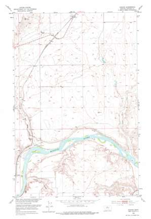
Verona Topo Map Montana
To zoom in, hover over the map of Verona
USGS Topo Quad 48110a2 - 1:24,000 scale
| Topo Map Name: | Verona |
| USGS Topo Quad ID: | 48110a2 |
| Print Size: | ca. 21 1/4" wide x 27" high |
| Southeast Coordinates: | 48° N latitude / 110.125° W longitude |
| Map Center Coordinates: | 48.0625° N latitude / 110.1875° W longitude |
| U.S. State: | MT |
| Filename: | o48110a2.jpg |
| Download Map JPG Image: | Verona topo map 1:24,000 scale |
| Map Type: | Topographic |
| Topo Series: | 7.5´ |
| Map Scale: | 1:24,000 |
| Source of Map Images: | United States Geological Survey (USGS) |
| Alternate Map Versions: |
Verona MT 1953, updated 1955 Download PDF Buy paper map Verona MT 1953, updated 1976 Download PDF Buy paper map Verona MT 2011 Download PDF Buy paper map Verona MT 2014 Download PDF Buy paper map |
1:24,000 Topo Quads surrounding Verona
> Back to 48110a1 at 1:100,000 scale
> Back to 48110a1 at 1:250,000 scale
> Back to U.S. Topo Maps home
Verona topo map: Gazetteer
Verona: Bridges
Coal Banks Bridge elevation 775m 2542′Verona: Dams
Knottnerus Dam elevation 806m 2644′Turk Dam elevation 816m 2677′
Verona: Parks
Coalbanks Recreation Area elevation 771m 2529′Verona: Populated Places
Coal Banks Landing elevation 765m 2509′Verona elevation 829m 2719′
Verona: Post Offices
Verona Post Office (historical) elevation 829m 2719′Verona: Streams
Little Sandy Creek elevation 764m 2506′Verona: Valleys
Coal Banks Coulee elevation 776m 2545′Jackson Coulee elevation 767m 2516′
Rattlesnake Coulee elevation 763m 2503′
Verona digital topo map on disk
Buy this Verona topo map showing relief, roads, GPS coordinates and other geographical features, as a high-resolution digital map file on DVD:


