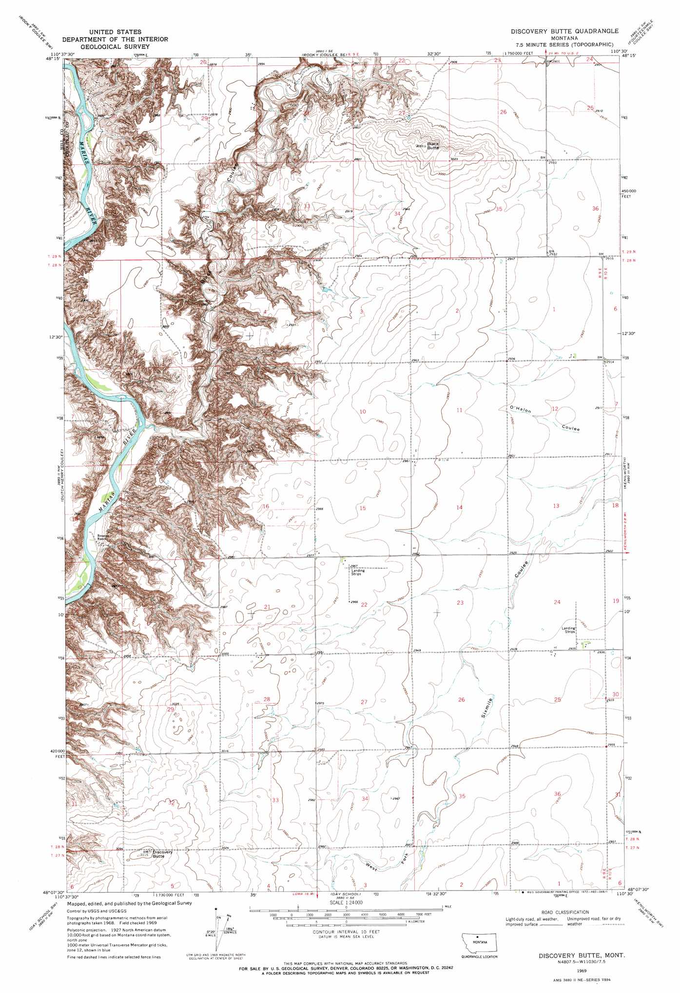
Discovery Butte Topo Map Montana
To zoom in, hover over the map of Discovery Butte
USGS Topo Quad 48110b5 - 1:24,000 scale
| Topo Map Name: | Discovery Butte |
| USGS Topo Quad ID: | 48110b5 |
| Print Size: | ca. 21 1/4" wide x 27" high |
| Southeast Coordinates: | 48.125° N latitude / 110.5° W longitude |
| Map Center Coordinates: | 48.1875° N latitude / 110.5625° W longitude |
| U.S. State: | MT |
| Filename: | o48110b5.jpg |
| Download Map JPG Image: | Discovery Butte topo map 1:24,000 scale |
| Map Type: | Topographic |
| Topo Series: | 7.5´ |
| Map Scale: | 1:24,000 |
| Source of Map Images: | United States Geological Survey (USGS) |
| Alternate Map Versions: |
Discovery Butte MT 1969, updated 1972 Download PDF Buy paper map Discovery Butte MT 2011 Download PDF Buy paper map Discovery Butte MT 2014 Download PDF Buy paper map |
1:24,000 Topo Quads surrounding Discovery Butte
Poverty Coulee Ne |
Rocky Coulee |
Een School |
Fourteenmile Coulee Nw |
Fourteenmile Coulee Ne |
Poverty Coulee Se |
Rocky Coulee Sw |
Rocky Coulee Se |
Fourteenmile Coulee Sw |
Fourteenmile Coulee Se |
Penzer School |
Dutch Henry Coulee |
Discovery Butte |
Kenilworth |
Kenilworth Ne |
Goose Bill Butte |
Day School Sw |
Day School |
Kenilworth Sw |
Boggs Island |
Carter Ne |
Fort Benton Nw |
Loma West |
Loma East |
Stranahan |
> Back to 48110a1 at 1:100,000 scale
> Back to 48110a1 at 1:250,000 scale
> Back to U.S. Topo Maps home
Discovery Butte topo map: Gazetteer
Discovery Butte: Post Offices
Peters Post Office (historical) elevation 857m 2811′Discovery Butte: Summits
Black Butte elevation 926m 3038′Discovery Butte elevation 949m 3113′
Discovery Butte: Valleys
Black Coulee elevation 812m 2664′O'Halon Coulee elevation 890m 2919′
West Fork Sixmile Coulee elevation 900m 2952′
Discovery Butte: Wells
28N02E31BCCC01 Well elevation 902m 2959′28N09E22BBBB01 Well elevation 909m 2982′
28N10E07BB__01 Well elevation 888m 2913′
Discovery Butte digital topo map on disk
Buy this Discovery Butte topo map showing relief, roads, GPS coordinates and other geographical features, as a high-resolution digital map file on DVD: