Fourteenmile Coulee Sw Topo Map Montana
To zoom in, hover over the map of Fourteenmile Coulee Sw
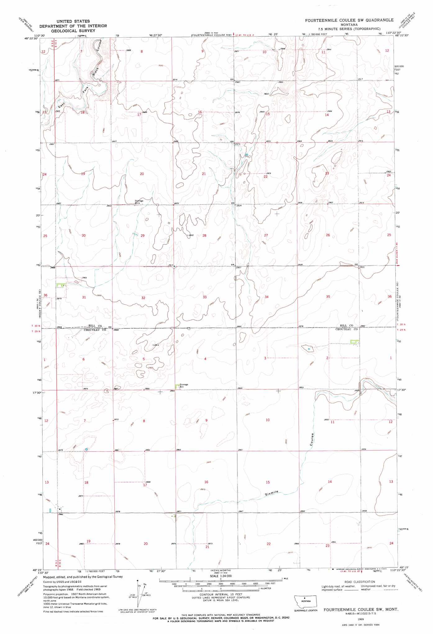
USGS Topo Quad 48110c4 - 1:24,000 scale
| Topo Map Name: | Fourteenmile Coulee Sw |
| USGS Topo Quad ID: | 48110c4 |
| Print Size: | ca. 21 1/4" wide x 27" high |
| Southeast Coordinates: | 48.25° N latitude / 110.375° W longitude |
| Map Center Coordinates: | 48.3125° N latitude / 110.4375° W longitude |
| U.S. State: | MT |
| Filename: | o48110c4.jpg |
| Download Map JPG Image: | Fourteenmile Coulee Sw topo map 1:24,000 scale |
| Map Type: | Topographic |
| Topo Series: | 7.5´ |
| Map Scale: | 1:24,000 |
| Source of Map Images: | United States Geological Survey (USGS) |
| Alternate Map Versions: |
Fourteenmile Coulee SW MT 1969, updated 1972 Download PDF Buy paper map Fourteenmile Coulee SW MT 2011 Download PDF Buy paper map Fourteenmile Coulee SW MT 2014 Download PDF Buy paper map |
1:24,000 Topo Quads surrounding Fourteenmile Coulee Sw
Inverness |
Rudyard |
Hingham |
Gildford |
Sage Lake |
Rocky Coulee |
Een School |
Fourteenmile Coulee Nw |
Fourteenmile Coulee Ne |
Box Elder Nw |
Rocky Coulee Sw |
Rocky Coulee Se |
Fourteenmile Coulee Sw |
Fourteenmile Coulee Se |
Lonesome Lake |
Dutch Henry Coulee |
Discovery Butte |
Kenilworth |
Kenilworth Ne |
Ihmsen Well |
Day School Sw |
Day School |
Kenilworth Sw |
Boggs Island |
Verona |
> Back to 48110a1 at 1:100,000 scale
> Back to 48110a1 at 1:250,000 scale
> Back to U.S. Topo Maps home
Fourteenmile Coulee Sw topo map: Gazetteer
Fourteenmile Coulee Sw: Post Offices
Prairie City Post Office (historical) elevation 882m 2893′Fourteenmile Coulee Sw: Wells
29N10E01CD__01 Well elevation 875m 2870′29N10E02AD__01 Well elevation 877m 2877′
29N10E18CC__01 Well elevation 878m 2880′
29N10E18CC__02 Well elevation 878m 2880′
29N10E18CCDB01 Well elevation 878m 2880′
29N10E20AA__01 Well elevation 876m 2874′
29N10E22BC__01 Well elevation 874m 2867′
29N10E22DD__01 Well elevation 876m 2874′
29N10E23AA__01 Well elevation 872m 2860′
29N10E23AADA01 Well elevation 873m 2864′
30N10E29AB__01 Well elevation 899m 2949′
Fourteenmile Coulee Sw digital topo map on disk
Buy this Fourteenmile Coulee Sw topo map showing relief, roads, GPS coordinates and other geographical features, as a high-resolution digital map file on DVD: