Chester Topo Map Montana
To zoom in, hover over the map of Chester
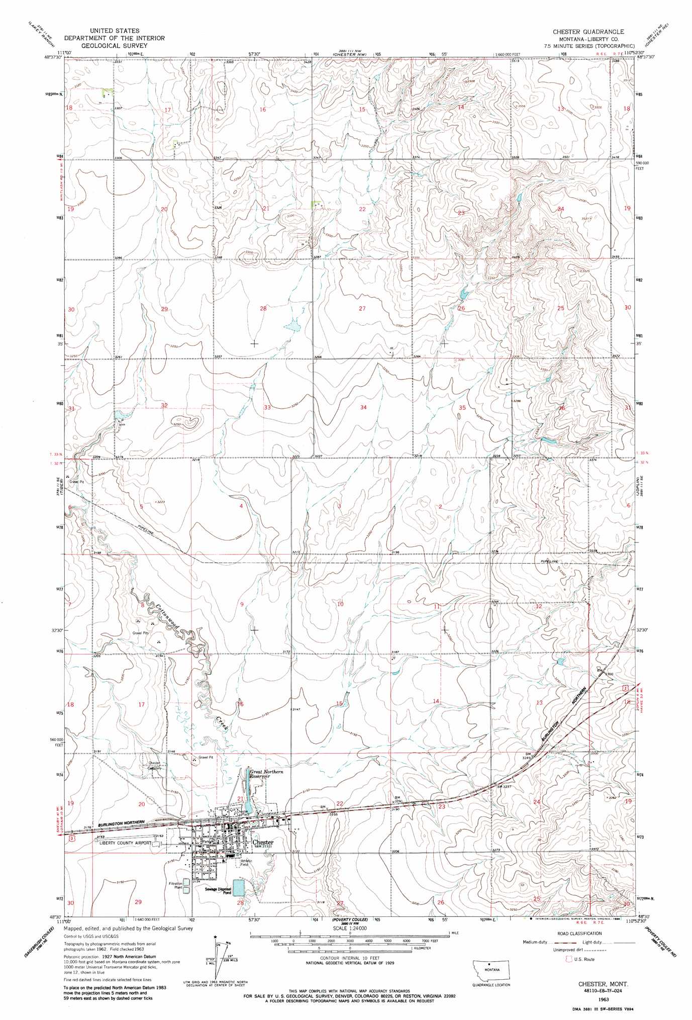
USGS Topo Quad 48110e8 - 1:24,000 scale
| Topo Map Name: | Chester |
| USGS Topo Quad ID: | 48110e8 |
| Print Size: | ca. 21 1/4" wide x 27" high |
| Southeast Coordinates: | 48.5° N latitude / 110.875° W longitude |
| Map Center Coordinates: | 48.5625° N latitude / 110.9375° W longitude |
| U.S. State: | MT |
| Filename: | o48110e8.jpg |
| Download Map JPG Image: | Chester topo map 1:24,000 scale |
| Map Type: | Topographic |
| Topo Series: | 7.5´ |
| Map Scale: | 1:24,000 |
| Source of Map Images: | United States Geological Survey (USGS) |
| Alternate Map Versions: |
Chester MT 1963, updated 1966 Download PDF Buy paper map Chester MT 1963, updated 1986 Download PDF Buy paper map Chester MT 2011 Download PDF Buy paper map Chester MT 2014 Download PDF Buy paper map |
1:24,000 Topo Quads surrounding Chester
Haystack Butte |
Mount Lebanon |
Vaver Reservoir |
Bobcat Coulee Se |
Goldstone Sw |
Blair Ranch |
Lakey Ranch |
Chester Nw |
Chester Ne |
Rudyard Nw |
North Lothair School |
Tiber |
Chester |
Joplin |
Inverness |
Lothair |
Sagebrush Coulee |
Poverty Coulee |
Poverty Coulee Ne |
Rocky Coulee |
Lothair Sw |
Tiber Dam |
Circle Bridge |
Poverty Coulee Se |
Rocky Coulee Sw |
> Back to 48110e1 at 1:100,000 scale
> Back to 48110a1 at 1:250,000 scale
> Back to U.S. Topo Maps home
Chester topo map: Gazetteer
Chester: Airports
Liberty County Airport elevation 964m 3162′Chester: Dams
Chester City Water Supply Number 1 Dam elevation 956m 3136′Chester City Water Supply Number 2 Dam elevation 956m 3136′
Gagnon Reservoir Dam elevation 984m 3228′
Chester: Parks
Chester City Park elevation 957m 3139′Chester: Populated Places
Chester elevation 955m 3133′Chester: Post Offices
Chester Post Office elevation 955m 3133′Chester: Reservoirs
Great Northern Reservoir elevation 958m 3143′Chester: Valleys
Alma Coulee elevation 963m 3159′Badger Coulee elevation 958m 3143′
Bison Coulee elevation 958m 3143′
Clayton Coulee elevation 966m 3169′
East Branch Alma Coulee elevation 963m 3159′
Heimbigner Coulee elevation 970m 3182′
Keith Coulee elevation 958m 3143′
Chester: Wells
32N06E12ADDD01 Well elevation 1004m 3293′32N14E30CBBA01 Well elevation 955m 3133′
33N06E22BCCD01 Well elevation 1015m 3330′
Chester digital topo map on disk
Buy this Chester topo map showing relief, roads, GPS coordinates and other geographical features, as a high-resolution digital map file on DVD: