Saint Johns Topo Map Montana
To zoom in, hover over the map of Saint Johns
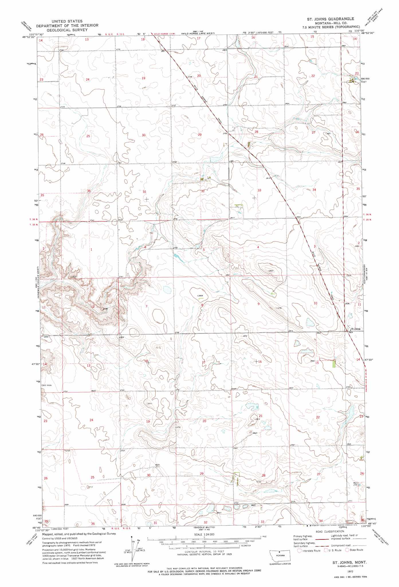
USGS Topo Quad 48110g1 - 1:24,000 scale
| Topo Map Name: | Saint Johns |
| USGS Topo Quad ID: | 48110g1 |
| Print Size: | ca. 21 1/4" wide x 27" high |
| Southeast Coordinates: | 48.75° N latitude / 110° W longitude |
| Map Center Coordinates: | 48.8125° N latitude / 110.0625° W longitude |
| U.S. State: | MT |
| Filename: | o48110g1.jpg |
| Download Map JPG Image: | Saint Johns topo map 1:24,000 scale |
| Map Type: | Topographic |
| Topo Series: | 7.5´ |
| Map Scale: | 1:24,000 |
| Source of Map Images: | United States Geological Survey (USGS) |
| Alternate Map Versions: |
St. Johns MT 1972, updated 1975 Download PDF Buy paper map Saint Johns MT 2011 Download PDF Buy paper map Saint Johns MT 2014 Download PDF Buy paper map |
1:24,000 Topo Quads surrounding Saint Johns
Lost River Ne |
Simpson |
Wild Horse Lake West |
Wild Horse Lake East |
Creedman Coulee West |
Ninemile Coulee West |
Ninemile Coulee East |
Saint Johns |
Cottonwood |
Hilldale Colony |
Gildford Ne |
Dry Lake |
Saddle Butte |
Kiehns Coulee |
Quigley Coulee |
Gildford |
Sage Lake |
Kremlin |
Fresno Dam |
Herron Park |
> Back to 48110e1 at 1:100,000 scale
> Back to 48110a1 at 1:250,000 scale
> Back to U.S. Topo Maps home
Saint Johns topo map: Gazetteer
Saint Johns: Dams
Sigurd Dam elevation 851m 2791′Saint Johns: Populated Places
Saint Johns elevation 860m 2821′Saint Johns: Post Offices
Miller Post Office (historical) elevation 849m 2785′Saint Johns: Wells
35N13E21CCBD01 Well elevation 850m 2788′Saint Johns digital topo map on disk
Buy this Saint Johns topo map showing relief, roads, GPS coordinates and other geographical features, as a high-resolution digital map file on DVD: