Wild Horse Lake West Topo Map Montana
To zoom in, hover over the map of Wild Horse Lake West
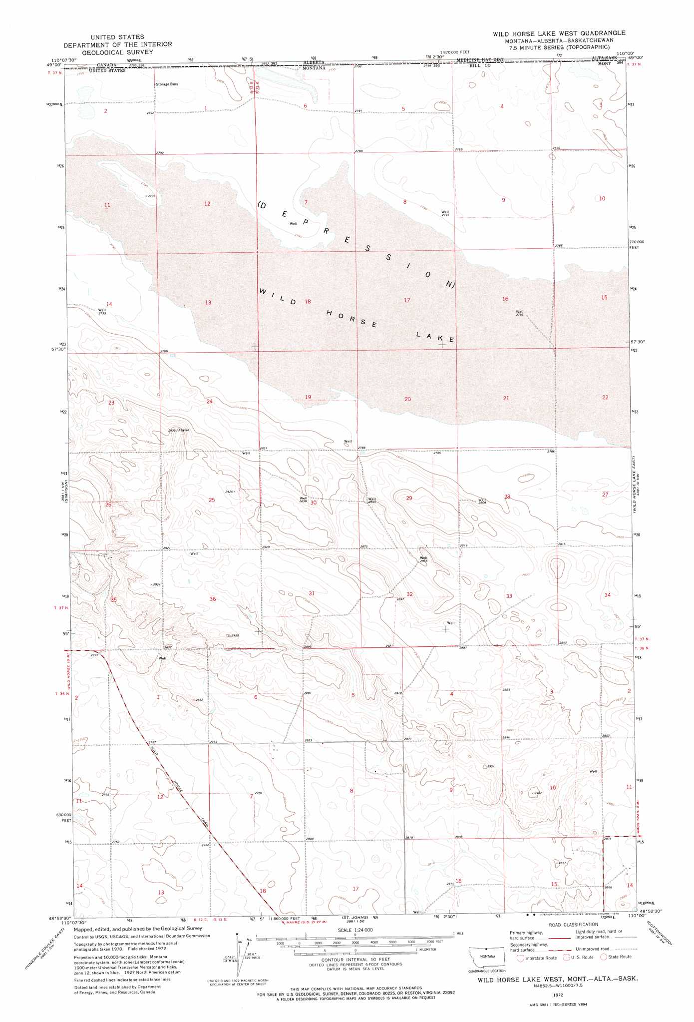
USGS Topo Quad 48110h1 - 1:24,000 scale
| Topo Map Name: | Wild Horse Lake West |
| USGS Topo Quad ID: | 48110h1 |
| Print Size: | ca. 21 1/4" wide x 27" high |
| Southeast Coordinates: | 48.875° N latitude / 110° W longitude |
| Map Center Coordinates: | 48.9375° N latitude / 110.0625° W longitude |
| U.S. State: | MT |
| Filename: | o48110h1.jpg |
| Download Map JPG Image: | Wild Horse Lake West topo map 1:24,000 scale |
| Map Type: | Topographic |
| Topo Series: | 7.5´ |
| Map Scale: | 1:24,000 |
| Source of Map Images: | United States Geological Survey (USGS) |
| Alternate Map Versions: |
Wild Horse Lake West MT 1972, updated 1975 Download PDF Buy paper map Wild Horse Lake West MT 2011 Download PDF Buy paper map Wild Horse Lake West MT 2014 Download PDF Buy paper map |
1:24,000 Topo Quads surrounding Wild Horse Lake West
Lost River Ne |
Simpson |
Wild Horse Lake West |
Wild Horse Lake East |
Creedman Coulee West |
Ninemile Coulee West |
Ninemile Coulee East |
Saint Johns |
Cottonwood |
Hilldale Colony |
Gildford Ne |
Dry Lake |
Saddle Butte |
Kiehns Coulee |
Quigley Coulee |
> Back to 48110e1 at 1:100,000 scale
> Back to 48110a1 at 1:250,000 scale
> Back to U.S. Topo Maps home
Wild Horse Lake West topo map: Gazetteer
Wild Horse Lake West: Dams
Fuago Dam elevation 851m 2791′Wild Horse Lake West: Lakes
Wild Horse Lake elevation 849m 2785′Wild Horse Lake West: Streams
Sage Creek elevation 850m 2788′Wild Horse Lake West: Wells
36N12E01BAAD01 Well elevation 854m 2801′36N13E15ADAB01 Well elevation 873m 2864′
37N13E32ABBD01 Well elevation 868m 2847′
Wild Horse Lake West digital topo map on disk
Buy this Wild Horse Lake West topo map showing relief, roads, GPS coordinates and other geographical features, as a high-resolution digital map file on DVD: