Faris School Topo Map Montana
To zoom in, hover over the map of Faris School
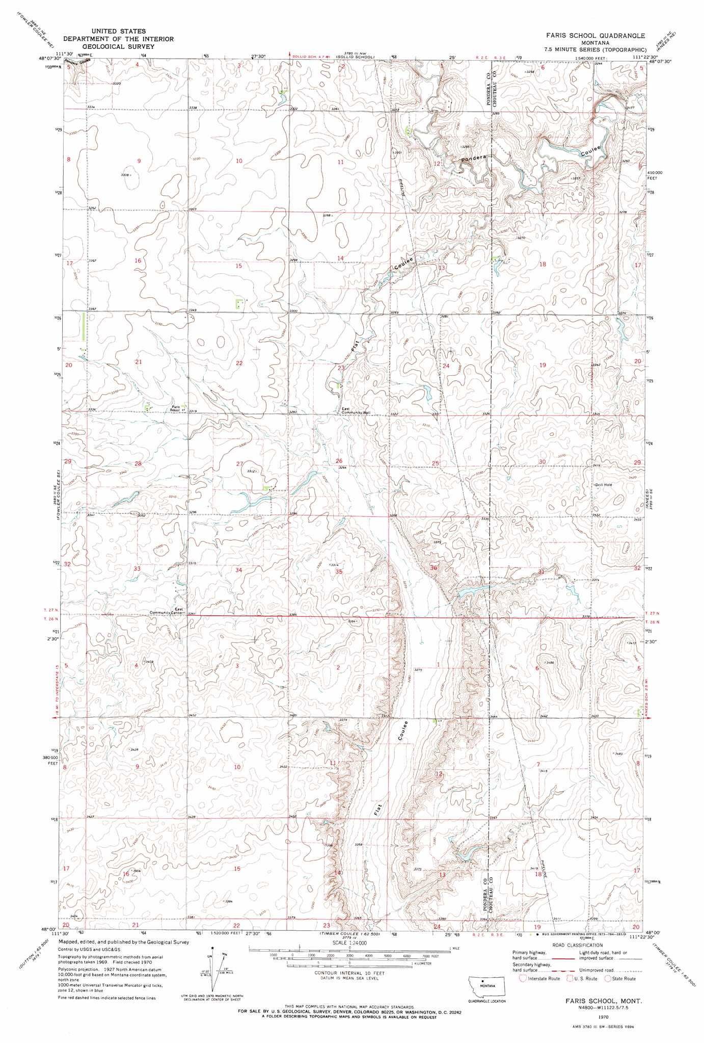
USGS Topo Quad 48111a4 - 1:24,000 scale
| Topo Map Name: | Faris School |
| USGS Topo Quad ID: | 48111a4 |
| Print Size: | ca. 21 1/4" wide x 27" high |
| Southeast Coordinates: | 48° N latitude / 111.375° W longitude |
| Map Center Coordinates: | 48.0625° N latitude / 111.4375° W longitude |
| U.S. State: | MT |
| Filename: | o48111a4.jpg |
| Download Map JPG Image: | Faris School topo map 1:24,000 scale |
| Map Type: | Topographic |
| Topo Series: | 7.5´ |
| Map Scale: | 1:24,000 |
| Source of Map Images: | United States Geological Survey (USGS) |
| Alternate Map Versions: |
Faris School MT 1970, updated 1973 Download PDF Buy paper map Faris School MT 2011 Download PDF Buy paper map Faris School MT 2014 Download PDF Buy paper map |
1:24,000 Topo Quads surrounding Faris School
Conrad Butte |
Central School |
Denson Ranch |
Pondera School |
Lothair Sw |
Fowler Coulee Nw |
Fowler Coulee Ne |
Sollid School |
Knees Ne |
Carlson Coulee |
Fowler Coulee Sw |
Fowler Coulee Se |
Faris School |
Knees |
Mcbridy Spring |
Dutton Nw |
Dutton Ne |
Timber Coulee North |
Shannon Bridge |
Dent Bridge |
Dutton |
Dutton Se |
Timber Coulee South |
Sheep Coulee Springs |
Antelope Flat |
> Back to 48111a1 at 1:100,000 scale
> Back to 48110a1 at 1:250,000 scale
> Back to U.S. Topo Maps home
Faris School topo map: Gazetteer
Faris School: Dams
Just Barely Dam elevation 1016m 3333′McLean and Sons Incorporated Number 1 Dam elevation 1020m 3346′
Ponderosa Pine Dam elevation 1013m 3323′
Faris School: Populated Places
East Community elevation 1019m 3343′Faris School: Wells
East Community Well elevation 992m 3254′Faris School digital topo map on disk
Buy this Faris School topo map showing relief, roads, GPS coordinates and other geographical features, as a high-resolution digital map file on DVD: