Knees Ne Topo Map Montana
To zoom in, hover over the map of Knees Ne
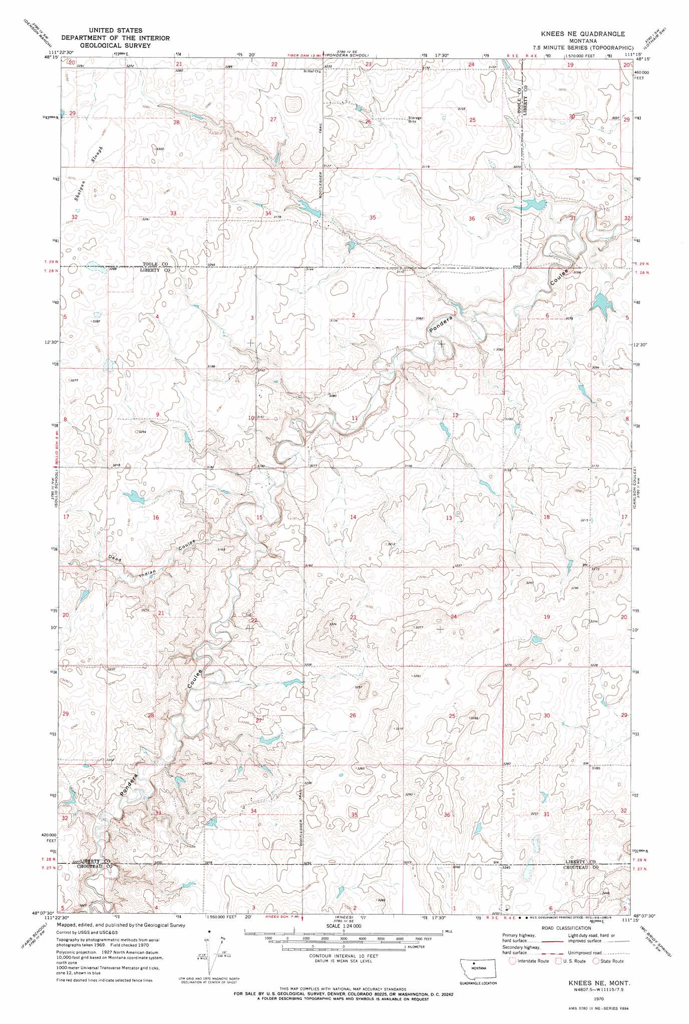
USGS Topo Quad 48111b3 - 1:24,000 scale
| Topo Map Name: | Knees Ne |
| USGS Topo Quad ID: | 48111b3 |
| Print Size: | ca. 21 1/4" wide x 27" high |
| Southeast Coordinates: | 48.125° N latitude / 111.25° W longitude |
| Map Center Coordinates: | 48.1875° N latitude / 111.3125° W longitude |
| U.S. State: | MT |
| Filename: | o48111b3.jpg |
| Download Map JPG Image: | Knees Ne topo map 1:24,000 scale |
| Map Type: | Topographic |
| Topo Series: | 7.5´ |
| Map Scale: | 1:24,000 |
| Source of Map Images: | United States Geological Survey (USGS) |
| Alternate Map Versions: |
Knees NE MT 1970, updated 1973 Download PDF Buy paper map Knees NE MT 2011 Download PDF Buy paper map Knees NE MT 2014 Download PDF Buy paper map |
1:24,000 Topo Quads surrounding Knees Ne
South Devon School |
Devon |
Galata |
Lothair |
Sagebrush Coulee |
Central School |
Denson Ranch |
Pondera School |
Lothair Sw |
Tiber Dam |
Fowler Coulee Ne |
Sollid School |
Knees Ne |
Carlson Coulee |
Uphill Creek |
Fowler Coulee Se |
Faris School |
Knees |
Mcbridy Spring |
Russell Chapel |
Dutton Ne |
Timber Coulee North |
Shannon Bridge |
Dent Bridge |
Dent Bridge Ne |
> Back to 48111a1 at 1:100,000 scale
> Back to 48110a1 at 1:250,000 scale
> Back to U.S. Topo Maps home
Knees Ne topo map: Gazetteer
Knees Ne: Basins
Shotgun Slough elevation 997m 3270′Knees Ne: Dams
Gladiolus Dam elevation 960m 3149′Hollandsworth Dam elevation 972m 3188′
Kneeded Dam elevation 972m 3188′
Knockin' Knees Reservoir Dam elevation 930m 3051′
O'Lot O'Farmin' Dam elevation 988m 3241′
Knees Ne: Reservoirs
Hollandsworth Reservoir elevation 972m 3188′Knees Ne: Trails
Bootlegger Trail elevation 979m 3211′Knees Ne digital topo map on disk
Buy this Knees Ne topo map showing relief, roads, GPS coordinates and other geographical features, as a high-resolution digital map file on DVD: