Fowler Coulee Ne Topo Map Montana
To zoom in, hover over the map of Fowler Coulee Ne
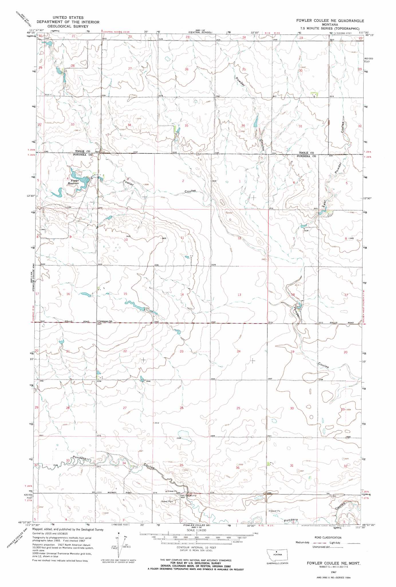
USGS Topo Quad 48111b5 - 1:24,000 scale
| Topo Map Name: | Fowler Coulee Ne |
| USGS Topo Quad ID: | 48111b5 |
| Print Size: | ca. 21 1/4" wide x 27" high |
| Southeast Coordinates: | 48.125° N latitude / 111.5° W longitude |
| Map Center Coordinates: | 48.1875° N latitude / 111.5625° W longitude |
| U.S. State: | MT |
| Filename: | o48111b5.jpg |
| Download Map JPG Image: | Fowler Coulee Ne topo map 1:24,000 scale |
| Map Type: | Topographic |
| Topo Series: | 7.5´ |
| Map Scale: | 1:24,000 |
| Source of Map Images: | United States Geological Survey (USGS) |
| Alternate Map Versions: |
Fowler Coulee NE MT 1967, updated 1971 Download PDF Buy paper map Fowler Coulee NE MT 1967, updated 1971 Download PDF Buy paper map Fowler Coulee NE MT 2011 Download PDF Buy paper map Fowler Coulee NE MT 2014 Download PDF Buy paper map |
1:24,000 Topo Quads surrounding Fowler Coulee Ne
Naismith |
Dunkirk |
South Devon School |
Devon |
Galata |
Ledger |
Conrad Butte |
Central School |
Denson Ranch |
Pondera School |
Letz Lake |
Fowler Coulee Nw |
Fowler Coulee Ne |
Sollid School |
Knees Ne |
Brady |
Fowler Coulee Sw |
Fowler Coulee Se |
Faris School |
Knees |
Collins |
Dutton Nw |
Dutton Ne |
Timber Coulee North |
Shannon Bridge |
> Back to 48111a1 at 1:100,000 scale
> Back to 48110a1 at 1:250,000 scale
> Back to U.S. Topo Maps home
Fowler Coulee Ne topo map: Gazetteer
Fowler Coulee Ne: Dams
Black Out Dam elevation 1038m 3405′Fowler Dam Number 2 elevation 1022m 3353′
Lester Peters Number 1 Dam elevation 1043m 3421′
Orcutt Ranch Company Number 1 Dam elevation 1026m 3366′
Fowler Coulee Ne: Reservoirs
Fowler Reservoir elevation 1022m 3353′Fowler Coulee Ne: Valleys
East Powder Coulee elevation 1008m 3307′Floberg Coulee elevation 1014m 3326′
Fowler Coulee elevation 1007m 3303′
Fowler Coulee Ne: Wells
Hall Community Well elevation 1010m 3313′Fowler Coulee Ne digital topo map on disk
Buy this Fowler Coulee Ne topo map showing relief, roads, GPS coordinates and other geographical features, as a high-resolution digital map file on DVD: