Fowler Coulee Nw Topo Map Montana
To zoom in, hover over the map of Fowler Coulee Nw
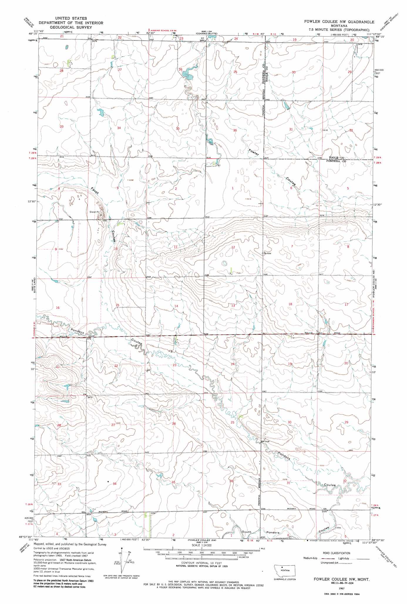
USGS Topo Quad 48111b6 - 1:24,000 scale
| Topo Map Name: | Fowler Coulee Nw |
| USGS Topo Quad ID: | 48111b6 |
| Print Size: | ca. 21 1/4" wide x 27" high |
| Southeast Coordinates: | 48.125° N latitude / 111.625° W longitude |
| Map Center Coordinates: | 48.1875° N latitude / 111.6875° W longitude |
| U.S. State: | MT |
| Filename: | o48111b6.jpg |
| Download Map JPG Image: | Fowler Coulee Nw topo map 1:24,000 scale |
| Map Type: | Topographic |
| Topo Series: | 7.5´ |
| Map Scale: | 1:24,000 |
| Source of Map Images: | United States Geological Survey (USGS) |
| Alternate Map Versions: |
Fowler Coulee NW MT 1967, updated 1971 Download PDF Buy paper map Fowler Coulee NW MT 1967, updated 1985 Download PDF Buy paper map Fowler Coulee NW MT 2011 Download PDF Buy paper map Fowler Coulee NW MT 2014 Download PDF Buy paper map |
1:24,000 Topo Quads surrounding Fowler Coulee Nw
Ledger Nw |
Naismith |
Dunkirk |
South Devon School |
Devon |
Pioneer School |
Ledger |
Conrad Butte |
Central School |
Denson Ranch |
Conrad |
Letz Lake |
Fowler Coulee Nw |
Fowler Coulee Ne |
Sollid School |
Conrad Sw |
Brady |
Fowler Coulee Sw |
Fowler Coulee Se |
Faris School |
Collins Nw |
Collins |
Dutton Nw |
Dutton Ne |
Timber Coulee North |
> Back to 48111a1 at 1:100,000 scale
> Back to 48110a1 at 1:250,000 scale
> Back to U.S. Topo Maps home
Fowler Coulee Nw topo map: Gazetteer
Fowler Coulee Nw: Dams
Bergstroms Farms Dam elevation 1019m 3343′Bergstroms Farms Number 2 Dam elevation 1019m 3343′
Dato Dam elevation 1057m 3467′
Harold Phillips Dam elevation 1030m 3379′
M Ratzburg Dam elevation 1056m 3464′
Fowler Coulee Nw: Reservoirs
M Ratzburg Reservoir elevation 1056m 3464′Fowler Coulee Nw: Valleys
Berens Coulee elevation 1019m 3343′Bird Coulee elevation 1022m 3353′
Favot Coulee elevation 1023m 3356′
Freebury Coulee elevation 1029m 3375′
Gibbons Coulee elevation 1018m 3339′
Miller Coulee elevation 1021m 3349′
South Pondera Coulee elevation 1013m 3323′
Wilkcox Coulee elevation 1028m 3372′
Fowler Coulee Nw: Wells
28N01W36ADBC01 Well elevation 1020m 3346′Fowler Coulee Nw digital topo map on disk
Buy this Fowler Coulee Nw topo map showing relief, roads, GPS coordinates and other geographical features, as a high-resolution digital map file on DVD: