Tiber Dam Topo Map Montana
To zoom in, hover over the map of Tiber Dam
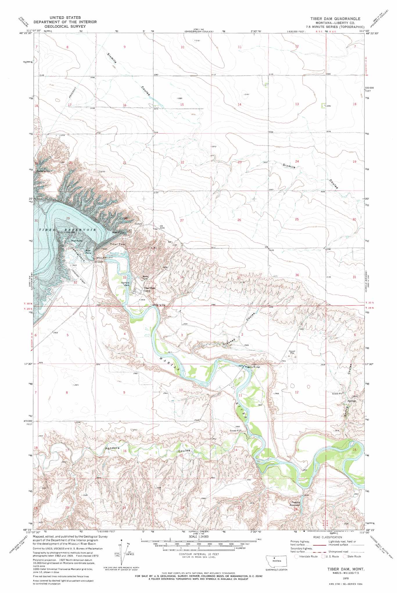
USGS Topo Quad 48111c1 - 1:24,000 scale
| Topo Map Name: | Tiber Dam |
| USGS Topo Quad ID: | 48111c1 |
| Print Size: | ca. 21 1/4" wide x 27" high |
| Southeast Coordinates: | 48.25° N latitude / 111° W longitude |
| Map Center Coordinates: | 48.3125° N latitude / 111.0625° W longitude |
| U.S. State: | MT |
| Filename: | o48111c1.jpg |
| Download Map JPG Image: | Tiber Dam topo map 1:24,000 scale |
| Map Type: | Topographic |
| Topo Series: | 7.5´ |
| Map Scale: | 1:24,000 |
| Source of Map Images: | United States Geological Survey (USGS) |
| Alternate Map Versions: |
Tiber Dam MT 1970, updated 1974 Download PDF Buy paper map Tiber Dam MT 2011 Download PDF Buy paper map Tiber Dam MT 2014 Download PDF Buy paper map |
1:24,000 Topo Quads surrounding Tiber Dam
Mccarters Lake Se |
North Lothair School |
Tiber |
Chester |
Joplin |
Galata |
Lothair |
Sagebrush Coulee |
Poverty Coulee |
Poverty Coulee Ne |
Pondera School |
Lothair Sw |
Tiber Dam |
Circle Bridge |
Poverty Coulee Se |
Knees Ne |
Carlson Coulee |
Uphill Creek |
Goose Bill Butte Nw |
Penzer School |
Knees |
Mcbridy Spring |
Russell Chapel |
Dorner School |
Goose Bill Butte |
> Back to 48111a1 at 1:100,000 scale
> Back to 48110a1 at 1:250,000 scale
> Back to U.S. Topo Maps home
Tiber Dam topo map: Gazetteer
Tiber Dam: Airports
Tiber Dam Airport elevation 923m 3028′Tiber Dam: Bridges
Pugsley Bridge elevation 857m 2811′Tiber Dam: Dams
Tiber Dam elevation 921m 3021′Tiber Dam: Parks
Sanford Park elevation 864m 2834′Tiber Dam: Populated Places
Tiber Dam Camp elevation 870m 2854′Tiber Dam: Reservoirs
Lake Elwell elevation 922m 3024′Pugsley Reservoir elevation 865m 2837′
Tiber Dam: Valleys
Crooked Coulee elevation 862m 2828′Pondera Coulee elevation 854m 2801′
Spring Coulee elevation 853m 2798′
Tiber Dam: Wells
30N05E15CBBA01 Well elevation 939m 3080′Tiber Dam digital topo map on disk
Buy this Tiber Dam topo map showing relief, roads, GPS coordinates and other geographical features, as a high-resolution digital map file on DVD: