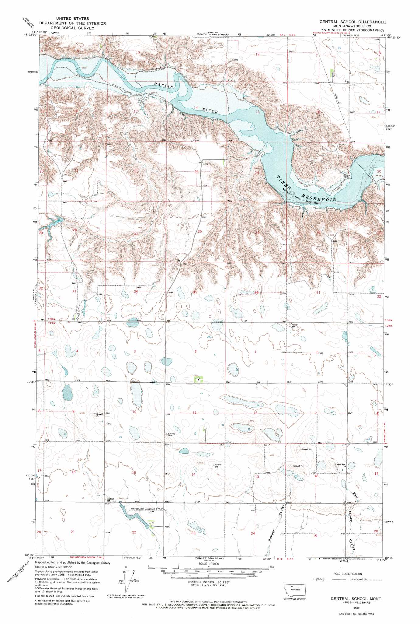
Central School Topo Map Montana
To zoom in, hover over the map of Central School
USGS Topo Quad 48111c5 - 1:24,000 scale
| Topo Map Name: | Central School |
| USGS Topo Quad ID: | 48111c5 |
| Print Size: | ca. 21 1/4" wide x 27" high |
| Southeast Coordinates: | 48.25° N latitude / 111.5° W longitude |
| Map Center Coordinates: | 48.3125° N latitude / 111.5625° W longitude |
| U.S. State: | MT |
| Filename: | o48111c5.jpg |
| Download Map JPG Image: | Central School topo map 1:24,000 scale |
| Map Type: | Topographic |
| Topo Series: | 7.5´ |
| Map Scale: | 1:24,000 |
| Source of Map Images: | United States Geological Survey (USGS) |
| Alternate Map Versions: |
Central School MT 1967, updated 1970 Download PDF Buy paper map Central School MT 2011 Download PDF Buy paper map Central School MT 2014 Download PDF Buy paper map |
1:24,000 Topo Quads surrounding Central School
Shelby |
Antelope Coulee Sw |
Antelope Coulee Se |
Mccarters Lake |
Mccarters Lake Se |
Naismith |
Dunkirk |
South Devon School |
Devon |
Galata |
Ledger |
Conrad Butte |
Central School |
Denson Ranch |
Pondera School |
Letz Lake |
Fowler Coulee Nw |
Fowler Coulee Ne |
Sollid School |
Knees Ne |
Brady |
Fowler Coulee Sw |
Fowler Coulee Se |
Faris School |
Knees |
> Back to 48111a1 at 1:100,000 scale
> Back to 48110a1 at 1:250,000 scale
> Back to U.S. Topo Maps home
Central School topo map: Gazetteer
Central School: Dams
D Ratzburg Dam elevation 1055m 3461′Loubren Incorporated Number 1 Dam elevation 1061m 3480′
McCracken Brothers Dam elevation 1033m 3389′
Central School: Post Offices
Gates Post Office (historical) elevation 1055m 3461′Omholt Post Office (historical) elevation 1062m 3484′
Central School: Reservoirs
D Ratzburg Reservoir elevation 1055m 3461′Central School digital topo map on disk
Buy this Central School topo map showing relief, roads, GPS coordinates and other geographical features, as a high-resolution digital map file on DVD: