Ledger Nw Topo Map Montana
To zoom in, hover over the map of Ledger Nw
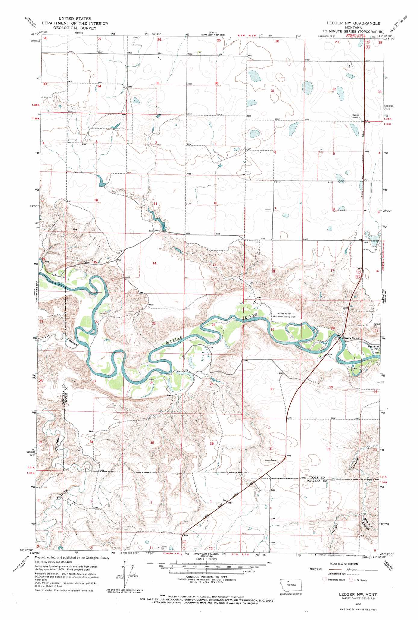
USGS Topo Quad 48111d8 - 1:24,000 scale
| Topo Map Name: | Ledger Nw |
| USGS Topo Quad ID: | 48111d8 |
| Print Size: | ca. 21 1/4" wide x 27" high |
| Southeast Coordinates: | 48.375° N latitude / 111.875° W longitude |
| Map Center Coordinates: | 48.4375° N latitude / 111.9375° W longitude |
| U.S. State: | MT |
| Filename: | o48111d8.jpg |
| Download Map JPG Image: | Ledger Nw topo map 1:24,000 scale |
| Map Type: | Topographic |
| Topo Series: | 7.5´ |
| Map Scale: | 1:24,000 |
| Source of Map Images: | United States Geological Survey (USGS) |
| Alternate Map Versions: |
Ledger NW MT 1967, updated 1971 Download PDF Buy paper map Ledger NW MT 2011 Download PDF Buy paper map Ledger NW MT 2014 Download PDF Buy paper map |
1:24,000 Topo Quads surrounding Ledger Nw
Ethridge Nw |
Aloe |
Kevin South |
Oilmont |
Antelope Coulee Nw |
Boru Spring |
Ethridge |
Virden |
Shelby |
Antelope Coulee Sw |
Abbott Lake |
Cactus Flat |
Ledger Nw |
Naismith |
Dunkirk |
Valier East |
Belgian Hill |
Pioneer School |
Ledger |
Conrad Butte |
Lone Man Coulee East |
Sam George Hill |
Conrad |
Letz Lake |
Fowler Coulee Nw |
> Back to 48111a1 at 1:100,000 scale
> Back to 48110a1 at 1:250,000 scale
> Back to U.S. Topo Maps home
Ledger Nw topo map: Gazetteer
Ledger Nw: Crossings
Interchange 358 elevation 1038m 3405′Ledger Nw: Dams
Ed McIntyre Dam elevation 1046m 3431′The Moonspinner Dam elevation 1051m 3448′
Wanken Dam elevation 1040m 3412′
Ledger Nw: Reservoirs
Ed McIntyre Reservoir elevation 1046m 3431′Wanken Reservoir elevation 1040m 3412′
Ledger Nw: Valleys
Moore Coulee elevation 1045m 3428′Pearson Coulee elevation 995m 3264′
Russell Coulee elevation 1032m 3385′
Schultz Coulee elevation 956m 3136′
Snow Coulee elevation 1046m 3431′
Twin Coulee elevation 950m 3116′
Zell Coulee elevation 1045m 3428′
Ledger Nw: Wells
31N02W20CDDB01 Well elevation 946m 3103′Ledger Nw digital topo map on disk
Buy this Ledger Nw topo map showing relief, roads, GPS coordinates and other geographical features, as a high-resolution digital map file on DVD: