Antelope Coulee Sw Topo Map Montana
To zoom in, hover over the map of Antelope Coulee Sw
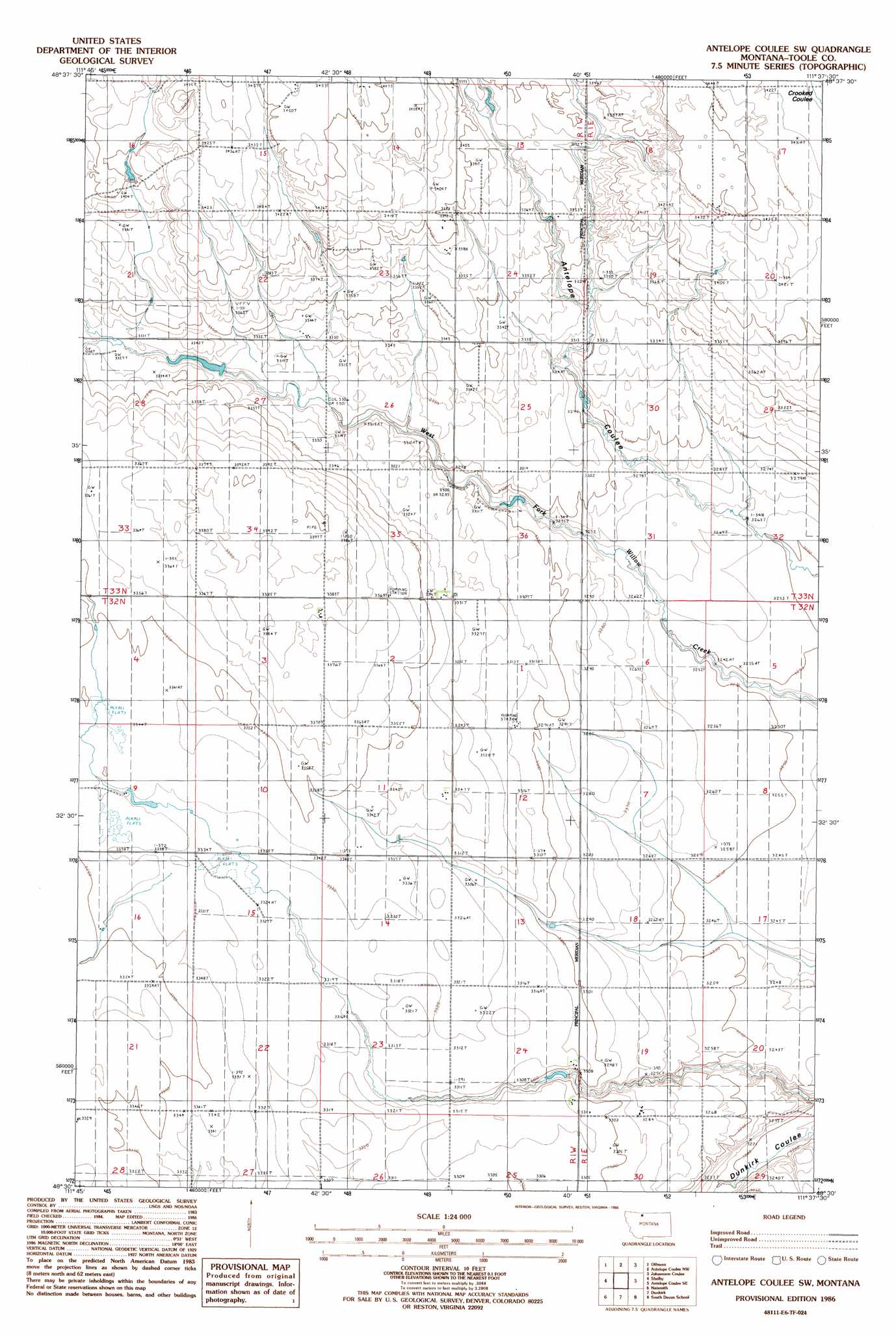
USGS Topo Quad 48111e6 - 1:24,000 scale
| Topo Map Name: | Antelope Coulee Sw |
| USGS Topo Quad ID: | 48111e6 |
| Print Size: | ca. 21 1/4" wide x 27" high |
| Southeast Coordinates: | 48.5° N latitude / 111.625° W longitude |
| Map Center Coordinates: | 48.5625° N latitude / 111.6875° W longitude |
| U.S. State: | MT |
| Filename: | o48111e6.jpg |
| Download Map JPG Image: | Antelope Coulee Sw topo map 1:24,000 scale |
| Map Type: | Topographic |
| Topo Series: | 7.5´ |
| Map Scale: | 1:24,000 |
| Source of Map Images: | United States Geological Survey (USGS) |
| Alternate Map Versions: |
Antelope Coulee SW MT 1986, updated 1986 Download PDF Buy paper map Antelope Coulee SW MT 2011 Download PDF Buy paper map Antelope Coulee SW MT 2014 Download PDF Buy paper map |
1:24,000 Topo Quads surrounding Antelope Coulee Sw
Kevin North |
Ferdig |
Fivemile Coulee West |
Fivemile Coulee East |
Cameron Lake |
Kevin South |
Oilmont |
Antelope Coulee Nw |
Johannson Coulee |
Hawthorne School |
Virden |
Shelby |
Antelope Coulee Sw |
Antelope Coulee Se |
Mccarters Lake |
Ledger Nw |
Naismith |
Dunkirk |
South Devon School |
Devon |
Pioneer School |
Ledger |
Conrad Butte |
Central School |
Denson Ranch |
> Back to 48111e1 at 1:100,000 scale
> Back to 48110a1 at 1:250,000 scale
> Back to U.S. Topo Maps home
Antelope Coulee Sw topo map: Gazetteer
Antelope Coulee Sw: Dams
Fransen Dam elevation 1008m 3307′Lipton Dam elevation 1038m 3405′
Antelope Coulee Sw: Wells
33N01W21ABCA01 Well elevation 1030m 3379′Antelope Coulee Sw digital topo map on disk
Buy this Antelope Coulee Sw topo map showing relief, roads, GPS coordinates and other geographical features, as a high-resolution digital map file on DVD: