Kevin North Topo Map Montana
To zoom in, hover over the map of Kevin North
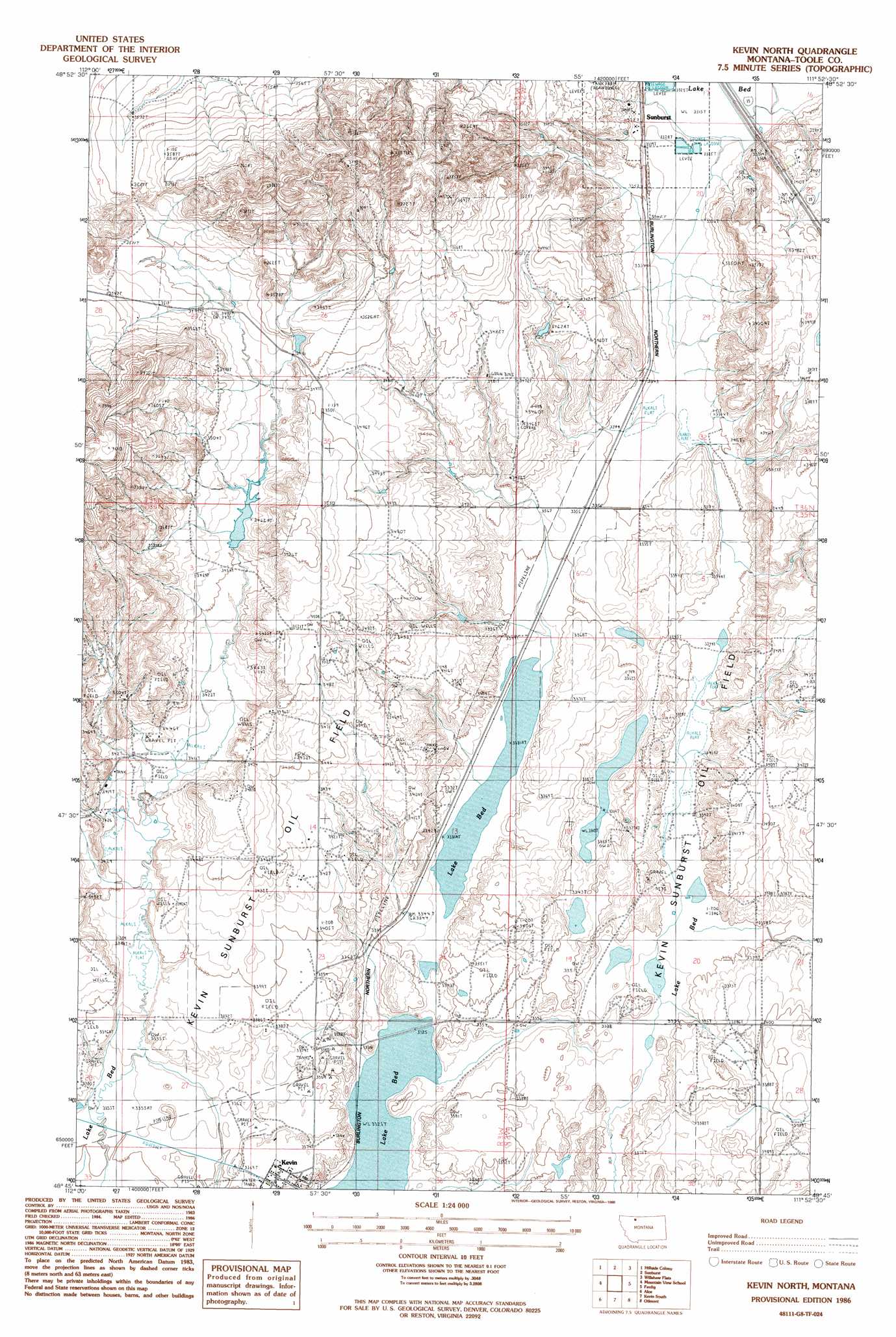
USGS Topo Quad 48111g8 - 1:24,000 scale
| Topo Map Name: | Kevin North |
| USGS Topo Quad ID: | 48111g8 |
| Print Size: | ca. 21 1/4" wide x 27" high |
| Southeast Coordinates: | 48.75° N latitude / 111.875° W longitude |
| Map Center Coordinates: | 48.8125° N latitude / 111.9375° W longitude |
| U.S. State: | MT |
| Filename: | o48111g8.jpg |
| Download Map JPG Image: | Kevin North topo map 1:24,000 scale |
| Map Type: | Topographic |
| Topo Series: | 7.5´ |
| Map Scale: | 1:24,000 |
| Source of Map Images: | United States Geological Survey (USGS) |
| Alternate Map Versions: |
Kevin North MT 1986, updated 1986 Download PDF Buy paper map Kevin North MT 2011 Download PDF Buy paper map Kevin North MT 2014 Download PDF Buy paper map |
1:24,000 Topo Quads surrounding Kevin North
Fitzpatrick Lake |
Hillside Colony |
Sunburst |
Willshaw Flats |
Beaupre Coulee |
Glacier Colony |
Mountain View School |
Kevin North |
Ferdig |
Fivemile Coulee West |
Ethridge Nw |
Aloe |
Kevin South |
Oilmont |
Antelope Coulee Nw |
Boru Spring |
Ethridge |
Virden |
Shelby |
Antelope Coulee Sw |
> Back to 48111e1 at 1:100,000 scale
> Back to 48110a1 at 1:250,000 scale
> Back to U.S. Topo Maps home
No gazetteer data is available for the Kevin North topo map sheet.
Kevin North digital topo map on disk
Buy this Kevin North topo map showing relief, roads, GPS coordinates and other geographical features, as a high-resolution digital map file on DVD: