Blackleaf Topo Map Montana
To zoom in, hover over the map of Blackleaf
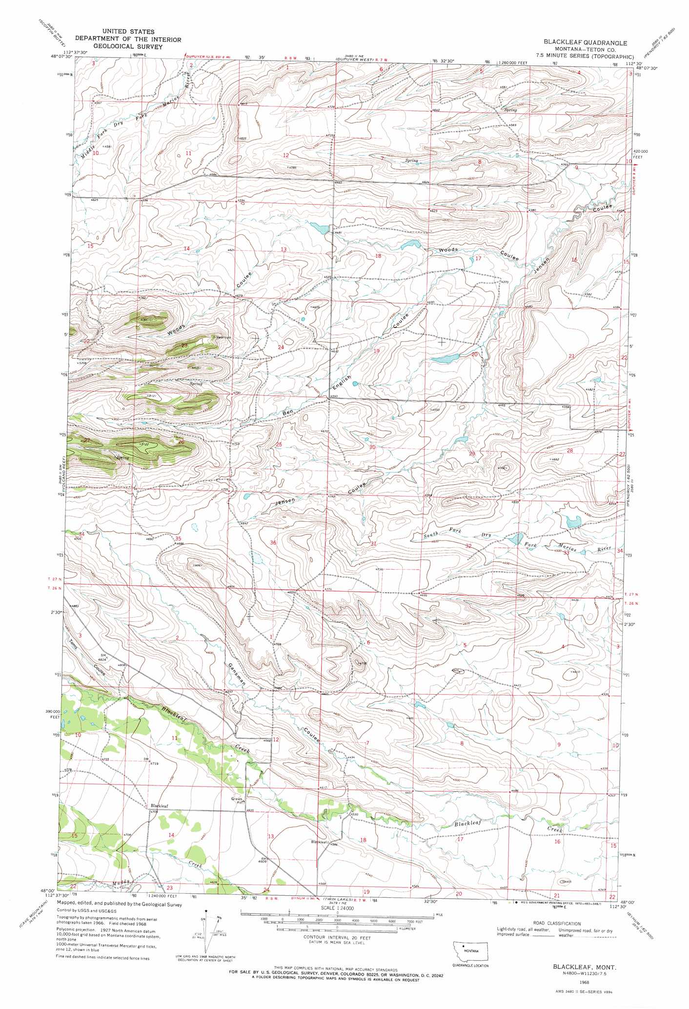
USGS Topo Quad 48112a5 - 1:24,000 scale
| Topo Map Name: | Blackleaf |
| USGS Topo Quad ID: | 48112a5 |
| Print Size: | ca. 21 1/4" wide x 27" high |
| Southeast Coordinates: | 48° N latitude / 112.5° W longitude |
| Map Center Coordinates: | 48.0625° N latitude / 112.5625° W longitude |
| U.S. State: | MT |
| Filename: | o48112a5.jpg |
| Download Map JPG Image: | Blackleaf topo map 1:24,000 scale |
| Map Type: | Topographic |
| Topo Series: | 7.5´ |
| Map Scale: | 1:24,000 |
| Source of Map Images: | United States Geological Survey (USGS) |
| Alternate Map Versions: |
Blackleaf MT 1968, updated 1972 Download PDF Buy paper map Blackleaf MT 2011 Download PDF Buy paper map Blackleaf MT 2014 Download PDF Buy paper map |
1:24,000 Topo Quads surrounding Blackleaf
Heart Butte |
Four Horns Lake |
Robere |
Kuka Crossing |
Valier West |
Fish Lake |
Scoffin Butte |
Dupuyer West |
Dupuyer East |
Lone Man Coulee West |
Walling Reef |
Volcano Reef |
Blackleaf |
Soap Creek |
Pendroy |
Mount Wright |
Cave Mountain |
Twin Lakes |
Bynum Reservoir |
Bynum |
Our Lake |
Ear Mountain |
Lake Theboe |
Watson Flats |
Teton Buttes |
> Back to 48112a1 at 1:100,000 scale
> Back to 48112a1 at 1:250,000 scale
> Back to U.S. Topo Maps home
Blackleaf topo map: Gazetteer
Blackleaf: Dams
Decameter Dam elevation 1373m 4504′Decarboxylation Dam elevation 1350m 4429′
Rockport Colong Number 1 Dam elevation 1369m 4491′
Rockport Colony Number 2 Dam elevation 1386m 4547′
Blackleaf: Populated Places
Blackleaf elevation 1435m 4708′Blackleaf: Post Offices
Blackleaf Post Office (historical) elevation 1433m 4701′Blackleaf: Valleys
Ben English Coulee elevation 1334m 4376′Gansman Coulee elevation 1344m 4409′
Toms Coulee elevation 1433m 4701′
Woods Coulee elevation 1321m 4333′
Blackleaf: Wells
27N08W13CDD_01 Well elevation 1373m 4504′Blackleaf digital topo map on disk
Buy this Blackleaf topo map showing relief, roads, GPS coordinates and other geographical features, as a high-resolution digital map file on DVD: