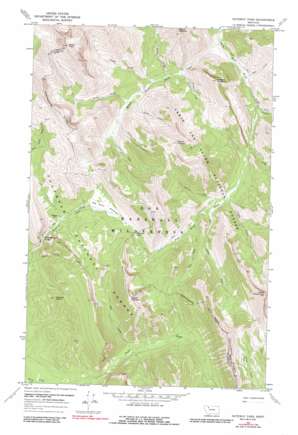
Gateway Pass Topo Map Montana
To zoom in, hover over the map of Gateway Pass
USGS Topo Quad 48112a8 - 1:24,000 scale
| Topo Map Name: | Gateway Pass |
| USGS Topo Quad ID: | 48112a8 |
| Print Size: | ca. 21 1/4" wide x 27" high |
| Southeast Coordinates: | 48° N latitude / 112.875° W longitude |
| Map Center Coordinates: | 48.0625° N latitude / 112.9375° W longitude |
| U.S. State: | MT |
| Filename: | o48112a8.jpg |
| Download Map JPG Image: | Gateway Pass topo map 1:24,000 scale |
| Map Type: | Topographic |
| Topo Series: | 7.5´ |
| Map Scale: | 1:24,000 |
| Source of Map Images: | United States Geological Survey (USGS) |
| Alternate Map Versions: |
Gateway Pass MT 1968, updated 1972 Download PDF Buy paper map Gateway Pass MT 1968, updated 1987 Download PDF Buy paper map Gateway Pass MT 1995, updated 1997 Download PDF Buy paper map Gateway Pass MT 2011 Download PDF Buy paper map Gateway Pass MT 2014 Download PDF Buy paper map |
| FStopo: | US Forest Service topo Gateway Pass is available: Download FStopo PDF Download FStopo TIF |
1:24,000 Topo Quads surrounding Gateway Pass
> Back to 48112a1 at 1:100,000 scale
> Back to 48112a1 at 1:250,000 scale
> Back to U.S. Topo Maps home
Gateway Pass topo map: Gazetteer
Gateway Pass: Flats
Big River Meadows elevation 1936m 6351′Gateway Pass: Gaps
Gateway Gorge elevation 1811m 5941′Gateway Pass elevation 1976m 6482′
Gateway Pass: Streams
Circus Creek elevation 1705m 5593′Crazy Creek elevation 1728m 5669′
Field Creek elevation 1627m 5337′
Jeff Creek elevation 1793m 5882′
Judy Creek elevation 1725m 5659′
Lake Creek elevation 1638m 5374′
Lost Horse Creek elevation 1668m 5472′
Middle Fork Birch Creek elevation 1528m 5013′
My Creek elevation 1785m 5856′
Nanny Creek elevation 2249m 7378′
Phone Creek elevation 1601m 5252′
Pinky Creek elevation 1590m 5216′
Pinto Creek elevation 1716m 5629′
Post Creek elevation 1559m 5114′
Punch Creek elevation 1703m 5587′
Shin Creek elevation 1756m 5761′
South Fork Trail Creek elevation 1711m 5613′
Spike Creek elevation 1650m 5413′
Tubby Creek elevation 1610m 5282′
Gateway Pass: Summits
Bighorn Mountain elevation 2471m 8106′Crooked Mountain elevation 2215m 7267′
Gateway Points elevation 2092m 6863′
Mount Drouillard elevation 2493m 8179′
Mount Field elevation 2609m 8559′
Mount Patrick Gass elevation 2562m 8405′
Gateway Pass digital topo map on disk
Buy this Gateway Pass topo map showing relief, roads, GPS coordinates and other geographical features, as a high-resolution digital map file on DVD:


