Swift Reservoir Topo Map Montana
To zoom in, hover over the map of Swift Reservoir
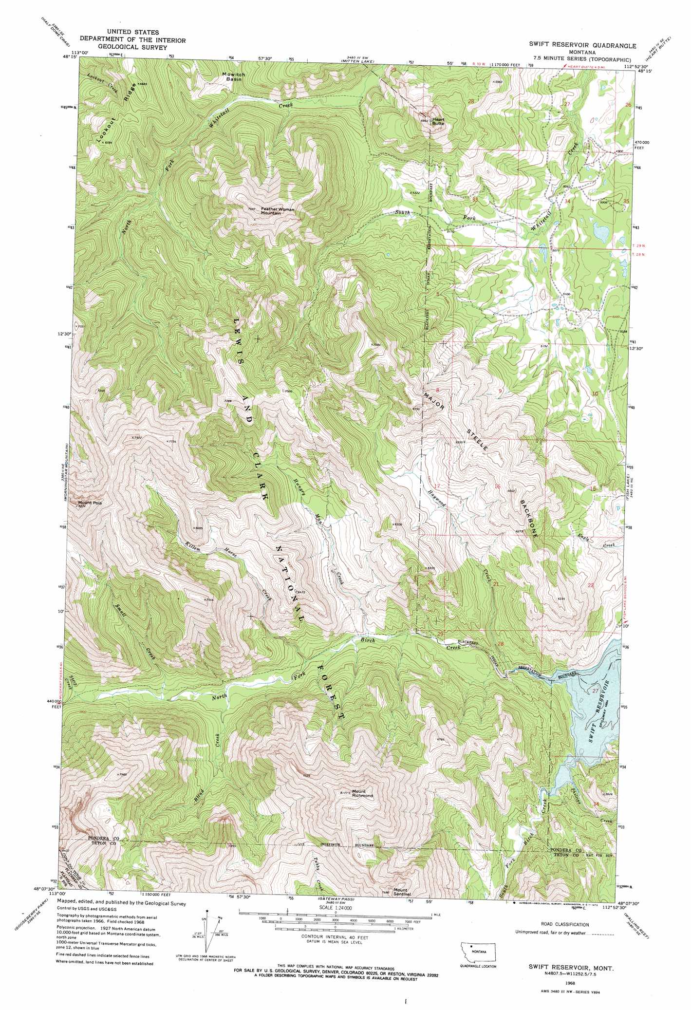
USGS Topo Quad 48112b8 - 1:24,000 scale
| Topo Map Name: | Swift Reservoir |
| USGS Topo Quad ID: | 48112b8 |
| Print Size: | ca. 21 1/4" wide x 27" high |
| Southeast Coordinates: | 48.125° N latitude / 112.875° W longitude |
| Map Center Coordinates: | 48.1875° N latitude / 112.9375° W longitude |
| U.S. State: | MT |
| Filename: | o48112b8.jpg |
| Download Map JPG Image: | Swift Reservoir topo map 1:24,000 scale |
| Map Type: | Topographic |
| Topo Series: | 7.5´ |
| Map Scale: | 1:24,000 |
| Source of Map Images: | United States Geological Survey (USGS) |
| Alternate Map Versions: |
Swift Reservoir MT 1968, updated 1971 Download PDF Buy paper map Swift Reservoir MT 1968, updated 1972 Download PDF Buy paper map Swift Reservoir MT 1995, updated 1997 Download PDF Buy paper map Swift Reservoir MT 2011 Download PDF Buy paper map Swift Reservoir MT 2014 Download PDF Buy paper map |
| FStopo: | US Forest Service topo Swift Reservoir is available: Download FStopo PDF Download FStopo TIF |
1:24,000 Topo Quads surrounding Swift Reservoir
East Glacier Park |
Big Rock |
Magee Ranch |
White Man Coulee |
Piegan |
Hyde Creek |
Half Dome Crag |
Mitten Lake |
Heart Butte |
Four Horns Lake |
Crescent Cliff |
Morningstar Mountain |
Swift Reservoir |
Fish Lake |
Scoffin Butte |
Gable Peaks |
Gooseberry Peak |
Gateway Pass |
Walling Reef |
Volcano Reef |
Trilobite Peak |
Pentagon Mountain |
Porphyry Reef |
Mount Wright |
Cave Mountain |
> Back to 48112a1 at 1:100,000 scale
> Back to 48112a1 at 1:250,000 scale
> Back to U.S. Topo Maps home
Swift Reservoir topo map: Gazetteer
Swift Reservoir: Dams
Swift Dike elevation 1580m 5183′Swift Reservoir: Ridges
Lookout Ridge elevation 1959m 6427′Major Steele Backbone elevation 1956m 6417′
Swift Reservoir: Springs
28N10W22DDCA01 Spring elevation 1497m 4911′Swift Reservoir: Streams
Blind Creek elevation 1619m 5311′Haywood Creek elevation 1492m 4895′
Hungry Man Creek elevation 1560m 5118′
Killem Horse Creek elevation 1577m 5173′
North Fork Birch Creek elevation 1490m 4888′
Phillips Creek elevation 1490m 4888′
Small Creek elevation 1652m 5419′
South Fork Birch Creek elevation 1490m 4888′
Steep Creek elevation 1693m 5554′
Swift Reservoir: Summits
Feather Woman Mountain elevation 2314m 7591′Heart Butte elevation 2079m 6820′
Mount Poia elevation 2521m 8270′
Mount Richmond elevation 2489m 8166′
Mount Sentinel elevation 2323m 7621′
Swift Reservoir digital topo map on disk
Buy this Swift Reservoir topo map showing relief, roads, GPS coordinates and other geographical features, as a high-resolution digital map file on DVD: