Rocky Ridge Topo Map Montana
To zoom in, hover over the map of Rocky Ridge
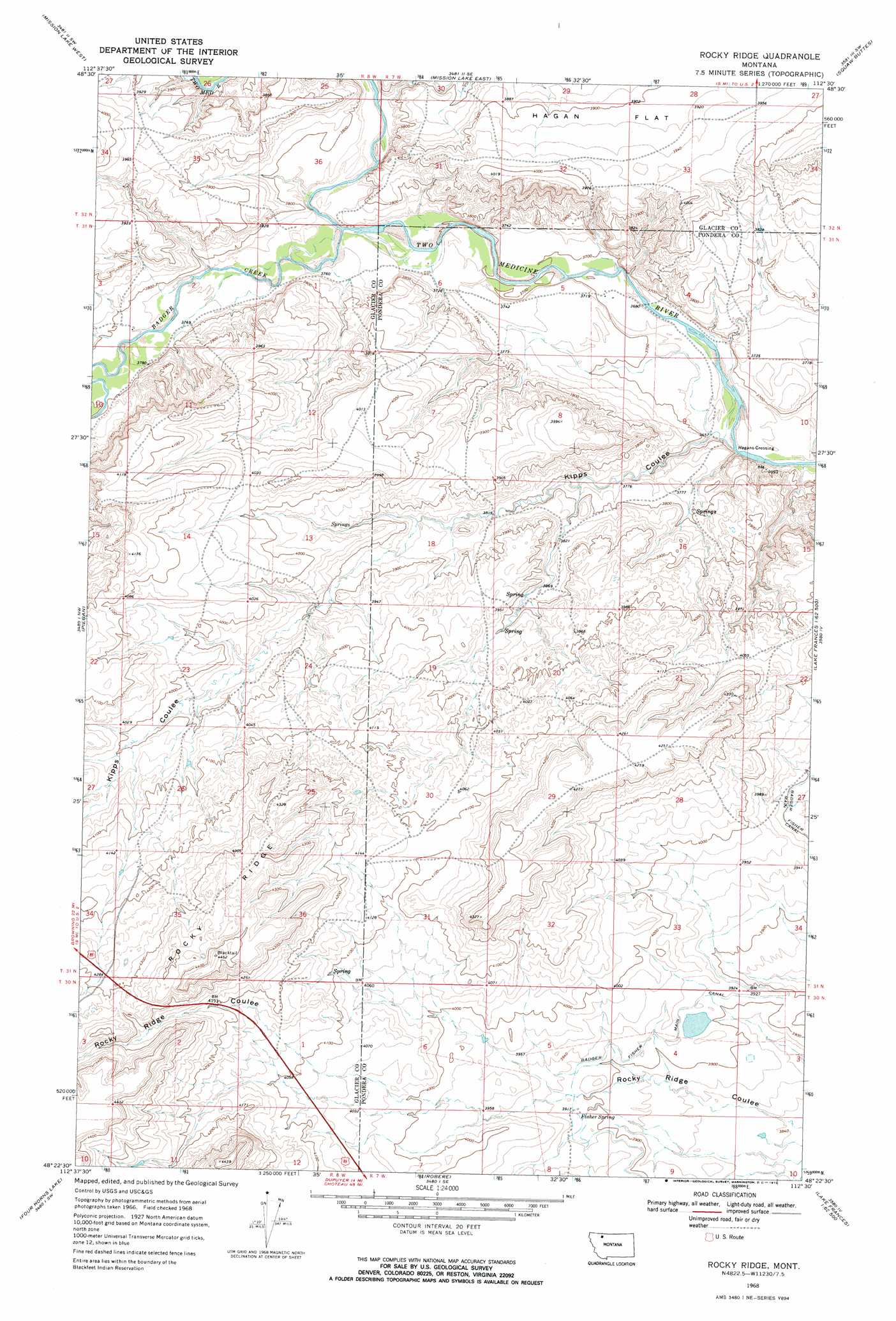
USGS Topo Quad 48112d5 - 1:24,000 scale
| Topo Map Name: | Rocky Ridge |
| USGS Topo Quad ID: | 48112d5 |
| Print Size: | ca. 21 1/4" wide x 27" high |
| Southeast Coordinates: | 48.375° N latitude / 112.5° W longitude |
| Map Center Coordinates: | 48.4375° N latitude / 112.5625° W longitude |
| U.S. State: | MT |
| Filename: | o48112d5.jpg |
| Download Map JPG Image: | Rocky Ridge topo map 1:24,000 scale |
| Map Type: | Topographic |
| Topo Series: | 7.5´ |
| Map Scale: | 1:24,000 |
| Source of Map Images: | United States Geological Survey (USGS) |
| Alternate Map Versions: |
Rocky Ridge MT 1968, updated 1972 Download PDF Buy paper map Rocky Ridge MT 2011 Download PDF Buy paper map Rocky Ridge MT 2014 Download PDF Buy paper map |
1:24,000 Topo Quads surrounding Rocky Ridge
Rimrock Butte |
Fort Piegan |
Sundance |
Gunsight |
Cut Bank |
Kipp Lake |
Mission Lake West |
Mission Lake East |
Squaw Buttes |
Cut Bank Se |
White Man Coulee |
Piegan |
Rocky Ridge |
Flag Butte |
Rock City |
Heart Butte |
Four Horns Lake |
Robere |
Kuka Crossing |
Valier West |
Fish Lake |
Scoffin Butte |
Dupuyer West |
Dupuyer East |
Lone Man Coulee West |
> Back to 48112a1 at 1:100,000 scale
> Back to 48112a1 at 1:250,000 scale
> Back to U.S. Topo Maps home
Rocky Ridge topo map: Gazetteer
Rocky Ridge: Populated Places
Hagans Crossing elevation 1112m 3648′Rocky Ridge: Ridges
Rocky Ridge elevation 1333m 4373′Rocky Ridge: Springs
30N07W08AABB01 Spring elevation 1193m 3914′Fisher Spring elevation 1193m 3914′
Rocky Ridge: Streams
Badger Creek elevation 1133m 3717′Rocky Ridge: Valleys
Kipps Coulee elevation 1113m 3651′Rocky Ridge digital topo map on disk
Buy this Rocky Ridge topo map showing relief, roads, GPS coordinates and other geographical features, as a high-resolution digital map file on DVD: