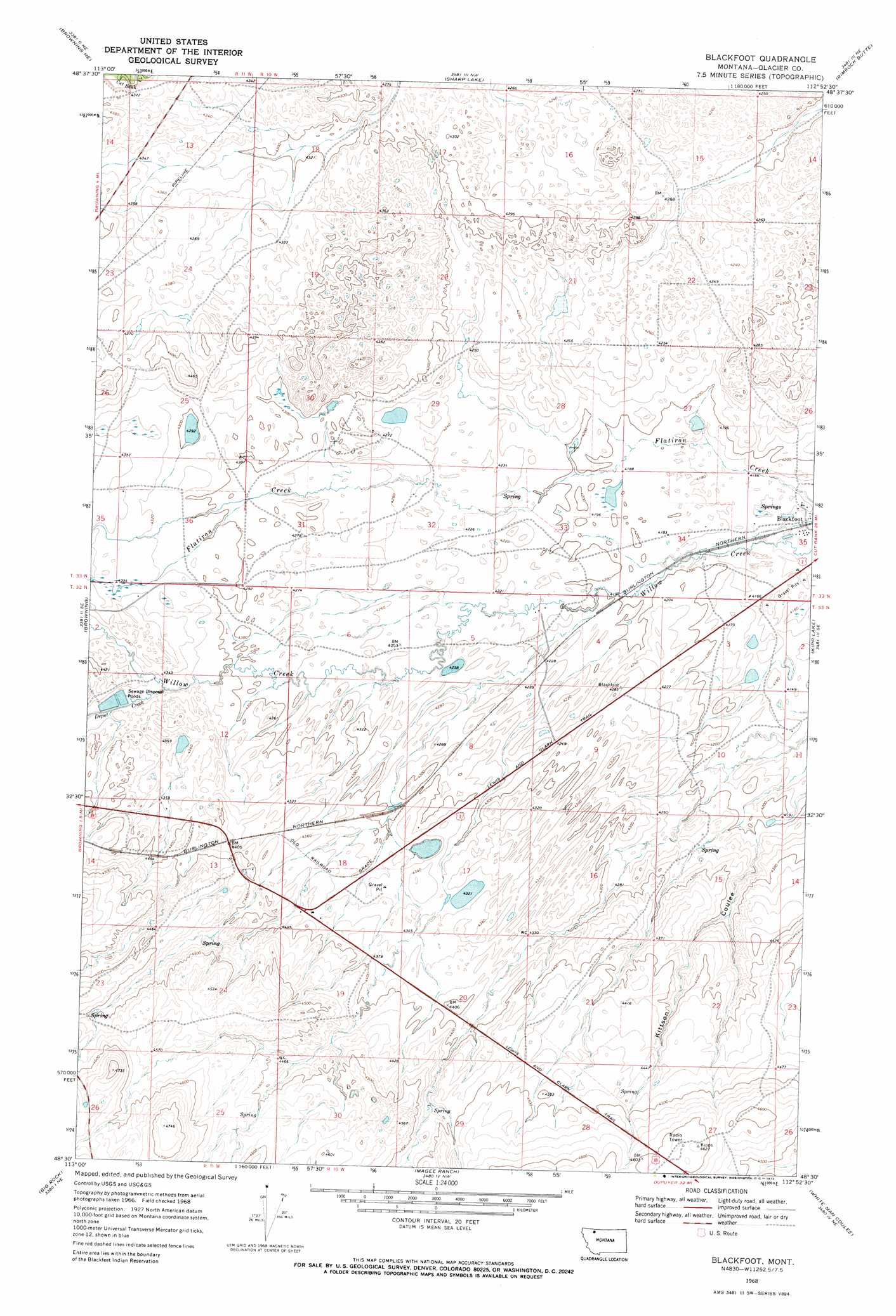
Blackfoot Topo Map Montana
To zoom in, hover over the map of Blackfoot
USGS Topo Quad 48112e8 - 1:24,000 scale
| Topo Map Name: | Blackfoot |
| USGS Topo Quad ID: | 48112e8 |
| Print Size: | ca. 21 1/4" wide x 27" high |
| Southeast Coordinates: | 48.5° N latitude / 112.875° W longitude |
| Map Center Coordinates: | 48.5625° N latitude / 112.9375° W longitude |
| U.S. State: | MT |
| Filename: | o48112e8.jpg |
| Download Map JPG Image: | Blackfoot topo map 1:24,000 scale |
| Map Type: | Topographic |
| Topo Series: | 7.5´ |
| Map Scale: | 1:24,000 |
| Source of Map Images: | United States Geological Survey (USGS) |
| Alternate Map Versions: |
Blackfoot MT 1968, updated 1972 Download PDF Buy paper map Blackfoot MT 2011 Download PDF Buy paper map Blackfoot MT 2014 Download PDF Buy paper map |
1:24,000 Topo Quads surrounding Blackfoot
Wetzel |
Hoodoo Hill |
Nightshoot Coulee |
Rimrock Ranch |
Buffalo Lake |
Horse Lake |
Browning Ne |
Sharp Lake |
Rimrock Butte |
Fort Piegan |
Starr School |
Browning |
Blackfoot |
Kipp Lake |
Mission Lake West |
East Glacier Park |
Big Rock |
Magee Ranch |
White Man Coulee |
Piegan |
Hyde Creek |
Half Dome Crag |
Mitten Lake |
Heart Butte |
Four Horns Lake |
> Back to 48112e1 at 1:100,000 scale
> Back to 48112a1 at 1:250,000 scale
> Back to U.S. Topo Maps home
Blackfoot topo map: Gazetteer
Blackfoot: Lakes
Aubery Lake elevation 1298m 4258′Blackfoot: Parks
Camp Disappointment Historical Marker elevation 1271m 4169′Blackfoot: Populated Places
Blackfoot elevation 1269m 4163′Blackfoot: Post Offices
Blackfoot Post Office (historical) elevation 1269m 4163′Kipp Post Office (historical) elevation 1269m 4163′
Blackfoot: Streams
Depot Creek elevation 1318m 4324′Blackfoot: Wells
33N10W35BDDA01 Well elevation 1269m 4163′33N10W35CBAB01 Well elevation 1269m 4163′
Blackfoot digital topo map on disk
Buy this Blackfoot topo map showing relief, roads, GPS coordinates and other geographical features, as a high-resolution digital map file on DVD: