Aloe Topo Map Montana
To zoom in, hover over the map of Aloe
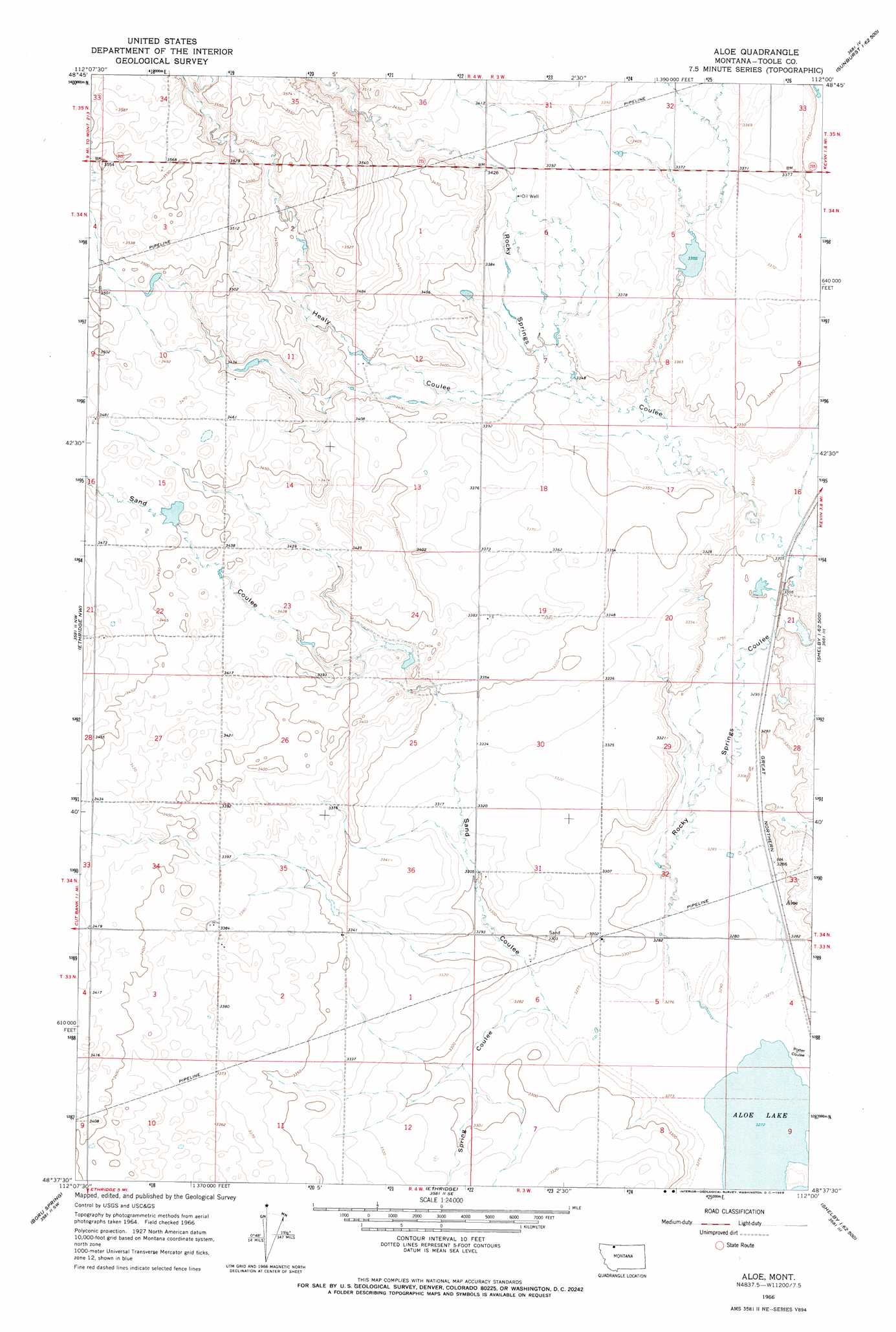
USGS Topo Quad 48112f1 - 1:24,000 scale
| Topo Map Name: | Aloe |
| USGS Topo Quad ID: | 48112f1 |
| Print Size: | ca. 21 1/4" wide x 27" high |
| Southeast Coordinates: | 48.625° N latitude / 112° W longitude |
| Map Center Coordinates: | 48.6875° N latitude / 112.0625° W longitude |
| U.S. State: | MT |
| Filename: | o48112f1.jpg |
| Download Map JPG Image: | Aloe topo map 1:24,000 scale |
| Map Type: | Topographic |
| Topo Series: | 7.5´ |
| Map Scale: | 1:24,000 |
| Source of Map Images: | United States Geological Survey (USGS) |
| Alternate Map Versions: |
Aloe MT 1966, updated 1969 Download PDF Buy paper map Aloe MT 2011 Download PDF Buy paper map Aloe MT 2014 Download PDF Buy paper map |
1:24,000 Topo Quads surrounding Aloe
Headlight Butte Ne |
Fitzpatrick Lake |
Hillside Colony |
Sunburst |
Willshaw Flats |
Headlight Butte |
Glacier Colony |
Mountain View School |
Kevin North |
Ferdig |
Cut Bank |
Ethridge Nw |
Aloe |
Kevin South |
Oilmont |
Cut Bank Se |
Boru Spring |
Ethridge |
Virden |
Shelby |
Rock City |
Abbott Lake |
Cactus Flat |
Ledger Nw |
Naismith |
> Back to 48112e1 at 1:100,000 scale
> Back to 48112a1 at 1:250,000 scale
> Back to U.S. Topo Maps home
Aloe topo map: Gazetteer
Aloe: Dams
McLean Dam elevation 1032m 3385′Rocky Mountain High Dam elevation 1024m 3359′
Aloe: Populated Places
Aloe elevation 1003m 3290′Aloe: Post Offices
Aloe Post Office (historical) elevation 1003m 3290′Aloe: Reservoirs
McLean Reservoir elevation 1032m 3385′Aloe: Valleys
Healy Coulee elevation 1016m 3333′Potter Coulee elevation 999m 3277′
Rocky Springs Coulee elevation 999m 3277′
Sand Coulee elevation 999m 3277′
Spring Coulee elevation 1000m 3280′
Aloe digital topo map on disk
Buy this Aloe topo map showing relief, roads, GPS coordinates and other geographical features, as a high-resolution digital map file on DVD: