Glacier Colony Topo Map Montana
To zoom in, hover over the map of Glacier Colony
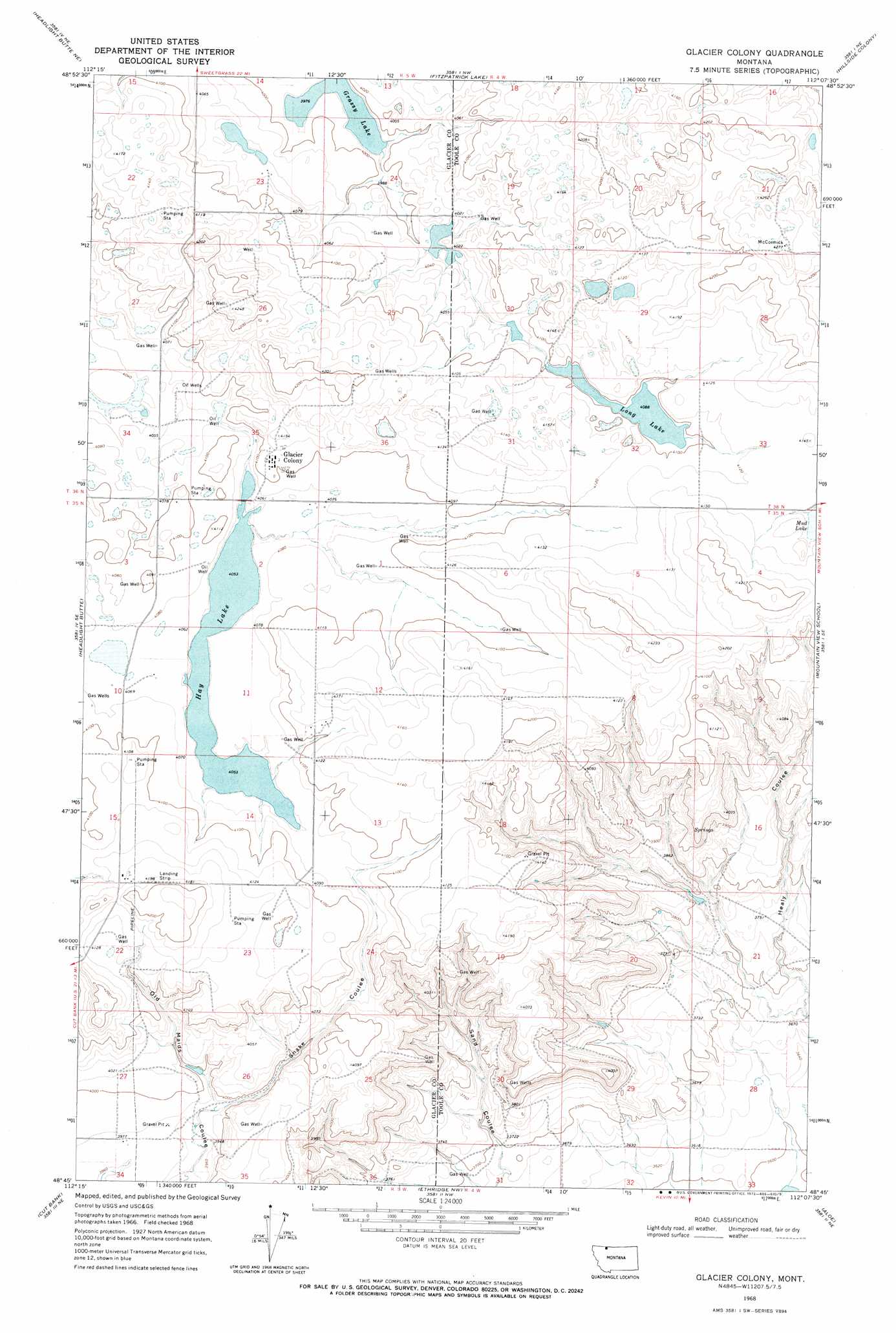
USGS Topo Quad 48112g2 - 1:24,000 scale
| Topo Map Name: | Glacier Colony |
| USGS Topo Quad ID: | 48112g2 |
| Print Size: | ca. 21 1/4" wide x 27" high |
| Southeast Coordinates: | 48.75° N latitude / 112.125° W longitude |
| Map Center Coordinates: | 48.8125° N latitude / 112.1875° W longitude |
| U.S. State: | MT |
| Filename: | o48112g2.jpg |
| Download Map JPG Image: | Glacier Colony topo map 1:24,000 scale |
| Map Type: | Topographic |
| Topo Series: | 7.5´ |
| Map Scale: | 1:24,000 |
| Source of Map Images: | United States Geological Survey (USGS) |
| Alternate Map Versions: |
Glacier Colony MT 1968, updated 1972 Download PDF Buy paper map Glacier Colony MT 2011 Download PDF Buy paper map Glacier Colony MT 2014 Download PDF Buy paper map |
1:24,000 Topo Quads surrounding Glacier Colony
Headlight Butte Nw |
Headlight Butte Ne |
Fitzpatrick Lake |
Hillside Colony |
Sunburst |
Dead Indian Spring |
Headlight Butte |
Glacier Colony |
Mountain View School |
Kevin North |
Gunsight |
Cut Bank |
Ethridge Nw |
Aloe |
Kevin South |
Squaw Buttes |
Cut Bank Se |
Boru Spring |
Ethridge |
Virden |
> Back to 48112e1 at 1:100,000 scale
> Back to 48112a1 at 1:250,000 scale
> Back to U.S. Topo Maps home
Glacier Colony topo map: Gazetteer
Glacier Colony: Dams
Long Lake Dam elevation 1247m 4091′Glacier Colony: Lakes
Grassy Lake elevation 1213m 3979′Hay Lake elevation 1236m 4055′
Long Lake elevation 1247m 4091′
Glacier Colony: Populated Places
Glacier Colony elevation 1256m 4120′Glacier Colony: Valleys
Snake Coulee elevation 1209m 3966′Glacier Colony: Wells
35N05W01CC__01 Well elevation 1251m 4104′35N05W02AA__01 Well elevation 1241m 4071′
35N05W12CC__01 Well elevation 1259m 4130′
35N05W15AB__01 Well elevation 1258m 4127′
35N05W15DC__01 Well elevation 1271m 4169′
35N05W23DA__01 Well elevation 1256m 4120′
35N05W34AB__01 Well elevation 1209m 3966′
36N04W21DC__01 Well elevation 1299m 4261′
36N04W33BB__01 Well elevation 1260m 4133′
36N05W23AC__01 Well elevation 1225m 4019′
36N05W24DA__01 Well elevation 1232m 4041′
36N05W26BA__01 Well elevation 1263m 4143′
36N05W27CD__01 Well elevation 1233m 4045′
36N05W35CD__01 Well elevation 1241m 4071′
Glacier Colony digital topo map on disk
Buy this Glacier Colony topo map showing relief, roads, GPS coordinates and other geographical features, as a high-resolution digital map file on DVD: