Big Rock Topo Map Montana
To zoom in, hover over the map of Big Rock
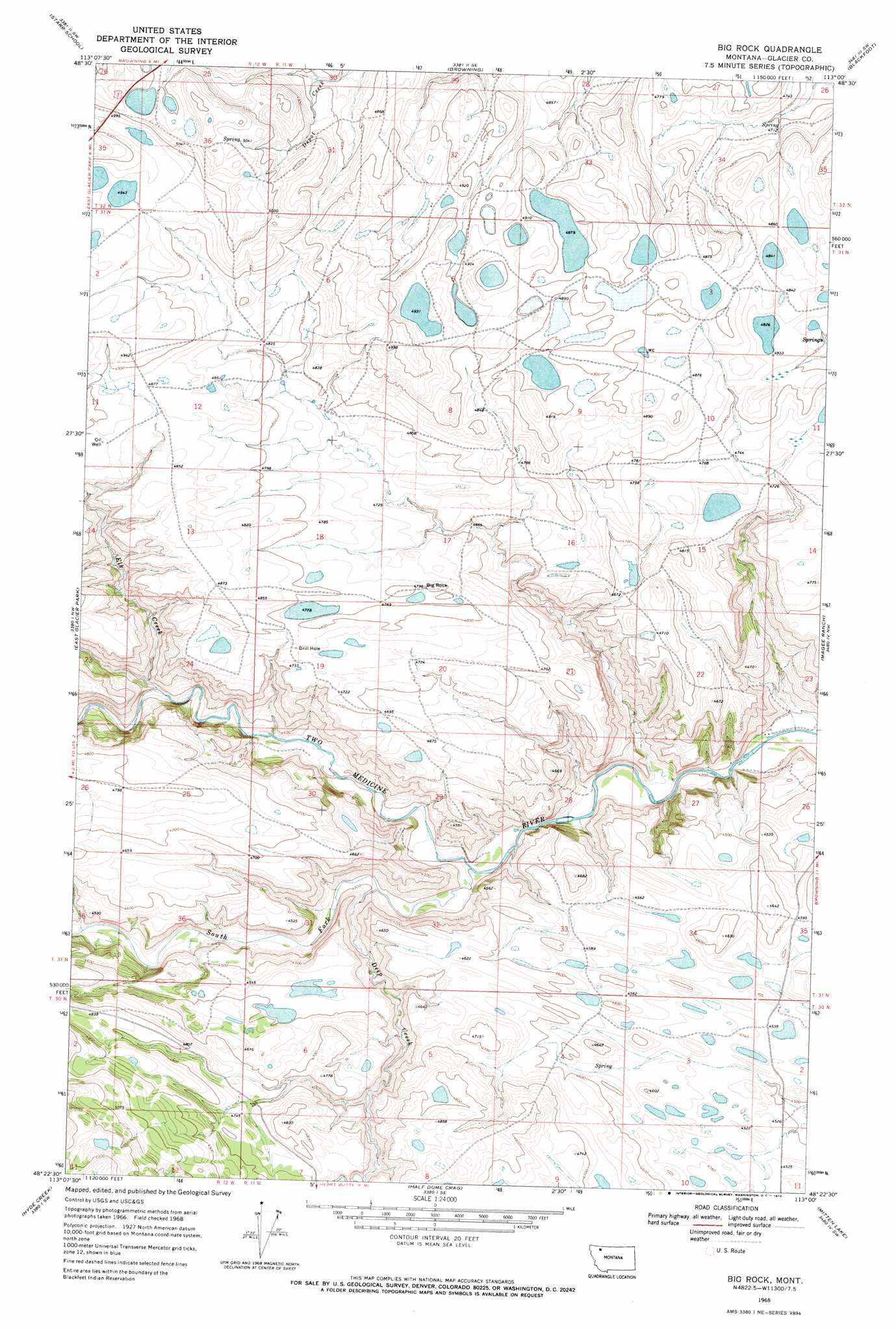
USGS Topo Quad 48113d1 - 1:24,000 scale
| Topo Map Name: | Big Rock |
| USGS Topo Quad ID: | 48113d1 |
| Print Size: | ca. 21 1/4" wide x 27" high |
| Southeast Coordinates: | 48.375° N latitude / 113° W longitude |
| Map Center Coordinates: | 48.4375° N latitude / 113.0625° W longitude |
| U.S. State: | MT |
| Filename: | o48113d1.jpg |
| Download Map JPG Image: | Big Rock topo map 1:24,000 scale |
| Map Type: | Topographic |
| Topo Series: | 7.5´ |
| Map Scale: | 1:24,000 |
| Source of Map Images: | United States Geological Survey (USGS) |
| Alternate Map Versions: |
Big Rock MT 1968, updated 1972 Download PDF Buy paper map Big Rock MT 2011 Download PDF Buy paper map Big Rock MT 2014 Download PDF Buy paper map |
1:24,000 Topo Quads surrounding Big Rock
Fox Creek |
Horse Lake |
Browning Ne |
Sharp Lake |
Rimrock Butte |
Kiowa |
Starr School |
Browning |
Blackfoot |
Kipp Lake |
Squaw Mountain |
East Glacier Park |
Big Rock |
Magee Ranch |
White Man Coulee |
Summit |
Hyde Creek |
Half Dome Crag |
Mitten Lake |
Heart Butte |
Red Plume Mountain |
Crescent Cliff |
Morningstar Mountain |
Swift Reservoir |
Fish Lake |
> Back to 48113a1 at 1:100,000 scale
> Back to 48112a1 at 1:250,000 scale
> Back to U.S. Topo Maps home
Big Rock topo map: Gazetteer
Big Rock: Pillars
Big Rock elevation 1461m 4793′Big Rock: Springs
32N12W36ADCC01 Spring elevation 1539m 5049′Big Rock: Streams
Deep Creek elevation 1308m 4291′Elk Creek elevation 1345m 4412′
South Fork Two Medicine River elevation 1296m 4251′
Big Rock digital topo map on disk
Buy this Big Rock topo map showing relief, roads, GPS coordinates and other geographical features, as a high-resolution digital map file on DVD: