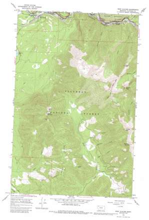
West Glacier Topo Map Montana
To zoom in, hover over the map of West Glacier
USGS Topo Quad 48113d8 - 1:24,000 scale
| Topo Map Name: | West Glacier |
| USGS Topo Quad ID: | 48113d8 |
| Print Size: | ca. 21 1/4" wide x 27" high |
| Southeast Coordinates: | 48.375° N latitude / 113.875° W longitude |
| Map Center Coordinates: | 48.4375° N latitude / 113.9375° W longitude |
| U.S. State: | MT |
| Filename: | o48113d8.jpg |
| Download Map JPG Image: | West Glacier topo map 1:24,000 scale |
| Map Type: | Topographic |
| Topo Series: | 7.5´ |
| Map Scale: | 1:24,000 |
| Source of Map Images: | United States Geological Survey (USGS) |
| Alternate Map Versions: |
West Glacier MT 1964, updated 1968 Download PDF Buy paper map West Glacier MT 1964, updated 1981 Download PDF Buy paper map West Glacier MT 1964, updated 1987 Download PDF Buy paper map West Glacier MT 1994, updated 1997 Download PDF Buy paper map West Glacier MT 1994, updated 1997 Download PDF Buy paper map West Glacier MT 2011 Download PDF Buy paper map West Glacier MT 2014 Download PDF Buy paper map |
| FStopo: | US Forest Service topo West Glacier is available: Download FStopo PDF Download FStopo TIF |
1:24,000 Topo Quads surrounding West Glacier
> Back to 48113a1 at 1:100,000 scale
> Back to 48112a1 at 1:250,000 scale
> Back to U.S. Topo Maps home
West Glacier topo map: Gazetteer
West Glacier: Parks
Coram Experimental Forest elevation 1380m 4527′West Glacier: Populated Places
West Glacier elevation 966m 3169′West Glacier: Post Offices
West Glacier Post Office elevation 983m 3225′West Glacier: Ridges
Emery Ridge elevation 1485m 4872′West Glacier: Streams
Kootenai Creek elevation 996m 3267′Lincoln Creek elevation 994m 3261′
Oliver Creek elevation 1234m 4048′
Ousel Creek elevation 995m 3264′
Remington Creek elevation 1215m 3986′
Royal Creek elevation 1204m 3950′
Strife Creek elevation 1195m 3920′
West Glacier: Summits
Belton Point elevation 1942m 6371′Desert Mountain elevation 1941m 6368′
Emery Hill elevation 1646m 5400′
Great Bear Mountain elevation 2310m 7578′
Ousel Peak elevation 2179m 7148′
Pyramid Peak elevation 2213m 7260′
Triangle Peak elevation 2294m 7526′
West Glacier: Trails
Ousel Peak Trail elevation 2066m 6778′West Glacier digital topo map on disk
Buy this West Glacier topo map showing relief, roads, GPS coordinates and other geographical features, as a high-resolution digital map file on DVD:


