Starr School Topo Map Montana
To zoom in, hover over the map of Starr School
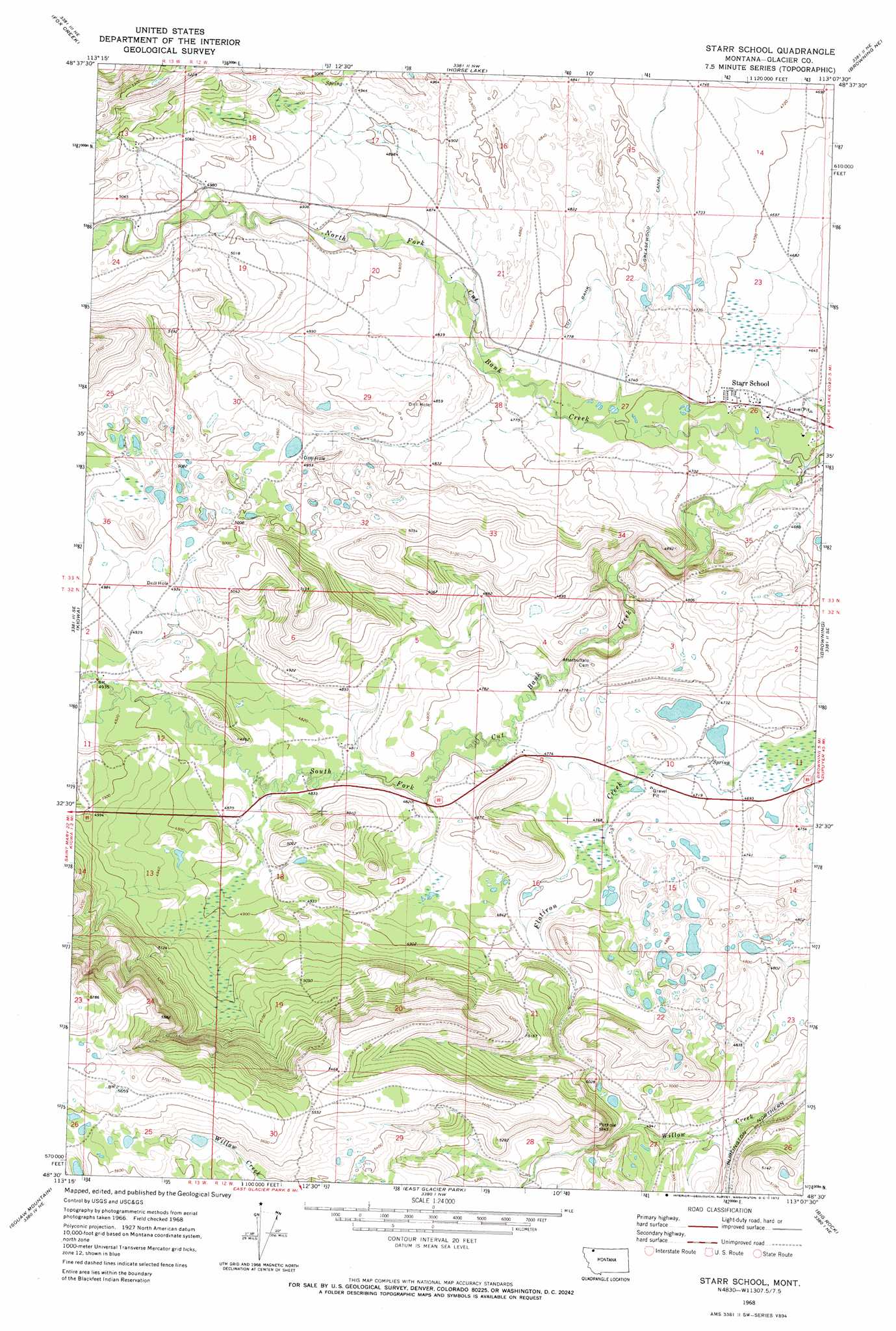
USGS Topo Quad 48113e2 - 1:24,000 scale
| Topo Map Name: | Starr School |
| USGS Topo Quad ID: | 48113e2 |
| Print Size: | ca. 21 1/4" wide x 27" high |
| Southeast Coordinates: | 48.5° N latitude / 113.125° W longitude |
| Map Center Coordinates: | 48.5625° N latitude / 113.1875° W longitude |
| U.S. State: | MT |
| Filename: | o48113e2.jpg |
| Download Map JPG Image: | Starr School topo map 1:24,000 scale |
| Map Type: | Topographic |
| Topo Series: | 7.5´ |
| Map Scale: | 1:24,000 |
| Source of Map Images: | United States Geological Survey (USGS) |
| Alternate Map Versions: |
Starr School MT 1968, updated 1972 Download PDF Buy paper map Starr School MT 2011 Download PDF Buy paper map Starr School MT 2014 Download PDF Buy paper map |
1:24,000 Topo Quads surrounding Starr School
Babb |
Duck Lake |
Wetzel |
Hoodoo Hill |
Nightshoot Coulee |
Saint Mary |
Fox Creek |
Horse Lake |
Browning Ne |
Sharp Lake |
Cut Bank Pass |
Kiowa |
Starr School |
Browning |
Blackfoot |
Mount Rockwell |
Squaw Mountain |
East Glacier Park |
Big Rock |
Magee Ranch |
Blacktail |
Summit |
Hyde Creek |
Half Dome Crag |
Mitten Lake |
> Back to 48113e1 at 1:100,000 scale
> Back to 48112a1 at 1:250,000 scale
> Back to U.S. Topo Maps home
Starr School topo map: Gazetteer
Starr School: Populated Places
Star elevation 1471m 4826′Starr School elevation 1428m 4685′
Starr School: Springs
33N12W25CBBC01 Spring elevation 1406m 4612′Starr School: Streams
North Fork Cut Bank Creek elevation 1403m 4603′South Fork Cut Bank Creek elevation 1403m 4603′
Starr School: Wells
33N12W25BBCC01 Well elevation 1414m 4639′33N12W25BCBC01 Well elevation 1412m 4632′
Starr School digital topo map on disk
Buy this Starr School topo map showing relief, roads, GPS coordinates and other geographical features, as a high-resolution digital map file on DVD: