Mount Jackson Topo Map Montana
To zoom in, hover over the map of Mount Jackson
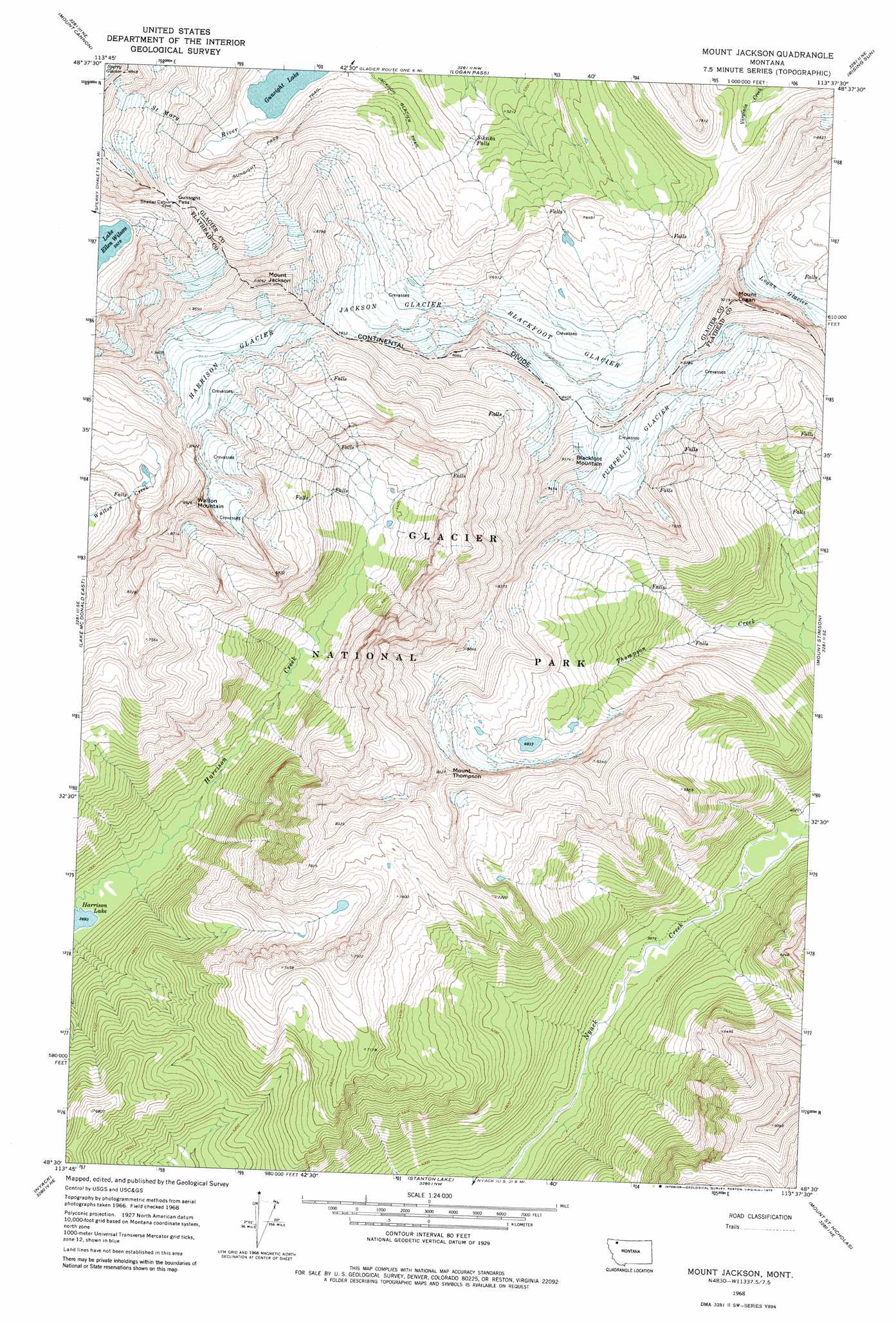
USGS Topo Quad 48113e6 - 1:24,000 scale
| Topo Map Name: | Mount Jackson |
| USGS Topo Quad ID: | 48113e6 |
| Print Size: | ca. 21 1/4" wide x 27" high |
| Southeast Coordinates: | 48.5° N latitude / 113.625° W longitude |
| Map Center Coordinates: | 48.5625° N latitude / 113.6875° W longitude |
| U.S. State: | MT |
| Filename: | o48113e6.jpg |
| Download Map JPG Image: | Mount Jackson topo map 1:24,000 scale |
| Map Type: | Topographic |
| Topo Series: | 7.5´ |
| Map Scale: | 1:24,000 |
| Source of Map Images: | United States Geological Survey (USGS) |
| Alternate Map Versions: |
Mount Jackson MT 1968, updated 1972 Download PDF Buy paper map Mount Jackson MT 1968, updated 1979 Download PDF Buy paper map Mount Jackson MT 1968, updated 1979 Download PDF Buy paper map Mount Jackson MT 2011 Download PDF Buy paper map Mount Jackson MT 2014 Download PDF Buy paper map |
1:24,000 Topo Quads surrounding Mount Jackson
Mount Geduhn |
Ahern Pass |
Many Glacier |
Lake Sherburne |
Babb |
Camas Ridge East |
Mount Cannon |
Logan Pass |
Rising Sun |
Saint Mary |
Lake Mcdonald West |
Lake Mcdonald East |
Mount Jackson |
Mount Stimson |
Cut Bank Pass |
West Glacier |
Nyack |
Stanton Lake |
Mount Saint Nicholas |
Mount Rockwell |
Nyack Sw |
Mount Grant |
Pinnacle |
Essex |
Blacktail |
> Back to 48113e1 at 1:100,000 scale
> Back to 48112a1 at 1:250,000 scale
> Back to U.S. Topo Maps home
Mount Jackson topo map: Gazetteer
Mount Jackson: Falls
Siksika Falls elevation 1611m 5285′Mount Jackson: Gaps
Gunsight Pass elevation 2118m 6948′Mount Jackson: Glaciers
Blackfoot Glacier elevation 2290m 7513′Harrison Glacier elevation 2586m 8484′
Jackson Glacier elevation 2228m 7309′
Logan Glacier elevation 2191m 7188′
Pumpelly Glacier elevation 2574m 8444′
Pumpkin Glacier elevation 2509m 8231′
Mount Jackson: Lakes
Gunsight Lake elevation 1631m 5351′Mount Jackson: Summits
Blackfoot Mountain elevation 2909m 9543′Mount Jackson elevation 3060m 10039′
Mount Logan elevation 2812m 9225′
Mount Thompson elevation 2591m 8500′
Walton Mountain elevation 2718m 8917′
Mount Jackson: Trails
Jackson Glacier Trail elevation 1774m 5820′Mount Jackson digital topo map on disk
Buy this Mount Jackson topo map showing relief, roads, GPS coordinates and other geographical features, as a high-resolution digital map file on DVD: