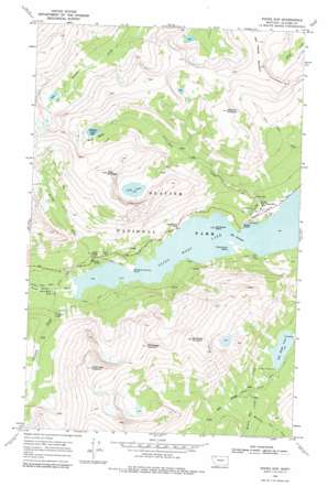
Rising Sun Topo Map Montana
To zoom in, hover over the map of Rising Sun
USGS Topo Quad 48113f5 - 1:24,000 scale
| Topo Map Name: | Rising Sun |
| USGS Topo Quad ID: | 48113f5 |
| Print Size: | ca. 21 1/4" wide x 27" high |
| Southeast Coordinates: | 48.625° N latitude / 113.5° W longitude |
| Map Center Coordinates: | 48.6875° N latitude / 113.5625° W longitude |
| U.S. State: | MT |
| Filename: | o48113f5.jpg |
| Download Map JPG Image: | Rising Sun topo map 1:24,000 scale |
| Map Type: | Topographic |
| Topo Series: | 7.5´ |
| Map Scale: | 1:24,000 |
| Source of Map Images: | United States Geological Survey (USGS) |
| Alternate Map Versions: |
Rising Sun MT 1968, updated 1972 Download PDF Buy paper map Rising Sun MT 1968, updated 1979 Download PDF Buy paper map Rising Sun MT 2011 Download PDF Buy paper map Rising Sun MT 2014 Download PDF Buy paper map |
1:24,000 Topo Quads surrounding Rising Sun
> Back to 48113e1 at 1:100,000 scale
> Back to 48112a1 at 1:250,000 scale
> Back to U.S. Topo Maps home
Rising Sun topo map: Gazetteer
Rising Sun: Basins
Rose Basin elevation 2001m 6564′Rising Sun: Bridges
Baring Creek Bridge elevation 1427m 4681′Rising Sun: Capes
Going-to-the-Sun Point elevation 1391m 4563′Rising Sun: Falls
Baring Falls elevation 1391m 4563′Saint Mary Falls elevation 1390m 4560′
Virginia Falls elevation 1488m 4881′
Rising Sun: Guts
The Narrows elevation 1368m 4488′Rising Sun: Islands
Wild Goose Island elevation 1368m 4488′Rising Sun: Lakes
Goat Lake elevation 1970m 6463′Lost Lake elevation 1431m 4694′
Otokomi Lake elevation 1977m 6486′
Red Eagle Lake elevation 1441m 4727′
Rising Sun: Populated Places
Rising Sun elevation 1394m 4573′Rising Sun: Streams
Baring Creek elevation 1369m 4491′Hudson Bay Creek elevation 1465m 4806′
Medicine Owl Creek elevation 1504m 4934′
Rose Creek elevation 1370m 4494′
Virginia Creek elevation 1386m 4547′
Rising Sun: Summits
East Flattop Mountain elevation 2548m 8359′Goat Mountain elevation 2612m 8569′
Little Chief Mountain elevation 2867m 9406′
Mahtotopa Mountain elevation 2621m 8599′
Otokomi Mountain elevation 2412m 7913′
Red Eagle Mountain elevation 2671m 8763′
Rising Sun: Trails
Many Falls Trail elevation 1401m 4596′Saint Mary Lake Trail elevation 1375m 4511′
Siyeh Pass Trail elevation 2279m 7477′
Water Ouzel Trail elevation 1412m 4632′
Rising Sun: Valleys
Sunrift Gorge elevation 1448m 4750′Rising Sun digital topo map on disk
Buy this Rising Sun topo map showing relief, roads, GPS coordinates and other geographical features, as a high-resolution digital map file on DVD:


