Chief Mountain Topo Map Montana
To zoom in, hover over the map of Chief Mountain
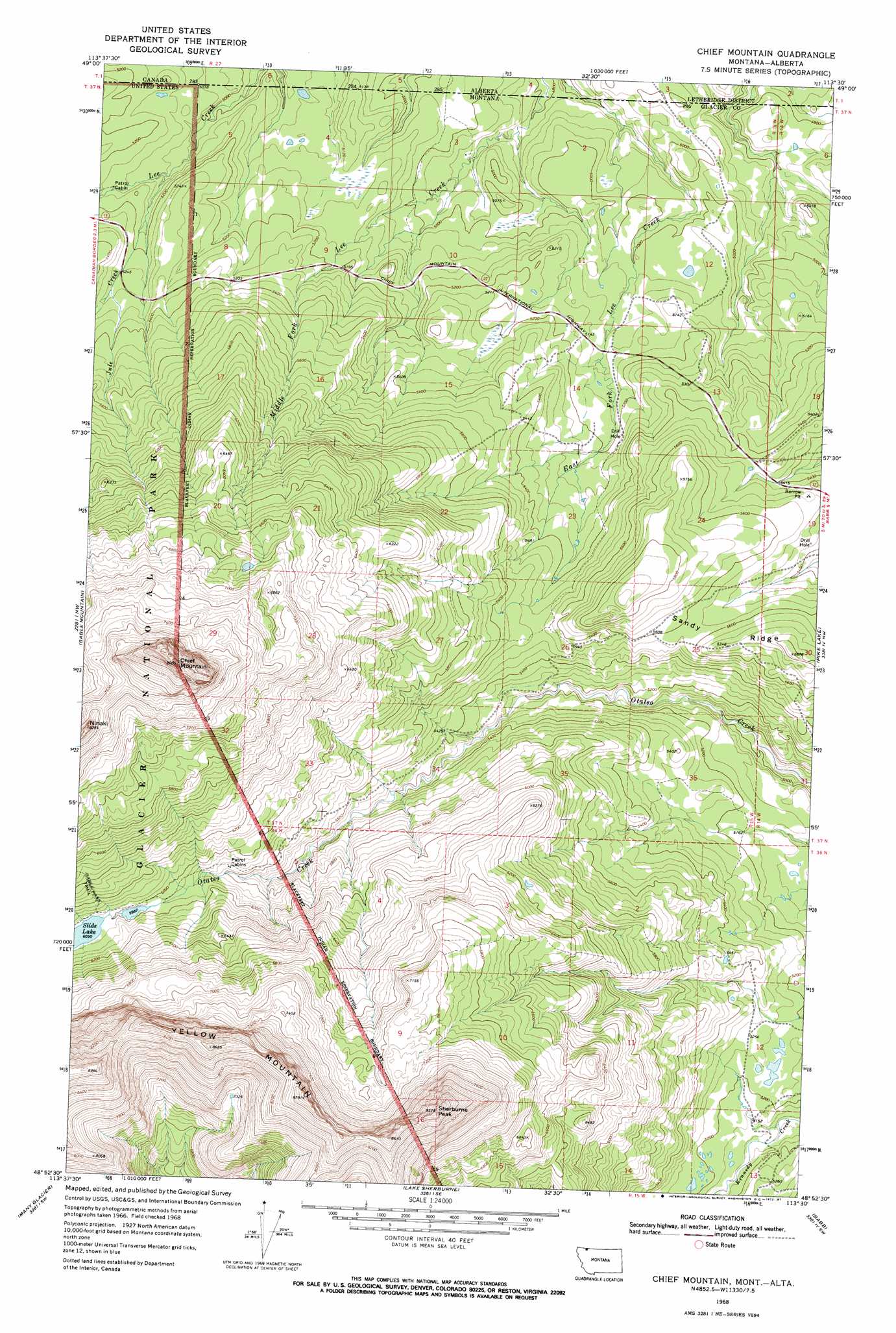
USGS Topo Quad 48113h5 - 1:24,000 scale
| Topo Map Name: | Chief Mountain |
| USGS Topo Quad ID: | 48113h5 |
| Print Size: | ca. 21 1/4" wide x 27" high |
| Southeast Coordinates: | 48.875° N latitude / 113.5° W longitude |
| Map Center Coordinates: | 48.9375° N latitude / 113.5625° W longitude |
| U.S. State: | MT |
| Filename: | o48113h5.jpg |
| Download Map JPG Image: | Chief Mountain topo map 1:24,000 scale |
| Map Type: | Topographic |
| Topo Series: | 7.5´ |
| Map Scale: | 1:24,000 |
| Source of Map Images: | United States Geological Survey (USGS) |
| Alternate Map Versions: |
Chief Mountain MT 1968, updated 1972 Download PDF Buy paper map Chief Mountain MT 1968, updated 1987 Download PDF Buy paper map Chief Mountain MT 2011 Download PDF Buy paper map Chief Mountain MT 2014 Download PDF Buy paper map |
1:24,000 Topo Quads surrounding Chief Mountain
Mount Cleveland |
Gable Mountain |
Chief Mountain |
Pike Lake |
Goose Lake |
Ahern Pass |
Many Glacier |
Lake Sherburne |
Babb |
Duck Lake |
Mount Cannon |
Logan Pass |
Rising Sun |
Saint Mary |
Fox Creek |
> Back to 48113e1 at 1:100,000 scale
> Back to 48112a1 at 1:250,000 scale
> Back to U.S. Topo Maps home
Chief Mountain topo map: Gazetteer
Chief Mountain: Lakes
Slide Lake elevation 1839m 6033′Chief Mountain: Ridges
Sandy Ridge elevation 1781m 5843′Chief Mountain: Streams
Jule Creek elevation 1545m 5068′Chief Mountain: Summits
Chief Mountain elevation 2745m 9005′Sherburne Peak elevation 2584m 8477′
Chief Mountain digital topo map on disk
Buy this Chief Mountain topo map showing relief, roads, GPS coordinates and other geographical features, as a high-resolution digital map file on DVD: