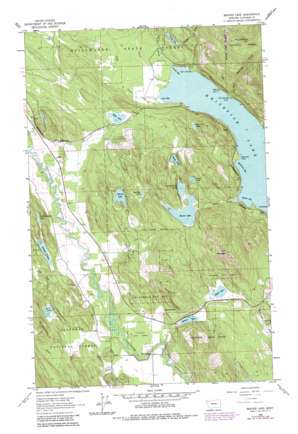
Beaver Lake Topo Map Montana
To zoom in, hover over the map of Beaver Lake
USGS Topo Quad 48114d4 - 1:24,000 scale
| Topo Map Name: | Beaver Lake |
| USGS Topo Quad ID: | 48114d4 |
| Print Size: | ca. 21 1/4" wide x 27" high |
| Southeast Coordinates: | 48.375° N latitude / 114.375° W longitude |
| Map Center Coordinates: | 48.4375° N latitude / 114.4375° W longitude |
| U.S. State: | MT |
| Filename: | o48114d4.jpg |
| Download Map JPG Image: | Beaver Lake topo map 1:24,000 scale |
| Map Type: | Topographic |
| Topo Series: | 7.5´ |
| Map Scale: | 1:24,000 |
| Source of Map Images: | United States Geological Survey (USGS) |
| Alternate Map Versions: |
Beaver Lake MT 1962, updated 1964 Download PDF Buy paper map Beaver Lake MT 1962, updated 1974 Download PDF Buy paper map Beaver Lake MT 1962, updated 1983 Download PDF Buy paper map Beaver Lake MT 1994, updated 1997 Download PDF Buy paper map Beaver Lake MT 2011 Download PDF Buy paper map Beaver Lake MT 2014 Download PDF Buy paper map |
| FStopo: | US Forest Service topo Beaver Lake is available: Download FStopo PDF Download FStopo TIF |
1:24,000 Topo Quads surrounding Beaver Lake
> Back to 48114a1 at 1:100,000 scale
> Back to 48114a1 at 1:250,000 scale
> Back to U.S. Topo Maps home
Beaver Lake topo map: Gazetteer
Beaver Lake: Bays
Beaver Bay elevation 914m 2998′Brush Bay elevation 914m 2998′
Lazy Bay elevation 914m 2998′
Mackinaw Bay elevation 914m 2998′
Beaver Lake: Capes
Eagle Point elevation 922m 3024′Hell Roaring Point elevation 915m 3001′
Inez Point elevation 914m 2998′
Mackinaw Point elevation 915m 3001′
Point of Pines elevation 914m 2998′
Beaver Lake: Islands
The Island elevation 914m 2998′Beaver Lake: Lakes
Beaver Lake elevation 995m 3264′Bootjack Lake elevation 939m 3080′
Boyle Lake elevation 941m 3087′
Dollar Lake elevation 1051m 3448′
Little Beaver Lake elevation 996m 3267′
Little Bootjack Lake elevation 964m 3162′
Murray Lake elevation 1030m 3379′
Rainbow Lake elevation 1043m 3421′
Skyles Lake elevation 963m 3159′
Smith Lake elevation 1017m 3336′
Spencer Lake elevation 942m 3090′
Thornberg Lake elevation 1010m 3313′
Twin Lakes elevation 958m 3143′
Whitefish Lake elevation 914m 2998′
Woods Lake elevation 1034m 3392′
Beaver Lake: Populated Places
Round Prairie elevation 939m 3080′Vista elevation 927m 3041′
Beaver Lake: Post Offices
Blodgett Post Office (historical) elevation 959m 3146′Beaver Lake: Streams
Beaver Creek elevation 914m 2998′Brush Creek elevation 914m 2998′
Cliff Creek elevation 941m 3087′
Eagle Creek elevation 929m 3047′
Hell Roaring Creek elevation 922m 3024′
Lazy Creek elevation 914m 2998′
Smith Creek elevation 916m 3005′
Swift Creek elevation 914m 2998′
Beaver Lake: Summits
Lion Mountain elevation 1328m 4356′Beaver Lake: Tunnels
Vista Tunnel elevation 969m 3179′Beaver Lake: Wells
30N23W01AB__01 Well elevation 958m 3143′31N23W02ADAB01 Well elevation 978m 3208′
31N23W25AB__01 Well elevation 930m 3051′
31N23W25ACCA01 Well elevation 922m 3024′
31N23W36BDBA01 Well elevation 922m 3024′
Beaver Lake digital topo map on disk
Buy this Beaver Lake topo map showing relief, roads, GPS coordinates and other geographical features, as a high-resolution digital map file on DVD:


