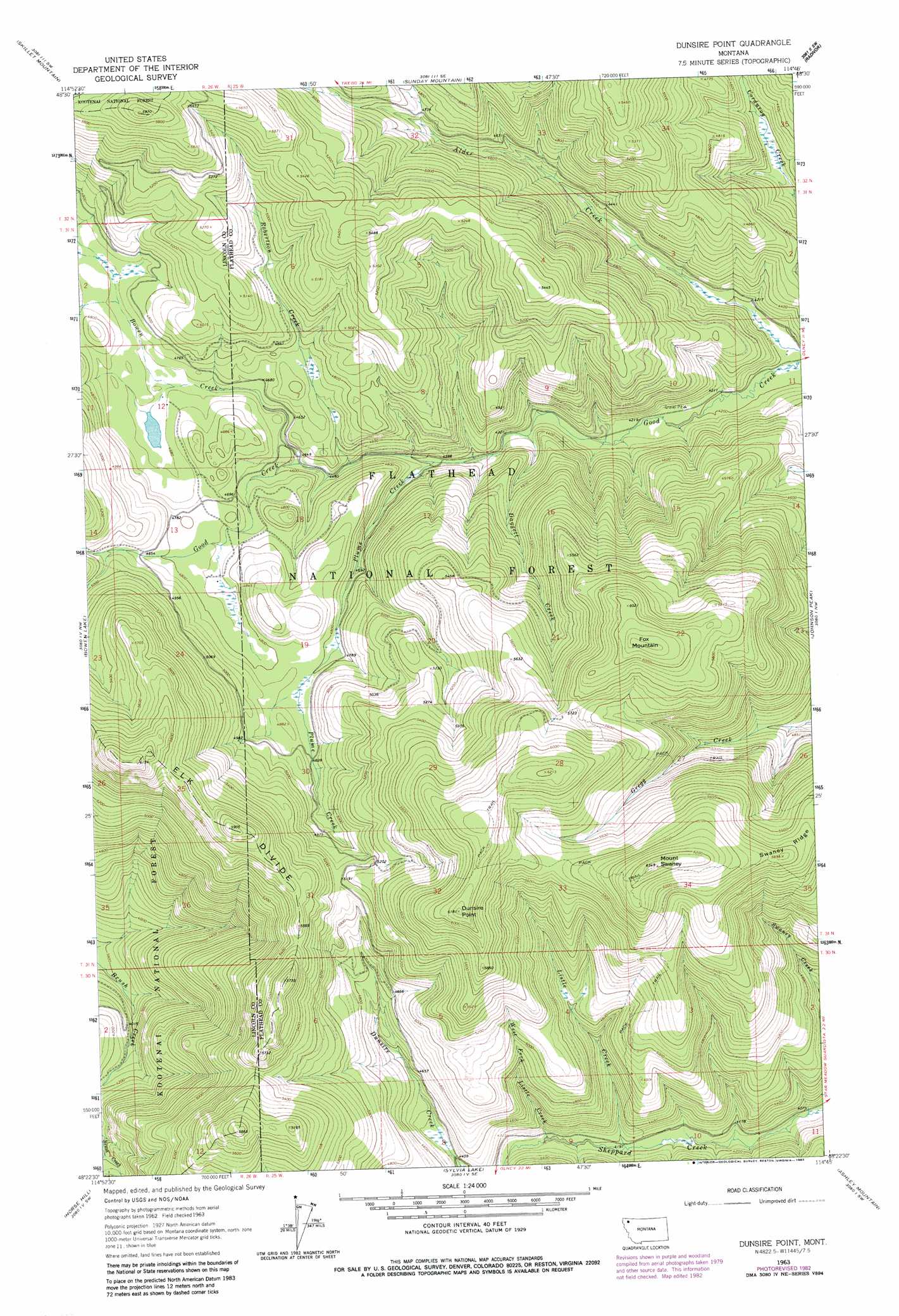
Dunsire Point Topo Map Montana
To zoom in, hover over the map of Dunsire Point
USGS Topo Quad 48114d7 - 1:24,000 scale
| Topo Map Name: | Dunsire Point |
| USGS Topo Quad ID: | 48114d7 |
| Print Size: | ca. 21 1/4" wide x 27" high |
| Southeast Coordinates: | 48.375° N latitude / 114.75° W longitude |
| Map Center Coordinates: | 48.4375° N latitude / 114.8125° W longitude |
| U.S. State: | MT |
| Filename: | o48114d7.jpg |
| Download Map JPG Image: | Dunsire Point topo map 1:24,000 scale |
| Map Type: | Topographic |
| Topo Series: | 7.5´ |
| Map Scale: | 1:24,000 |
| Source of Map Images: | United States Geological Survey (USGS) |
| Alternate Map Versions: |
Dunsire Point MT 1963, updated 1966 Download PDF Buy paper map Dunsire Point MT 1963, updated 1983 Download PDF Buy paper map Dunsire Point MT 1994, updated 1997 Download PDF Buy paper map Dunsire Point MT 2011 Download PDF Buy paper map Dunsire Point MT 2014 Download PDF Buy paper map |
| FStopo: | US Forest Service topo Dunsire Point is available: Download FStopo PDF Download FStopo TIF |
1:24,000 Topo Quads surrounding Dunsire Point
Pinkham Mountain |
Edna Mountain |
Stryker |
Bull Lake |
Upper Whitefish Lake |
Davis Mountain |
Skillet Mountain |
Sunday Mountain |
Radnor |
Olney |
Warland Peak |
Bowen Lake |
Dunsire Point |
Johnson Peak |
Tally Lake |
Wolf Prairie |
Horse Hill |
Sylvia Lake |
Ashley Mountain |
Lost Creek Divide |
Deer Creek |
Lynch Lake |
Dahl Lake |
Pleasant Valley Mountain |
Lone Lake |
> Back to 48114a1 at 1:100,000 scale
> Back to 48114a1 at 1:250,000 scale
> Back to U.S. Topo Maps home
Dunsire Point topo map: Gazetteer
Dunsire Point: Ridges
Elk Divide elevation 1678m 5505′Swaney Ridge elevation 1785m 5856′
Dunsire Point: Streams
Bowen Creek elevation 1385m 4543′Daggett Creek elevation 1308m 4291′
Listle Creek elevation 1279m 4196′
Plume Creek elevation 1337m 4386′
Robertson Creek elevation 1359m 4458′
West Fork Listle Creek elevation 1282m 4206′
Dunsire Point: Summits
Dunsire Point elevation 1881m 6171′Fox Mountain elevation 1882m 6174′
Mount Swaney elevation 1926m 6318′
Dunsire Point: Trails
Elk Mountain National Recreation Trail elevation 1726m 5662′Dunsire Point digital topo map on disk
Buy this Dunsire Point topo map showing relief, roads, GPS coordinates and other geographical features, as a high-resolution digital map file on DVD: