Mount Marston Topo Map Montana
To zoom in, hover over the map of Mount Marston
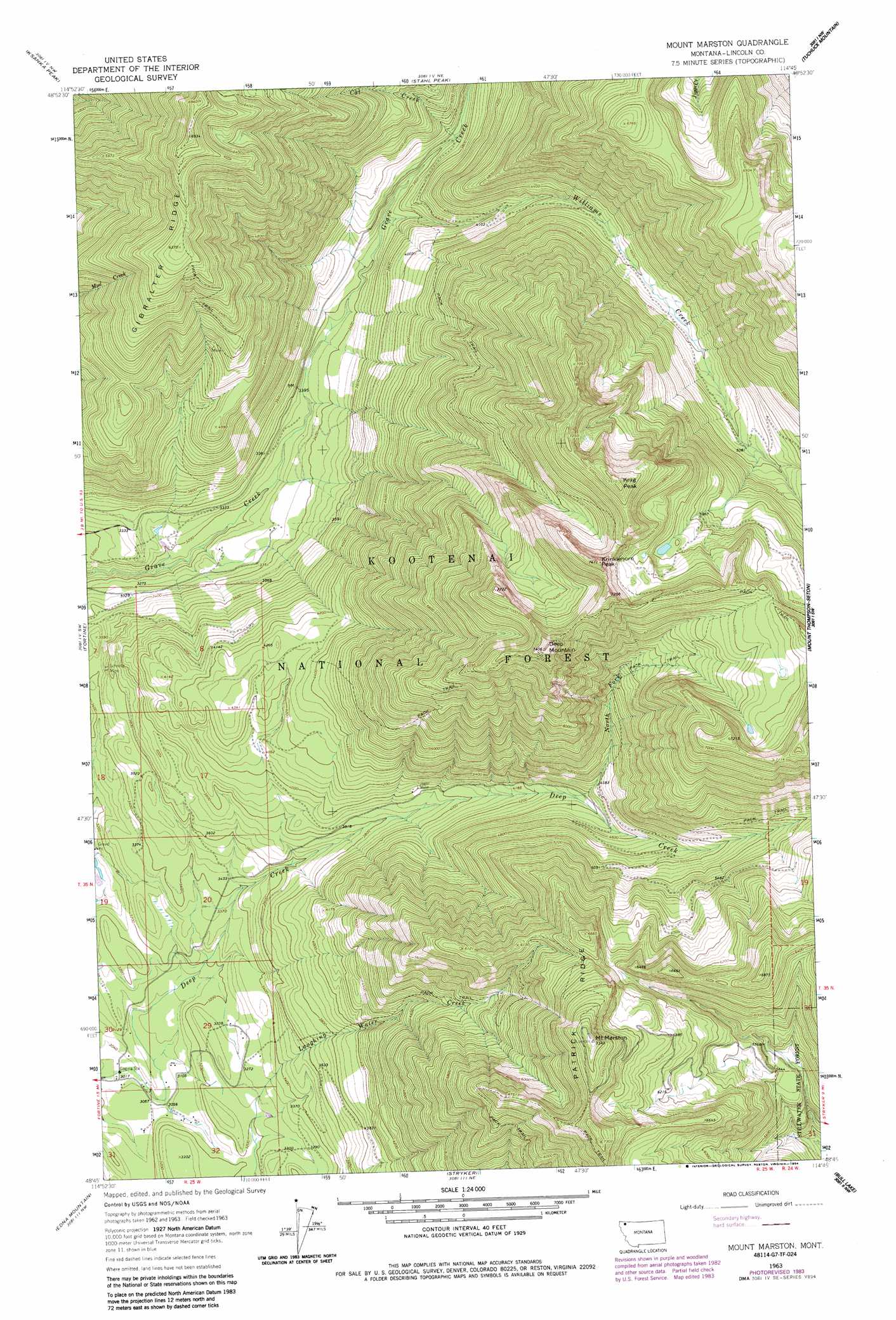
USGS Topo Quad 48114g7 - 1:24,000 scale
| Topo Map Name: | Mount Marston |
| USGS Topo Quad ID: | 48114g7 |
| Print Size: | ca. 21 1/4" wide x 27" high |
| Southeast Coordinates: | 48.75° N latitude / 114.75° W longitude |
| Map Center Coordinates: | 48.8125° N latitude / 114.8125° W longitude |
| U.S. State: | MT |
| Filename: | o48114g7.jpg |
| Download Map JPG Image: | Mount Marston topo map 1:24,000 scale |
| Map Type: | Topographic |
| Topo Series: | 7.5´ |
| Map Scale: | 1:24,000 |
| Source of Map Images: | United States Geological Survey (USGS) |
| Alternate Map Versions: |
Mount Marston MT 1963, updated 1966 Download PDF Buy paper map Mount Marston MT 1963, updated 1984 Download PDF Buy paper map Mount Marston MT 1997, updated 2000 Download PDF Buy paper map Mount Marston MT 2011 Download PDF Buy paper map Mount Marston MT 2014 Download PDF Buy paper map |
| FStopo: | US Forest Service topo Mount Marston is available: Download FStopo PDF Download FStopo TIF |
1:24,000 Topo Quads surrounding Mount Marston
Eureka North |
Ksanka Peak |
Stahl Peak |
Tuchuck Mountain |
Mount Hefty |
Eureka South |
Fortine |
Mount Marston |
Mount Thompson-Seton |
Red Meadow Lake |
Pinkham Mountain |
Edna Mountain |
Stryker |
Bull Lake |
Upper Whitefish Lake |
Davis Mountain |
Skillet Mountain |
Sunday Mountain |
Radnor |
Olney |
> Back to 48114e1 at 1:100,000 scale
> Back to 48114a1 at 1:250,000 scale
> Back to U.S. Topo Maps home
Mount Marston topo map: Gazetteer
Mount Marston: Dams
Vredenburg Dam elevation 1019m 3343′Mount Marston: Mines
Jager Mine elevation 1224m 4015′Mount Marston: Ridges
Gibralter Ridge elevation 1940m 6364′Mount Marston: Streams
Cat Creek elevation 1112m 3648′North Fork Deep Creek elevation 1314m 4311′
Williams Creek elevation 1071m 3513′
Mount Marston: Summits
Deep Mountain elevation 2257m 7404′Krag Peak elevation 2274m 7460′
Krinklehorn Peak elevation 2251m 7385′
Mount Marston elevation 2238m 7342′
Mount Marston: Trails
Mount Marston National Recreation Trail elevation 2041m 6696′Mount Marston: Wells
35N25W32ADCB01 Well elevation 973m 3192′36N25W05CCBA01 Well elevation 1012m 3320′
Mount Marston digital topo map on disk
Buy this Mount Marston topo map showing relief, roads, GPS coordinates and other geographical features, as a high-resolution digital map file on DVD: