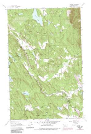
Fortine Topo Map Montana
To zoom in, hover over the map of Fortine
USGS Topo Quad 48114g8 - 1:24,000 scale
| Topo Map Name: | Fortine |
| USGS Topo Quad ID: | 48114g8 |
| Print Size: | ca. 21 1/4" wide x 27" high |
| Southeast Coordinates: | 48.75° N latitude / 114.875° W longitude |
| Map Center Coordinates: | 48.8125° N latitude / 114.9375° W longitude |
| U.S. State: | MT |
| Filename: | o48114g8.jpg |
| Download Map JPG Image: | Fortine topo map 1:24,000 scale |
| Map Type: | Topographic |
| Topo Series: | 7.5´ |
| Map Scale: | 1:24,000 |
| Source of Map Images: | United States Geological Survey (USGS) |
| Alternate Map Versions: |
Fortine MT 1963, updated 1966 Download PDF Buy paper map Fortine MT 1963, updated 1984 Download PDF Buy paper map Fortine MT 1997, updated 2000 Download PDF Buy paper map Fortine MT 2011 Download PDF Buy paper map Fortine MT 2014 Download PDF Buy paper map |
| FStopo: | US Forest Service topo Fortine is available: Download FStopo PDF Download FStopo TIF |
1:24,000 Topo Quads surrounding Fortine
> Back to 48114e1 at 1:100,000 scale
> Back to 48114a1 at 1:250,000 scale
> Back to U.S. Topo Maps home
Fortine topo map: Gazetteer
Fortine: Airports
Crystal Lakes Resort Airport elevation 940m 3083′Vredenberg Airstrip elevation 962m 3156′
Fortine: Dams
Black Lake Dam elevation 942m 3090′Crystal Lake Dam elevation 912m 2992′
Glen Lake Dam elevation 903m 2962′
Fortine: Lakes
Barnaby Lake elevation 924m 3031′Black Lake elevation 942m 3090′
Crystal Lake elevation 912m 2992′
Dry Lake elevation 893m 2929′
Glen Lake elevation 903m 2962′
Homes Lake elevation 968m 3175′
Lick Lake elevation 942m 3090′
Long Lake elevation 876m 2874′
Fortine: Populated Places
Eagle Lake Ranch elevation 895m 2936′Fortine elevation 906m 2972′
Tobacco elevation 830m 2723′
Fortine: Post Offices
Fortine Post Office elevation 906m 2972′Marston Post Office (historical) elevation 858m 2814′
Fortine: Reservoirs
Bass Lake elevation 839m 2752′Fortine: Springs
36N26W33DC__01 Spring elevation 883m 2896′Fortine: Streams
Barton Creek elevation 928m 3044′Deep Creek elevation 896m 2939′
Fortine Creek elevation 852m 2795′
Glen Creek elevation 903m 2962′
Grave Creek elevation 852m 2795′
Griffith Creek elevation 973m 3192′
Lick Creek elevation 824m 2703′
Marl Lake Creek elevation 943m 3093′
Meadow Creek elevation 876m 2874′
Mud Creek elevation 832m 2729′
Murphy Creek elevation 903m 2962′
Sherman Creek elevation 932m 3057′
Therriault Creek elevation 826m 2709′
Fortine: Wells
35N25W19BA__01 Well elevation 934m 3064′35N25W31CA__01 Well elevation 913m 2995′
35N26W08ABAA01 Well elevation 871m 2857′
35N26W08ADAC01 Well elevation 854m 2801′
35N26W12ACBB01 Well elevation 904m 2965′
35N26W14BD__01 Well elevation 875m 2870′
35N26W14BDDC01 Well elevation 874m 2867′
35N26W14CABD01 Well elevation 873m 2864′
35N26W25AB__01 Well elevation 911m 2988′
35N26W25CA__01 Well elevation 910m 2985′
35N26W27CCAB01 Well elevation 926m 3038′
35N26W27CCAD01 Well elevation 929m 3047′
36N26W22CBAA01 Well elevation 907m 2975′
36N26W22DBBC01 Well elevation 923m 3028′
Fortine digital topo map on disk
Buy this Fortine topo map showing relief, roads, GPS coordinates and other geographical features, as a high-resolution digital map file on DVD:


