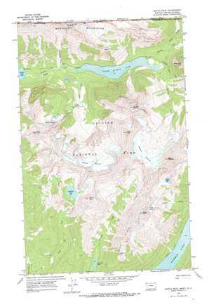
Kintla Peak Topo Map Montana
To zoom in, hover over the map of Kintla Peak
USGS Topo Quad 48114h2 - 1:24,000 scale
| Topo Map Name: | Kintla Peak |
| USGS Topo Quad ID: | 48114h2 |
| Print Size: | ca. 21 1/4" wide x 27" high |
| Southeast Coordinates: | 48.875° N latitude / 114.125° W longitude |
| Map Center Coordinates: | 48.9375° N latitude / 114.1875° W longitude |
| U.S. State: | MT |
| Filename: | o48114h2.jpg |
| Download Map JPG Image: | Kintla Peak topo map 1:24,000 scale |
| Map Type: | Topographic |
| Topo Series: | 7.5´ |
| Map Scale: | 1:24,000 |
| Source of Map Images: | United States Geological Survey (USGS) |
| Alternate Map Versions: |
Kintla Peak MT 1968, updated 1971 Download PDF Buy paper map Kintla Peak MT 1968, updated 1972 Download PDF Buy paper map Kintla Peak MT 2011 Download PDF Buy paper map Kintla Peak MT 2014 Download PDF Buy paper map |
1:24,000 Topo Quads surrounding Kintla Peak
Trailcreek |
Kintla Lake |
Kintla Peak |
Mount Carter |
Porcupine Ridge |
Whale Buttes |
Polebridge |
Quartz Ridge |
Vulture Peak |
Mount Geduhn |
Moose Peak |
Cyclone Lake |
Demers Ridge |
Camas Ridge West |
Camas Ridge East |
> Back to 48114e1 at 1:100,000 scale
> Back to 48114a1 at 1:250,000 scale
> Back to U.S. Topo Maps home
Kintla Peak topo map: Gazetteer
Kintla Peak: Glaciers
Agassiz Glacier elevation 2395m 7857′Baby Glacier elevation 2074m 6804′
Harris Glacier elevation 1974m 6476′
Kintla Glacier elevation 2373m 7785′
Kintla Peak: Lakes
Akokala Lake elevation 1445m 4740′Long Bow Lake elevation 2102m 6896′
Numa Lake elevation 1989m 6525′
Upper Kintla Lake elevation 1334m 4376′
Kintla Peak: Ridges
Boundary Mountains elevation 2806m 9206′Numa Ridge elevation 2347m 7700′
Kintla Peak: Streams
Agassiz Creek elevation 1335m 4379′Long Knife Creek elevation 1309m 4294′
North Fork Kintla Creek elevation 1404m 4606′
Red Medicine Bow Creek elevation 1297m 4255′
Kintla Peak: Summits
Gardner Point elevation 2243m 7358′Kinnerly Peak elevation 3032m 9947′
Kintla Peak elevation 3070m 10072′
Long Knife Peak elevation 2959m 9708′
Mount Peabody elevation 2773m 9097′
Numa Peak elevation 2718m 8917′
Parke Peak elevation 2725m 8940′
Reuter Peak elevation 2667m 8750′
Kintla Peak: Trails
Boulder Pass Trail elevation 1621m 5318′Bowman Lake Trail elevation 1230m 4035′
Kintla Peak digital topo map on disk
Buy this Kintla Peak topo map showing relief, roads, GPS coordinates and other geographical features, as a high-resolution digital map file on DVD:


