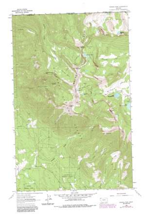
Ksanka Peak Topo Map Montana
To zoom in, hover over the map of Ksanka Peak
USGS Topo Quad 48114h8 - 1:24,000 scale
| Topo Map Name: | Ksanka Peak |
| USGS Topo Quad ID: | 48114h8 |
| Print Size: | ca. 21 1/4" wide x 27" high |
| Southeast Coordinates: | 48.875° N latitude / 114.875° W longitude |
| Map Center Coordinates: | 48.9375° N latitude / 114.9375° W longitude |
| U.S. State: | MT |
| Filename: | o48114h8.jpg |
| Download Map JPG Image: | Ksanka Peak topo map 1:24,000 scale |
| Map Type: | Topographic |
| Topo Series: | 7.5´ |
| Map Scale: | 1:24,000 |
| Source of Map Images: | United States Geological Survey (USGS) |
| Alternate Map Versions: |
Ksanka Peak MT 1963, updated 1966 Download PDF Buy paper map Ksanka Peak MT 1963, updated 1984 Download PDF Buy paper map Ksanka Peak MT 1997, updated 2000 Download PDF Buy paper map Ksanka Peak MT 2011 Download PDF Buy paper map Ksanka Peak MT 2014 Download PDF Buy paper map |
| FStopo: | US Forest Service topo Ksanka Peak is available: Download FStopo PDF Download FStopo TIF |
1:24,000 Topo Quads surrounding Ksanka Peak
> Back to 48114e1 at 1:100,000 scale
> Back to 48114a1 at 1:250,000 scale
> Back to U.S. Topo Maps home
Ksanka Peak topo map: Gazetteer
Ksanka Peak: Basins
Bluebird Basin elevation 2028m 6653′Poorman Basin elevation 2034m 6673′
Ten Lakes Basin elevation 1935m 6348′
Ksanka Peak: Flats
Wolverine Flat elevation 2086m 6843′Ksanka Peak: Lakes
Big Therriault Lake elevation 1707m 5600′Big Therriault Lake elevation 1692m 5551′
Bluebird Lake elevation 2082m 6830′
Little Therriault Lake elevation 1682m 5518′
Paradise Lake elevation 2048m 6719′
Wolverine Lakes elevation 2083m 6833′
Ksanka Peak: Mines
Independence Mine elevation 1950m 6397′Independence Mine elevation 1942m 6371′
Twin Peaks Mine elevation 2158m 7080′
Twin Peaks Mine elevation 1777m 5830′
Ksanka Peak: Parks
Ten Lakes Scenic Area elevation 2193m 7194′Ksanka Peak: Ridges
Galton Range elevation 2219m 7280′Ksanka Peak: Springs
Lemonade Springs elevation 1856m 6089′Ksanka Peak: Summits
Green Mountain elevation 2384m 7821′Independence Peak elevation 2207m 7240′
Ksanka Peak elevation 2285m 7496′
Mount Barnaby elevation 2076m 6811′
Poorman Mountain elevation 2360m 7742′
Saint Clair Peak elevation 2198m 7211′
Ksanka Peak digital topo map on disk
Buy this Ksanka Peak topo map showing relief, roads, GPS coordinates and other geographical features, as a high-resolution digital map file on DVD:


