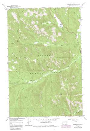
Barren Peak Topo Map Montana
To zoom in, hover over the map of Barren Peak
USGS Topo Quad 48115a4 - 1:24,000 scale
| Topo Map Name: | Barren Peak |
| USGS Topo Quad ID: | 48115a4 |
| Print Size: | ca. 21 1/4" wide x 27" high |
| Southeast Coordinates: | 48° N latitude / 115.375° W longitude |
| Map Center Coordinates: | 48.0625° N latitude / 115.4375° W longitude |
| U.S. State: | MT |
| Filename: | o48115a4.jpg |
| Download Map JPG Image: | Barren Peak topo map 1:24,000 scale |
| Map Type: | Topographic |
| Topo Series: | 7.5´ |
| Map Scale: | 1:24,000 |
| Source of Map Images: | United States Geological Survey (USGS) |
| Alternate Map Versions: |
Barren Peak MT 1966, updated 1971 Download PDF Buy paper map Barren Peak MT 1966, updated 1984 Download PDF Buy paper map Barren Peak MT 1997, updated 2000 Download PDF Buy paper map Barren Peak MT 2011 Download PDF Buy paper map Barren Peak MT 2014 Download PDF Buy paper map |
| FStopo: | US Forest Service topo Barren Peak is available: Download FStopo PDF Download FStopo TIF |
1:24,000 Topo Quads surrounding Barren Peak
> Back to 48115a1 at 1:100,000 scale
> Back to 48114a1 at 1:250,000 scale
> Back to U.S. Topo Maps home
Barren Peak topo map: Gazetteer
Barren Peak: Lakes
Schrieber Lake elevation 925m 3034′Barren Peak: Mines
Waylett Mine elevation 1399m 4589′Barren Peak: Streams
Bramlet Creek elevation 1021m 3349′Brulee Creek elevation 874m 2867′
Coyote Creek elevation 949m 3113′
Lake Creek elevation 974m 3195′
North Fork Miller Creek elevation 1057m 3467′
Porcupine Creek elevation 941m 3087′
South Fork Miller Creek elevation 1022m 3353′
Trail Creek elevation 957m 3139′
West Fisher Creek elevation 884m 2900′
Barren Peak: Summits
Barren Peak elevation 1625m 5331′Teeters Peak elevation 1575m 5167′
Barren Peak: Trails
Divide Trail elevation 1353m 4438′Iron Meadow Trail elevation 1045m 3428′
Libby Divide Trail elevation 1611m 5285′
Teeters Peak Trail elevation 1399m 4589′
Barren Peak digital topo map on disk
Buy this Barren Peak topo map showing relief, roads, GPS coordinates and other geographical features, as a high-resolution digital map file on DVD:


