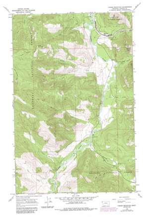
Fisher Mountain Topo Map Montana
To zoom in, hover over the map of Fisher Mountain
USGS Topo Quad 48115b3 - 1:24,000 scale
| Topo Map Name: | Fisher Mountain |
| USGS Topo Quad ID: | 48115b3 |
| Print Size: | ca. 21 1/4" wide x 27" high |
| Southeast Coordinates: | 48.125° N latitude / 115.25° W longitude |
| Map Center Coordinates: | 48.1875° N latitude / 115.3125° W longitude |
| U.S. State: | MT |
| Filename: | o48115b3.jpg |
| Download Map JPG Image: | Fisher Mountain topo map 1:24,000 scale |
| Map Type: | Topographic |
| Topo Series: | 7.5´ |
| Map Scale: | 1:24,000 |
| Source of Map Images: | United States Geological Survey (USGS) |
| Alternate Map Versions: |
Fisher Mountain MT 1966, updated 1970 Download PDF Buy paper map Fisher Mountain MT 1966, updated 1984 Download PDF Buy paper map Fisher Mountain MT 2011 Download PDF Buy paper map Fisher Mountain MT 2014 Download PDF Buy paper map |
| FStopo: | US Forest Service topo Fisher Mountain is available: Download FStopo PDF Download FStopo TIF |
1:24,000 Topo Quads surrounding Fisher Mountain
> Back to 48115a1 at 1:100,000 scale
> Back to 48114a1 at 1:250,000 scale
> Back to U.S. Topo Maps home
Fisher Mountain topo map: Gazetteer
Fisher Mountain: Streams
Brush Creek elevation 846m 2775′Cow Creek elevation 769m 2522′
Harris Creek elevation 797m 2614′
Leckrone Creek elevation 829m 2719′
McKillop Creek elevation 806m 2644′
Pecolet Creek elevation 765m 2509′
Smoke Creek elevation 860m 2821′
Snell Creek elevation 779m 2555′
Tepee Creek elevation 852m 2795′
Vian Creek elevation 756m 2480′
Wolf Creek elevation 761m 2496′
Fisher Mountain: Summits
Fisher Mountain elevation 1655m 5429′Lightning Peak elevation 1257m 4124′
Fisher Mountain: Trails
Fisher Mountain Trail elevation 1653m 5423′Fisher Mountain digital topo map on disk
Buy this Fisher Mountain topo map showing relief, roads, GPS coordinates and other geographical features, as a high-resolution digital map file on DVD:


