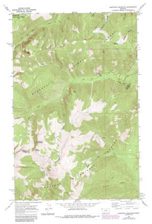
Sawtooth Mountain Topo Map Montana
To zoom in, hover over the map of Sawtooth Mountain
USGS Topo Quad 48115b8 - 1:24,000 scale
| Topo Map Name: | Sawtooth Mountain |
| USGS Topo Quad ID: | 48115b8 |
| Print Size: | ca. 21 1/4" wide x 27" high |
| Southeast Coordinates: | 48.125° N latitude / 115.875° W longitude |
| Map Center Coordinates: | 48.1875° N latitude / 115.9375° W longitude |
| U.S. State: | MT |
| Filename: | o48115b8.jpg |
| Download Map JPG Image: | Sawtooth Mountain topo map 1:24,000 scale |
| Map Type: | Topographic |
| Topo Series: | 7.5´ |
| Map Scale: | 1:24,000 |
| Source of Map Images: | United States Geological Survey (USGS) |
| Alternate Map Versions: |
Sawtooth Mountain MT 1966, updated 1971 Download PDF Buy paper map Sawtooth Mountain MT 1966, updated 1984 Download PDF Buy paper map Sawtooth Mountain MT 1997, updated 2000 Download PDF Buy paper map Sawtooth Mountain MT 2011 Download PDF Buy paper map Sawtooth Mountain MT 2014 Download PDF Buy paper map |
| FStopo: | US Forest Service topo Sawtooth Mountain is available: Download FStopo PDF Download FStopo TIF |
1:24,000 Topo Quads surrounding Sawtooth Mountain
> Back to 48115a1 at 1:100,000 scale
> Back to 48114a1 at 1:250,000 scale
> Back to U.S. Topo Maps home
Sawtooth Mountain topo map: Gazetteer
Sawtooth Mountain: Cliffs
Ross Point elevation 1357m 4452′Sawtooth Mountain: Mines
Stanley Creek Mine elevation 1233m 4045′Sawtooth Mountain: Parks
Ross Creek Natural Area elevation 872m 2860′Ross Creek Picnic Area elevation 872m 2860′
Sawtooth Mountain: Streams
Cub Creek elevation 1063m 3487′North Fork Ross Creek elevation 907m 2975′
Pooch Creek elevation 1026m 3366′
South Fork Dry Creek elevation 838m 2749′
South Fork Ross Creek elevation 972m 3188′
Sawtooth Mountain: Summits
Middle Mountain elevation 1962m 6437′Mount Vernon elevation 1699m 5574′
Sawtooth Mountain elevation 2064m 6771′
Spar Peak elevation 1997m 6551′
Sawtooth Mountain: Trails
Ross Creek Pack Trail elevation 1044m 3425′South Fork Ross Creek Trail elevation 951m 3120′
Sawtooth Mountain digital topo map on disk
Buy this Sawtooth Mountain topo map showing relief, roads, GPS coordinates and other geographical features, as a high-resolution digital map file on DVD:


