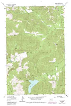
Spar Lake Topo Map Montana
To zoom in, hover over the map of Spar Lake
USGS Topo Quad 48115c8 - 1:24,000 scale
| Topo Map Name: | Spar Lake |
| USGS Topo Quad ID: | 48115c8 |
| Print Size: | ca. 21 1/4" wide x 27" high |
| Southeast Coordinates: | 48.25° N latitude / 115.875° W longitude |
| Map Center Coordinates: | 48.3125° N latitude / 115.9375° W longitude |
| U.S. State: | MT |
| Filename: | o48115c8.jpg |
| Download Map JPG Image: | Spar Lake topo map 1:24,000 scale |
| Map Type: | Topographic |
| Topo Series: | 7.5´ |
| Map Scale: | 1:24,000 |
| Source of Map Images: | United States Geological Survey (USGS) |
| Alternate Map Versions: |
Spar Lake MT 1963, updated 1966 Download PDF Buy paper map Spar Lake MT 1963, updated 1984 Download PDF Buy paper map Spar Lake MT 1997, updated 2000 Download PDF Buy paper map Spar Lake MT 2011 Download PDF Buy paper map Spar Lake MT 2014 Download PDF Buy paper map |
| FStopo: | US Forest Service topo Spar Lake is available: Download FStopo PDF Download FStopo TIF |
1:24,000 Topo Quads surrounding Spar Lake
> Back to 48115a1 at 1:100,000 scale
> Back to 48114a1 at 1:250,000 scale
> Back to U.S. Topo Maps home
Spar Lake topo map: Gazetteer
Spar Lake: Lakes
Grouse Lake elevation 895m 2936′Spar Lake elevation 1005m 3297′
Spruce Lake elevation 1251m 4104′
Spar Lake: Mines
Bimetalic Mine elevation 831m 2726′Blue Bird Mine elevation 1270m 4166′
Grouse Mountain Number 2 Mine elevation 1366m 4481′
Grouse Mountain Number 5 Mine elevation 1233m 4045′
Spar Lake: Streams
Briar Creek elevation 1251m 4104′Club Creek elevation 1008m 3307′
Drift Creek elevation 1260m 4133′
Fairway Creek elevation 762m 2500′
Hiatt Creek elevation 1005m 3297′
North Fork Keeler Creek elevation 744m 2440′
South Fork Keeler Creek elevation 785m 2575′
Spar Creek elevation 1006m 3300′
Thicket Creek elevation 760m 2493′
Twilight Creek elevation 893m 2929′
Whoopee Creek elevation 1007m 3303′
Spar Lake: Summits
Keeler Mountain elevation 1508m 4947′Lime Butte elevation 797m 2614′
Pony Mountain elevation 1555m 5101′
Spruce Mountain elevation 1754m 5754′
Stanley Mountain elevation 1301m 4268′
Stanley Peak elevation 1768m 5800′
Spar Lake: Trails
Grouse Lake Trail elevation 865m 2837′Spar Lake: Valleys
Carr Draw elevation 914m 2998′Surprise Draw elevation 1013m 3323′
Spar Lake digital topo map on disk
Buy this Spar Lake topo map showing relief, roads, GPS coordinates and other geographical features, as a high-resolution digital map file on DVD:


