Warland Peak Topo Map Montana
To zoom in, hover over the map of Warland Peak
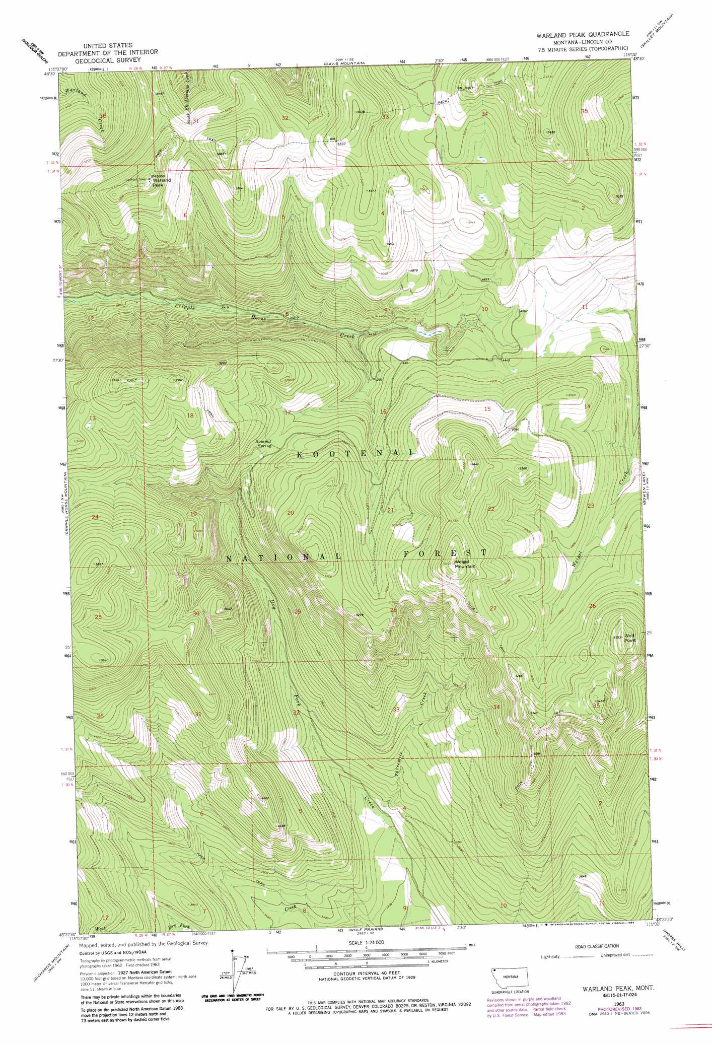
USGS Topo Quad 48115d1 - 1:24,000 scale
| Topo Map Name: | Warland Peak |
| USGS Topo Quad ID: | 48115d1 |
| Print Size: | ca. 21 1/4" wide x 27" high |
| Southeast Coordinates: | 48.375° N latitude / 115° W longitude |
| Map Center Coordinates: | 48.4375° N latitude / 115.0625° W longitude |
| U.S. State: | MT |
| Filename: | o48115d1.jpg |
| Download Map JPG Image: | Warland Peak topo map 1:24,000 scale |
| Map Type: | Topographic |
| Topo Series: | 7.5´ |
| Map Scale: | 1:24,000 |
| Source of Map Images: | United States Geological Survey (USGS) |
| Alternate Map Versions: |
Warland Peak MT 1963, updated 1966 Download PDF Buy paper map Warland Peak MT 1963, updated 1984 Download PDF Buy paper map Warland Peak MT 1997, updated 2000 Download PDF Buy paper map Warland Peak MT 2011 Download PDF Buy paper map Warland Peak MT 2014 Download PDF Buy paper map |
| FStopo: | US Forest Service topo Warland Peak is available: Download FStopo PDF Download FStopo TIF |
1:24,000 Topo Quads surrounding Warland Peak
Inch Mountain |
Mcguire Mountain |
Pinkham Mountain |
Edna Mountain |
Stryker |
Ural |
Volcour |
Davis Mountain |
Skillet Mountain |
Sunday Mountain |
Alexander Mountain |
Cripple Horse Mountain |
Warland Peak |
Bowen Lake |
Dunsire Point |
Tony Peak |
Richards Mountain |
Wolf Prairie |
Horse Hill |
Sylvia Lake |
Fisher Mountain |
Calx Mountain |
Deer Creek |
Lynch Lake |
Dahl Lake |
> Back to 48115a1 at 1:100,000 scale
> Back to 48114a1 at 1:250,000 scale
> Back to U.S. Topo Maps home
Warland Peak topo map: Gazetteer
Warland Peak: Mines
Mustang I Mine elevation 1122m 3681′Warland Peak: Springs
Summit Spring elevation 1421m 4662′Warland Peak: Streams
Threemile Creek elevation 1001m 3284′Warland Peak: Summits
Warland Peak elevation 1814m 5951′Weigel Mountain elevation 1758m 5767′
Wolf Point elevation 1685m 5528′
Warland Peak digital topo map on disk
Buy this Warland Peak topo map showing relief, roads, GPS coordinates and other geographical features, as a high-resolution digital map file on DVD: