Gold Hill Topo Map Montana
To zoom in, hover over the map of Gold Hill
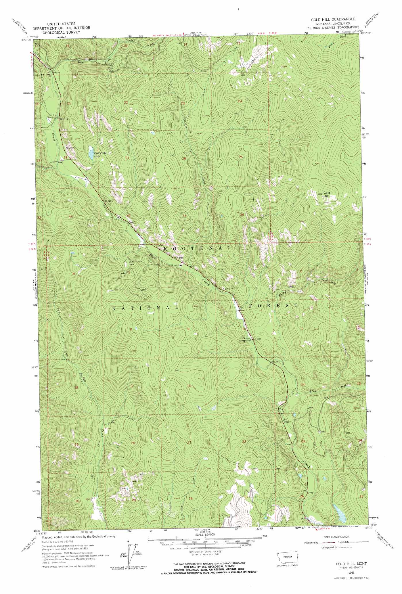
USGS Topo Quad 48115e5 - 1:24,000 scale
| Topo Map Name: | Gold Hill |
| USGS Topo Quad ID: | 48115e5 |
| Print Size: | ca. 21 1/4" wide x 27" high |
| Southeast Coordinates: | 48.5° N latitude / 115.5° W longitude |
| Map Center Coordinates: | 48.5625° N latitude / 115.5625° W longitude |
| U.S. State: | MT |
| Filename: | o48115e5.jpg |
| Download Map JPG Image: | Gold Hill topo map 1:24,000 scale |
| Map Type: | Topographic |
| Topo Series: | 7.5´ |
| Map Scale: | 1:24,000 |
| Source of Map Images: | United States Geological Survey (USGS) |
| Alternate Map Versions: |
Gold Hill MT 1963, updated 1966 Download PDF Buy paper map Gold Hill MT 1997, updated 2000 Download PDF Buy paper map Gold Hill MT 2011 Download PDF Buy paper map Gold Hill MT 2014 Download PDF Buy paper map |
| FStopo: | US Forest Service topo Gold Hill is available: Download FStopo PDF Download FStopo TIF |
1:24,000 Topo Quads surrounding Gold Hill
Clark Mountain |
Yaak |
Lost Horse Mountain |
Boulder Lakes |
Webb Mountain |
Sylvanite |
Flatiron Mountain |
Pink Mountain |
Parsnip Mountain |
Inch Mountain |
Pulpit Mountain |
Turner Mountain |
Gold Hill |
Banfield Mountain |
Ural |
Kootenai Falls |
Scenery Mountain |
Libby |
Vermiculite Mountain |
Alexander Mountain |
Crowell Mountain |
Treasure Mountain |
Little Hoodo Mountain |
Swede Mountain |
Tony Peak |
> Back to 48115e1 at 1:100,000 scale
> Back to 48114a1 at 1:250,000 scale
> Back to U.S. Topo Maps home
Gold Hill topo map: Gazetteer
Gold Hill: Lakes
Tom Poole Lake elevation 1044m 3425′Gold Hill: Streams
Blue Creek elevation 853m 2798′Cruien Creek elevation 995m 3264′
East Fork Pipe Creek elevation 961m 3152′
Noisy Creek elevation 862m 2828′
Shafer Creek elevation 896m 2939′
Terge Creek elevation 914m 2998′
Weasel Creek elevation 996m 3267′
Gold Hill: Summits
Gold Hill elevation 1688m 5538′Gold Hill digital topo map on disk
Buy this Gold Hill topo map showing relief, roads, GPS coordinates and other geographical features, as a high-resolution digital map file on DVD: